


![]()


Durata
 3:50 h
Distanza
 9,1 km
 Ascesa
 500 m
500 mDiscesa
 500 m
500 mH Max
 2837 m
H Min
 2436 m
Cima Roma from the Rifugio Stoppani to the Grostè
DESCRIPTION
Spectacular snowshoe hike in the Brenta Group.
Welcome to the heart of the Brenta Group, a magical place where the beauty of nature meets the majesty of the mountains. If you are looking for an excursion that takes you to discover the wonders of the snowy landscape, then this is definitely the one for you!
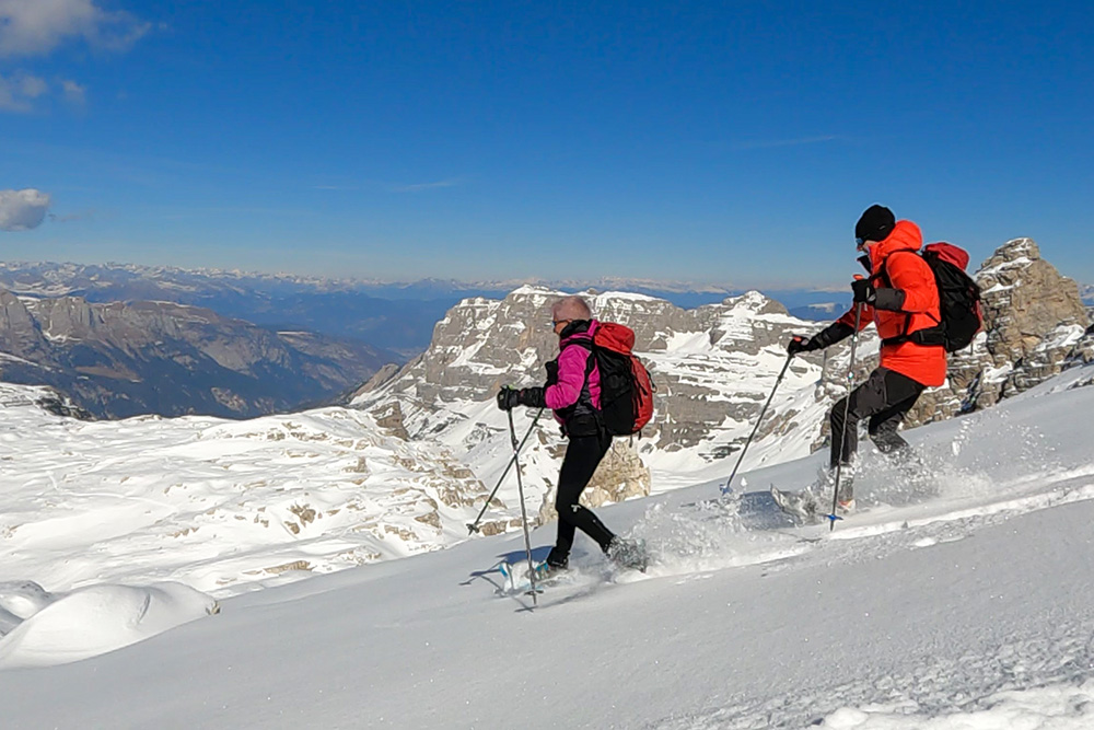
We will start from a suggestive environmental context, surrounded by the most spectacular peaks of the Dolomites. With snowshoes on, we will walk in a fairytale landscape, framed by majestic mountains and surrounded by a unique atmosphere.
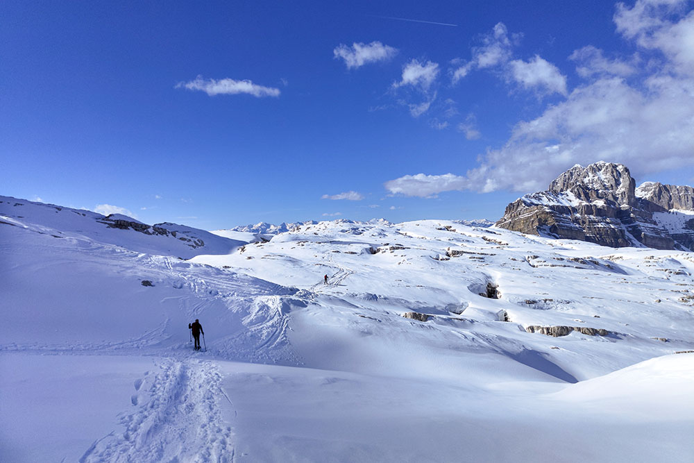
The itinerary that we propose is particularly enjoyable, not particularly tiring and with a moderate difference in height (about 500 metres). Almost the entire route is on a plateau, making it quite safe. But don't be fooled by the ease of the route: the view from the top of Cima Roma will leave you breathless!
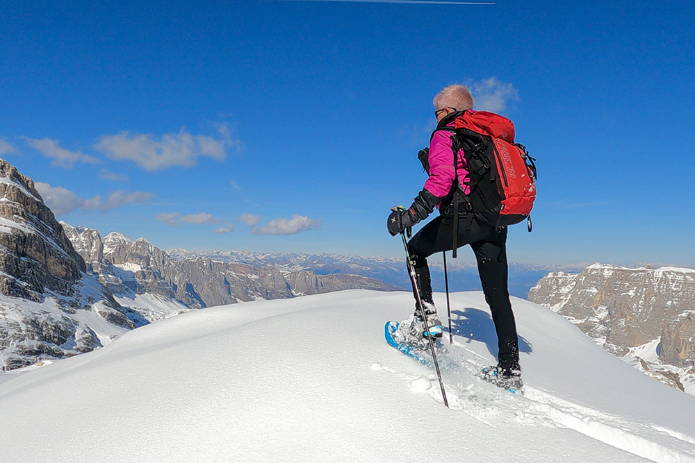
The summit of Cima Roma offers a breathtaking view of the Brenta Group, the Paganella, Lake Molveno and many other peaks of Trentino and Alto Adige. Let yourself be conquered by the unique sensations that only the mountain can offer and enjoy the intact beauty of a snowy landscape.
Don't miss this unique opportunity to live an unforgettable experience in the pristine beauty of the Dolomites. Get ready for a snowshoe excursion that will leave you speechless!
ITINERARY
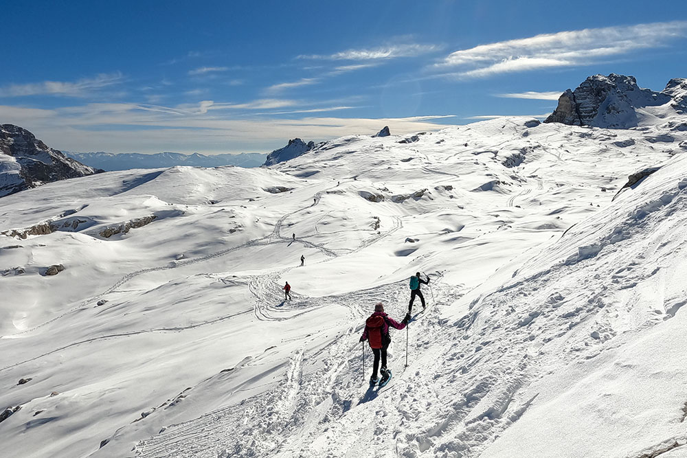
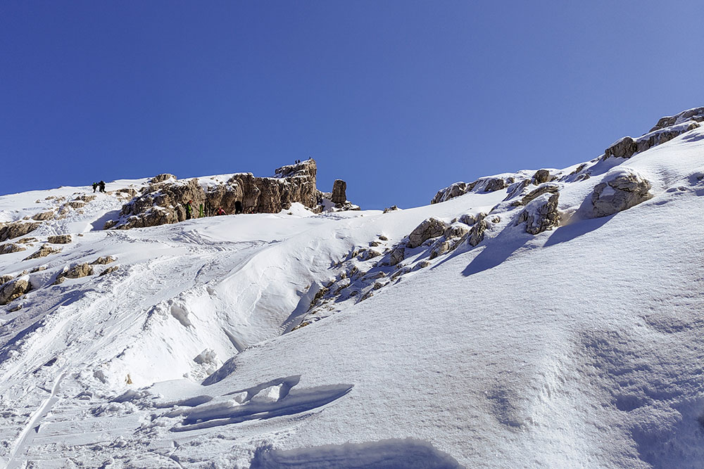
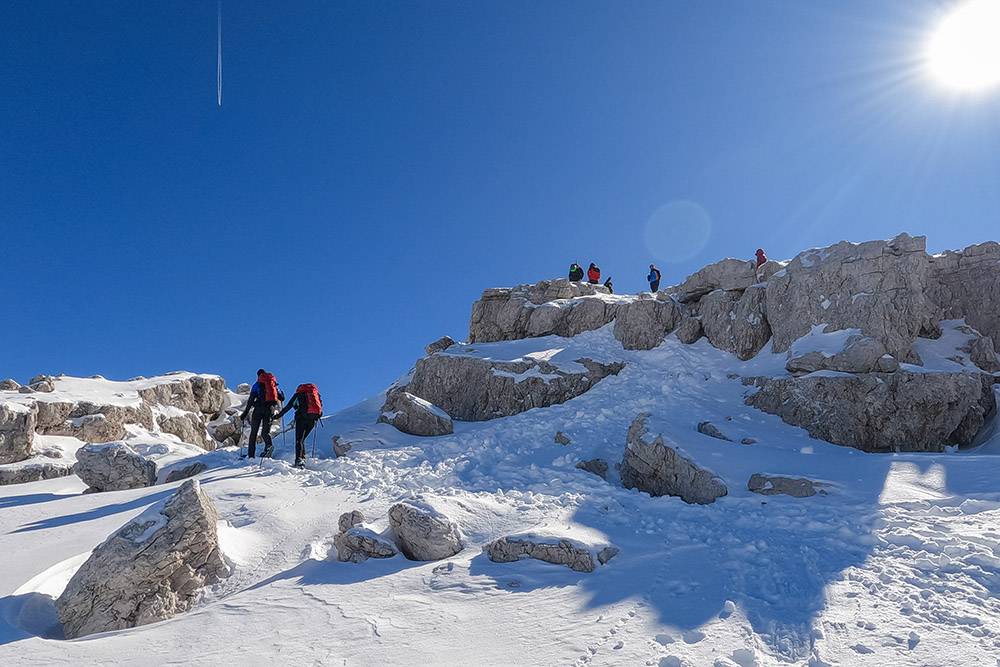
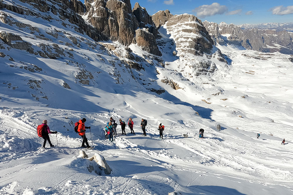
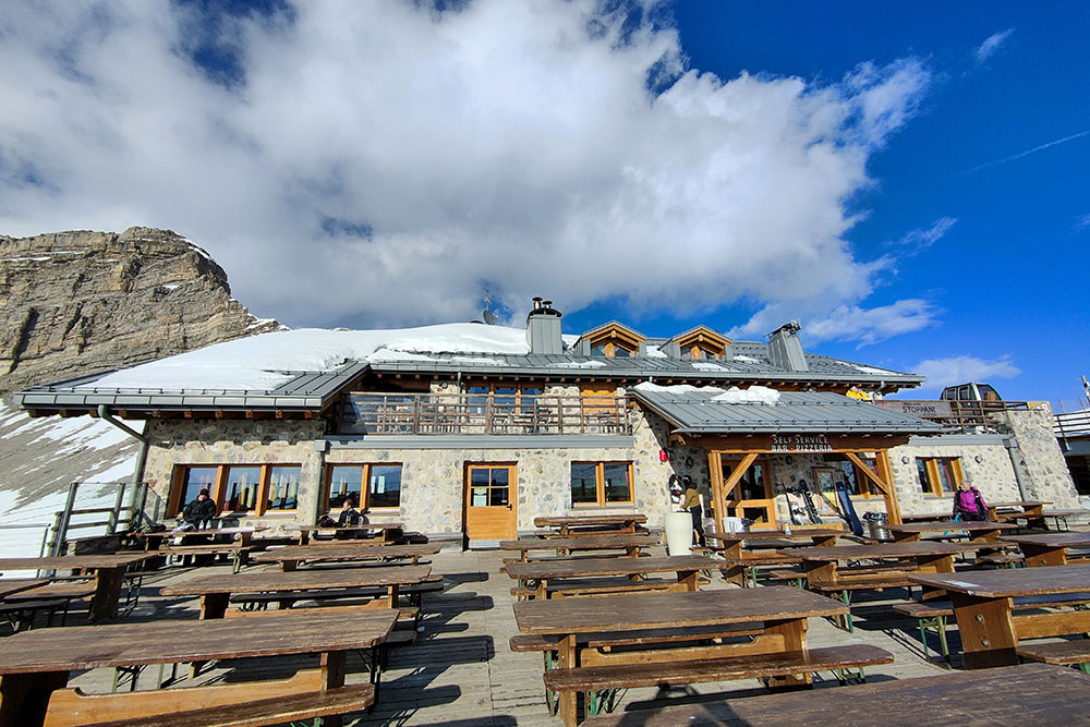
From Rifugio Stoppani al Grostè (2436 m) go up for a short stretch, trying to avoid the ski slopes, up to the top station of the Grostè Express chairlift (2500 m). Here begins the real itinerary. There are no indications and signs. You follow the tracks which, depending on the state of the snow, were left by previous hikers. We proceed in a continuous ups and downs passing under the Grostè and Falkner peaks. Arrived at a small iron cross (2595 m), go down to the right and then go up again for the last very steep section. Near the summit, if there is little snow, it will be necessary to take off your snowshoes for greater safety. Once you reach Cima Roma (2837 m) you return along the same road.
EXCURSION DATE
March 5, 2023
STARTING POINT
Rifugio Stoppani al Grostè (2436 m)
REFRESHMENT POINT
Nobody
AUTHOR’S SUGGESTIONS
As the route is not marked, it is advisable to download the GPX track.
SAFETY TIPS
Snowpack stability is subject to sudden and unpredictable changes. For your safety, always consult the avalanche bulletin, because the snowpack is subject to rapid changes, ask the competent local offices for information. Our GPX tracks are indicative only, that is, the route was best done with the snow and weather conditions of that day. So always evaluate what to do on site. Also remember to evaluate the route based on your physical abilities, training and the equipment you have. It is appropriate to let someone know the itinerary you intend to take. Remember that the emergency number is 112.
EQUIPMENT
It is recommended to have the appropriate equipment: kit for self-rescue in avalanches (consisting of Artva, shovel and probe), snowshoes, sticks, crampons, glasses, sunscreen, hiking boots, winter clothing, gloves, cap, backpack hot drinks.
RECOMMENDED MAPS
Tabacco 053 Dolomiti di Brenta
INTERESTING LINKS
https://www.campigliodolomiti.it/it/skiarea/inverno/in-funivia
HOW TO ARRIVE
From Tione of Trento SS239 towards Pinzolo. After Madonna di Campiglio, you arrive at Passo Carlo Magno where there is a large paid car park, Fortini Parking.
PARKING AREA
Fortini parking for a fee
GPS coordinates: 46.237230, 10.836440
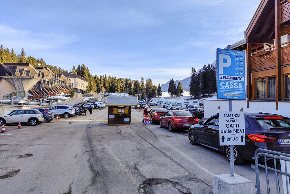
Parcheggio Fortini
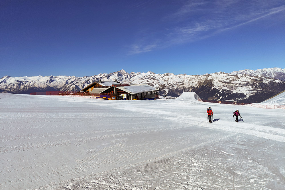
Si parte dal Rifugio Stoppani al Grostè
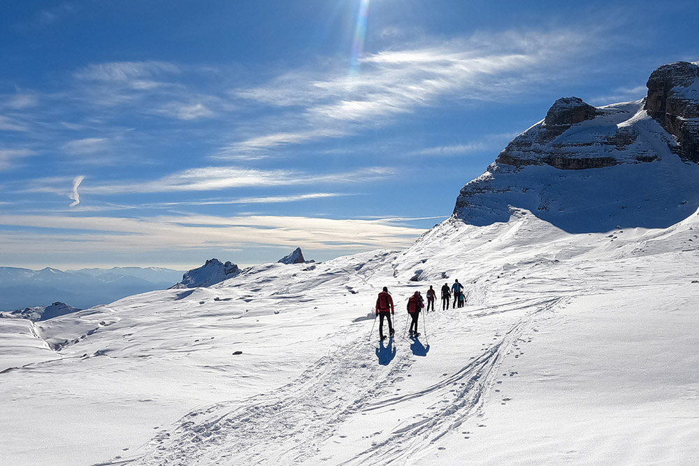
Si inizia il saliscendi
Ottima neve per le ciaspole
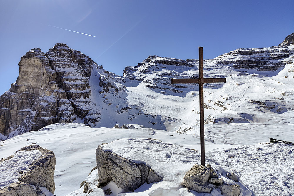
Una croce in ferro e alle spalle Cima Roma
Paesaggio fantastico
Saliamo per il tratto ripido
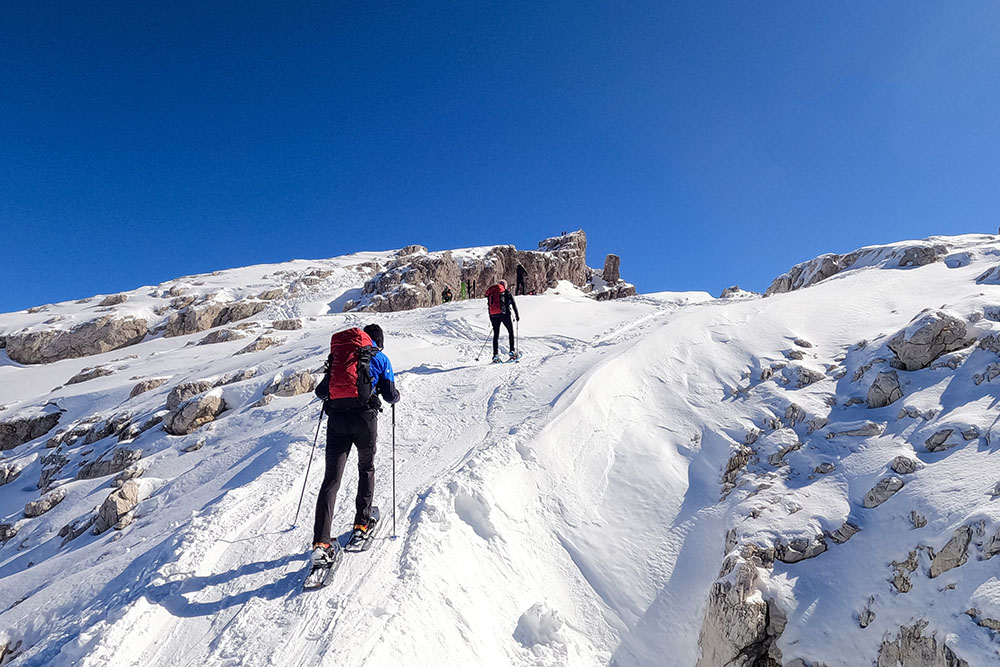
Saliamo per il tratto ripido
Arrivati a Cima Roma
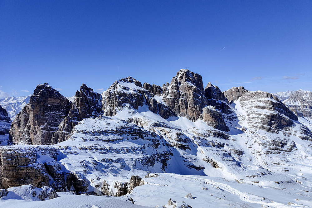
Dalla vetta il Gruppo del Brenta
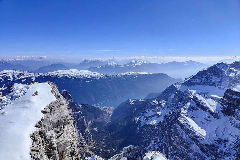
Dalla vetta il Lago di Molveno
Si ritorna per la stessa strada
Velocemente in discesca
Iniziano le prime ombre
Ritorno al Rifugio Stoppani al Grostè


