


![]()


Durata
 7:14 h
Distanza
 18,1 km
 Ascesa
 1080 m
Discesa
 1080 m
H Max
 2667 m
H Min
 1858 m
On the Alta Via di Neves: Giovanni Porro Refuges and Ponte di Ghiaccio
DESCRIPTION
Wonderful excursion in a breathtaking glacial scenery.
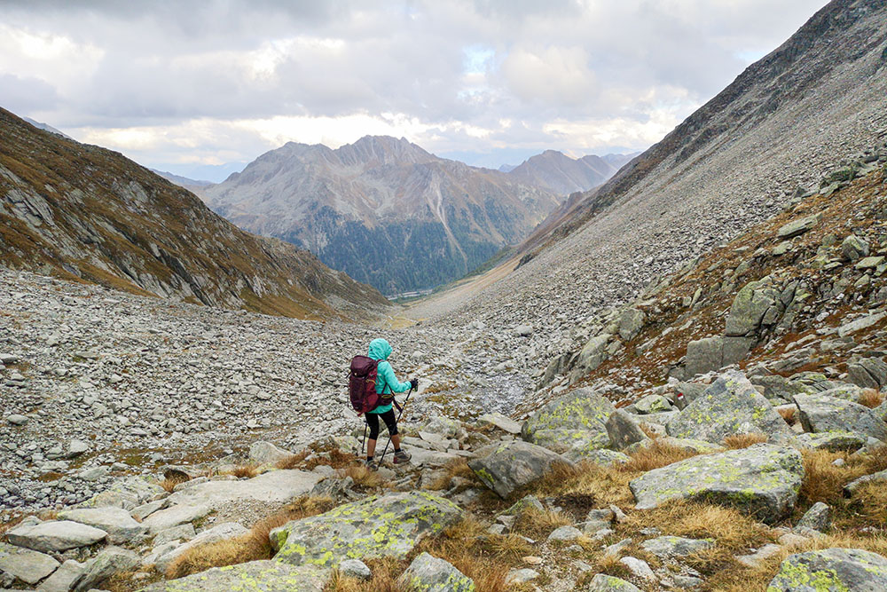
The itinerary does not present any difficulties except for the length and the difference in height. The Alta Via di Neves is a spectacular path, dominated by imposing three thousand such as: Cima di Sella, Gran Mèsule, Punta Bianca, Monte Guardia. You always walk with a beautiful view: Lake Neves, glaciers and high peaks.
ITINERARY
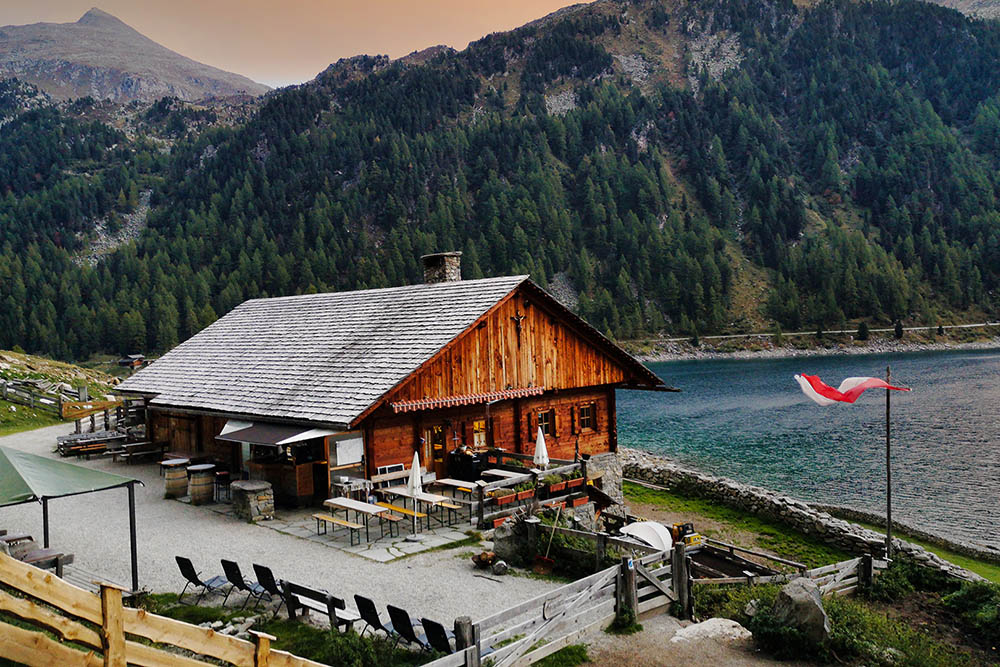
From the car park (1858 m) you go north and arrive at the Untermaurer mountain hut (1865 m) and then taking the trail sign n. 24 you pass some beautiful huts (2196 m) and arrive at the Rifugio Porro / Chemnitzer Hütte (2420 m). Here you take the Alta Via di Neves / Neveser Höhenweg and passing by Lake Gletscher (2643 m) you reach the Rifugio Ponte di Ghiaccio / Edelrauthütte (2545 m). Now you return to Lake Neves, trail marker 26, along the Valle della Pipa / Pfeifholdertal. Arriving at the lake, turn left, pass by Malga Neves (1882 m) and return to the starting point.
EXCURSION DATE
October 2, 2021
STARTING POINT
Neves Lake
REFRESHMENT POINT
Malga Untermaurer (1865 m), Rifugio Giovanni Porro (2420 m), Rifugio Ponte di Ghiaccio (2545 m) and Malga Neves (1882 m)
AUTHOR’S SUGGESTIONS
Go around counterclockwise.
SAFETY TIPS
The viability of the proposed itinerary, like all mountain morphology, is subject to environmental changes due to natural events and weather conditions. Therefore, before leaving, consult the competent tourist offices and / or the refuges of reference.
Our GPX tracks are only indicative, that is, the route was carried out at best with the conditions of the trails and weather of that day. So always consider what to do on site.
Also remember to evaluate the route based on your physical abilities, training and the equipment you have.
You should leave someone the route you intend to do told.
Remember that the emergency number is 112.
EQUIPMENT
It is recommended to have the appropriate equipment for the route, weather conditions and season: windproof and / or rain jacket, map and / or GPS device, goggles, sunscreen, boots, first aid kit, specific clothing, gloves, backpack with food and drink.
RECOMMENDED MAPS
Tabacco 036 1:25.000 CAMPO TURES
INTERESTING LINKS
http://www.chemnitzerhuette.com/it/chemnitzerhuette/willkommen.html
HOW TO ARRIVE
From Brunico SS61 towards Val Aurina. Once in Molini di Tures, turn left towards Lappago / Lappach. Once in Lappago, continue until you reach Lake Neves.
PARKING AREA
For a fee at the Neves Lake.
GPS coordinates: 46.947739, 11.784850
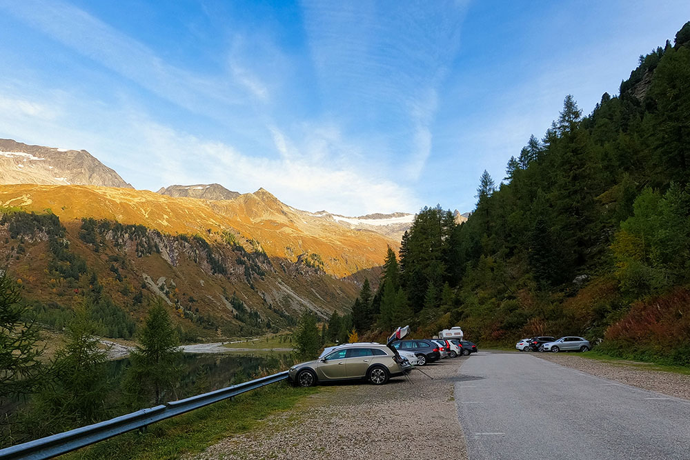
Punto di partenza
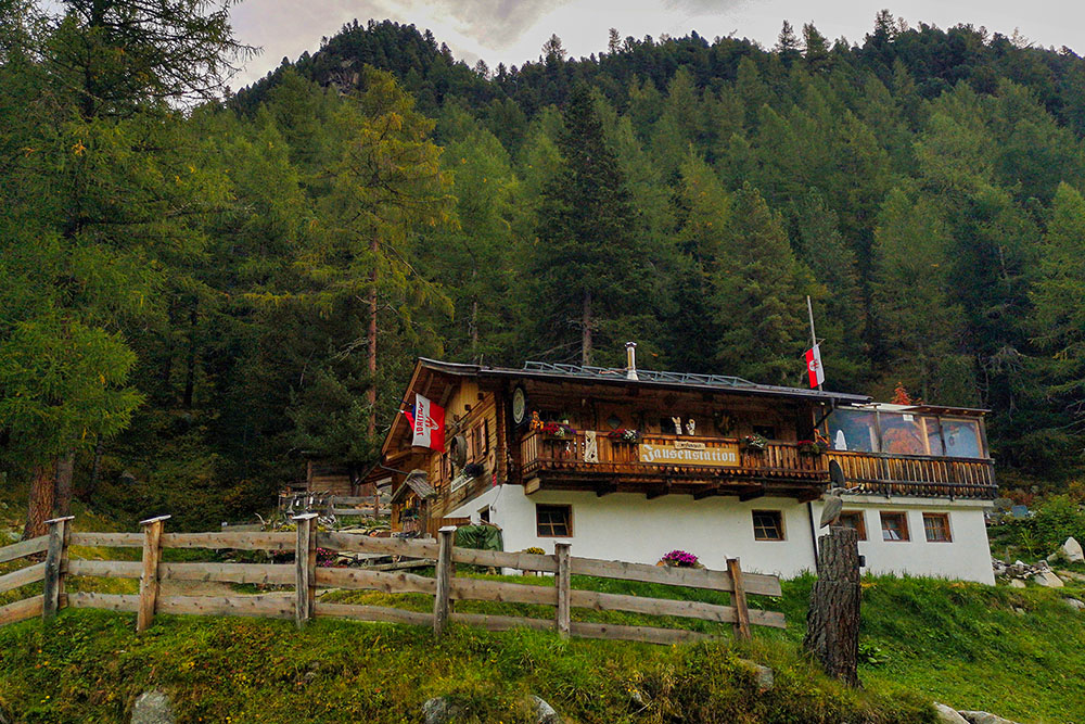
Malga Untermaurer
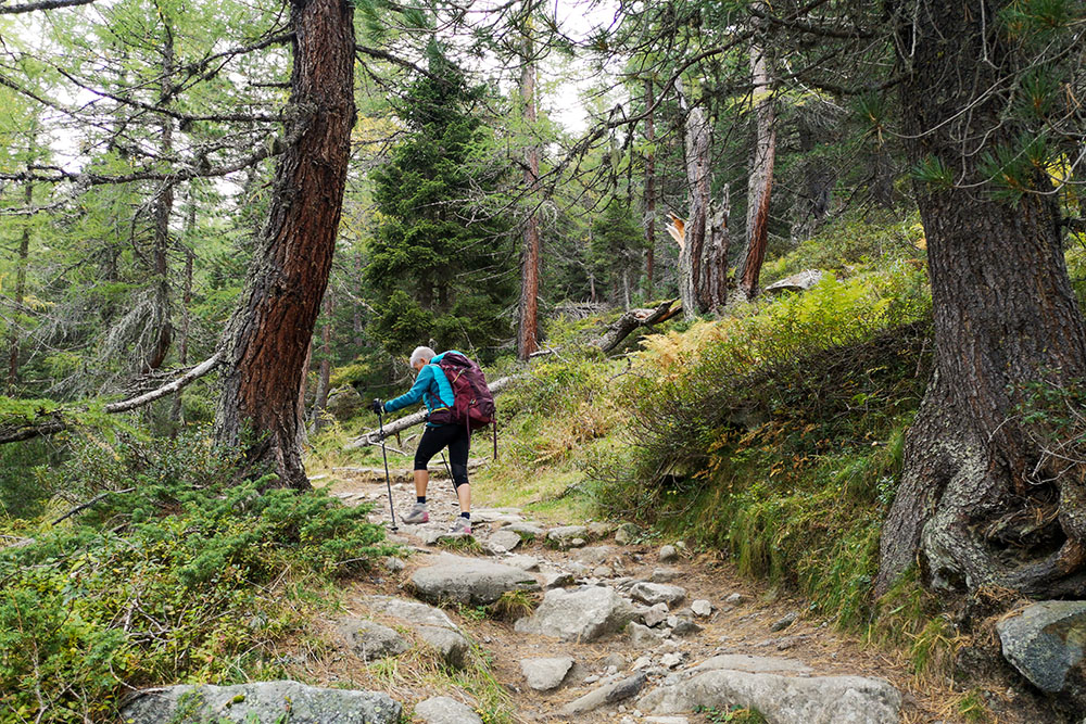
Si sale per il sentiero
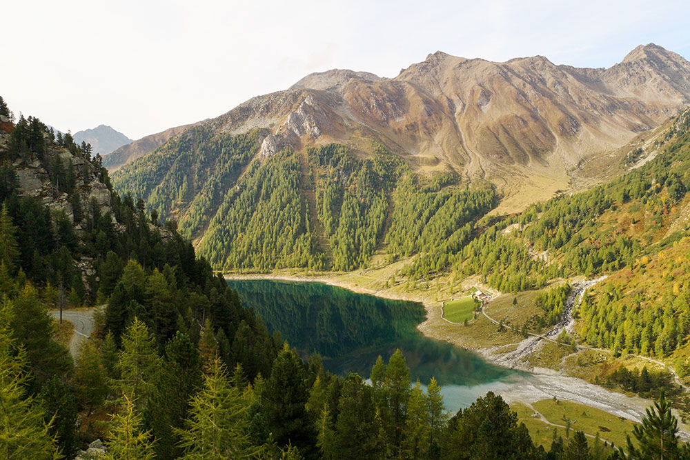
Ci lasciamo il Lago di Neves alle spalle
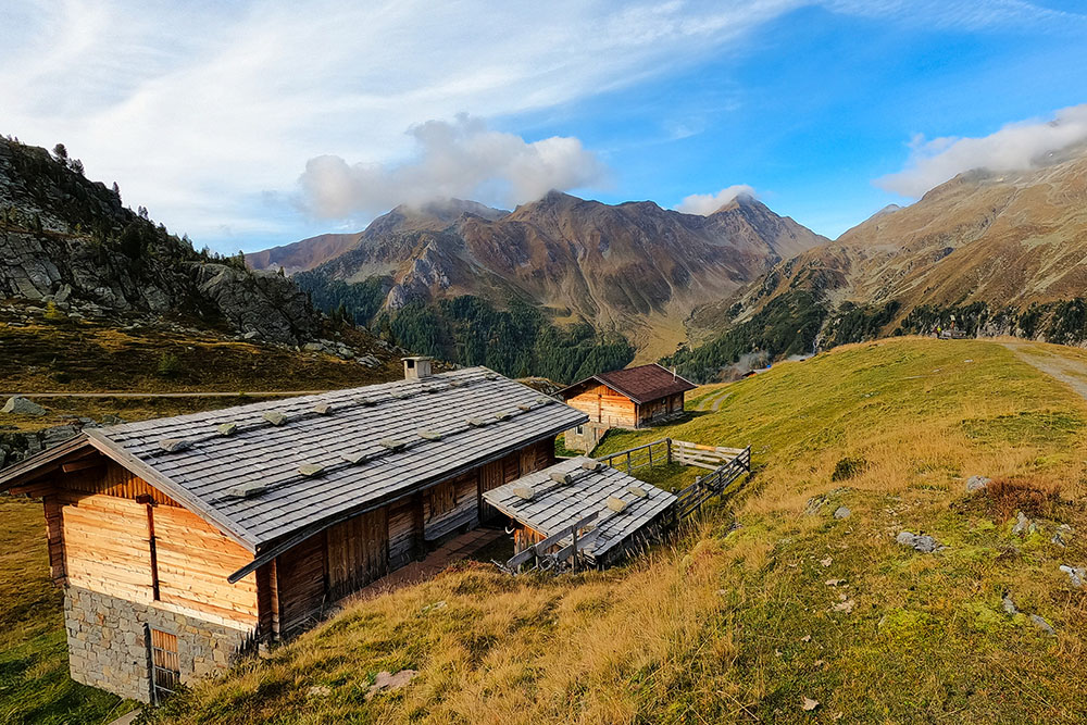
Un bel gruppo di baite
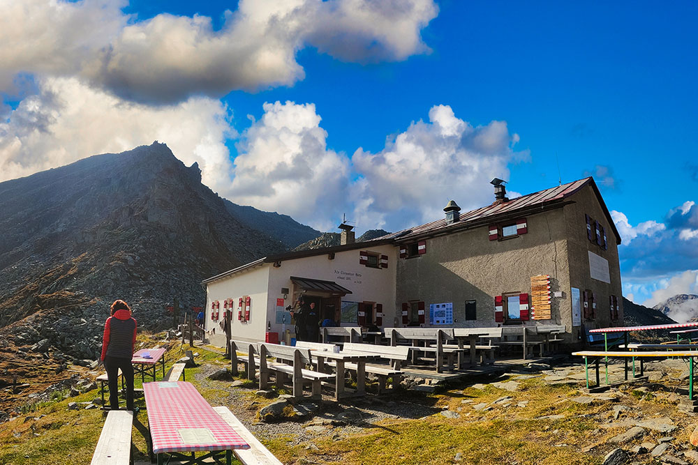
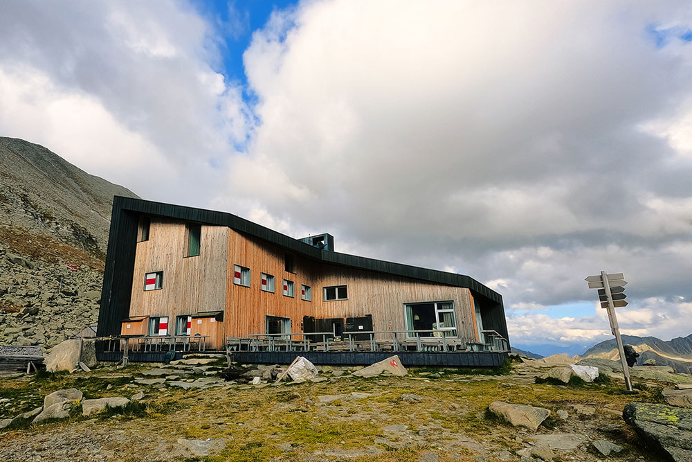
Il Rifugio Giovanni Porro
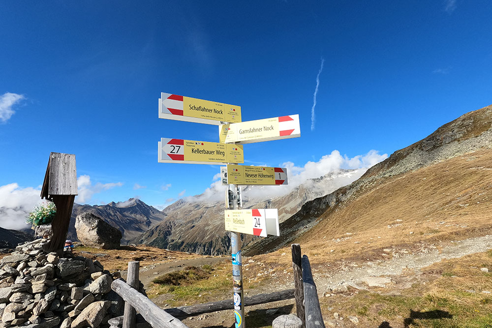
Seguiamo il sentiero n 1
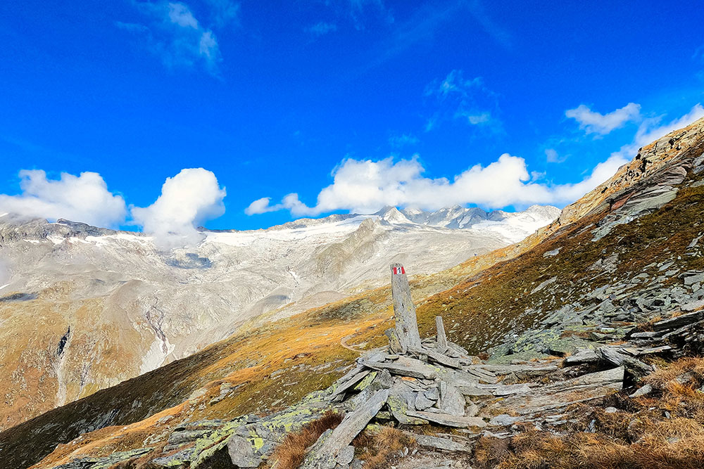
Vista sui ghiacciai di Neves
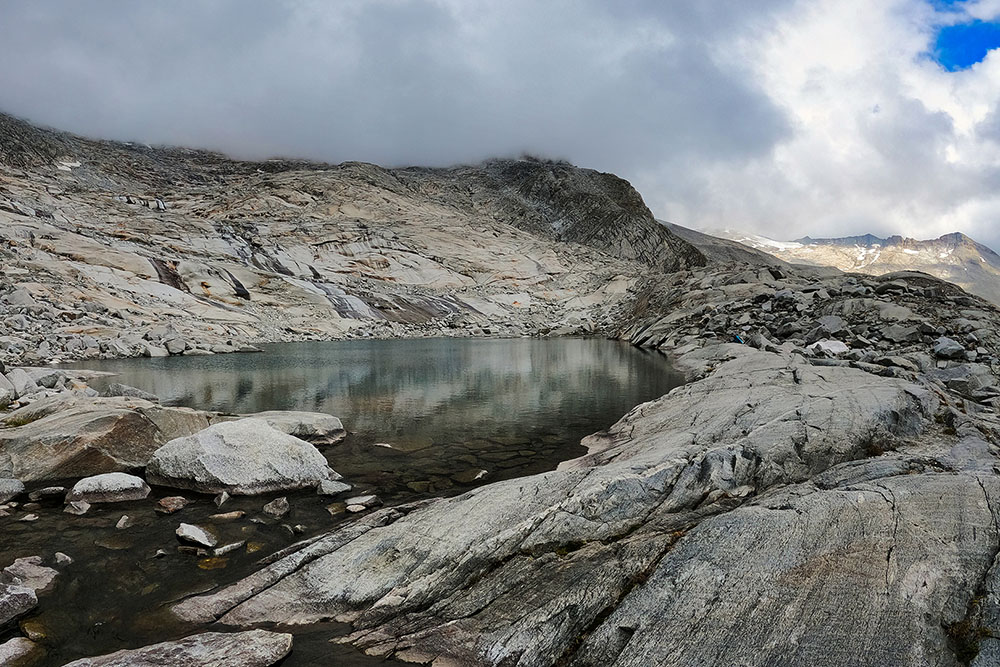
Lago Gletscher
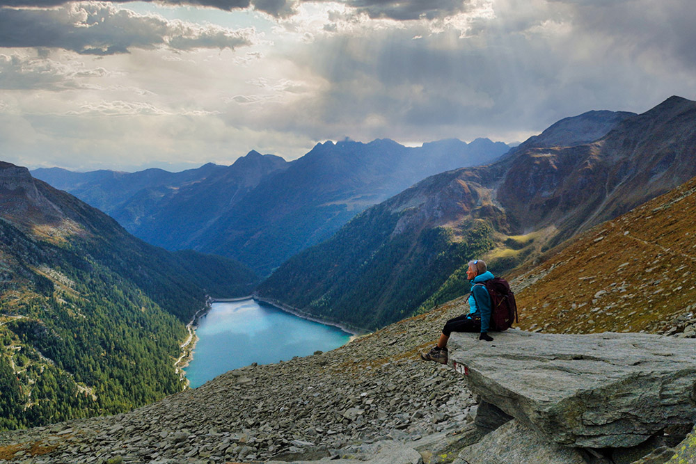
Vista sul Lago di Neves
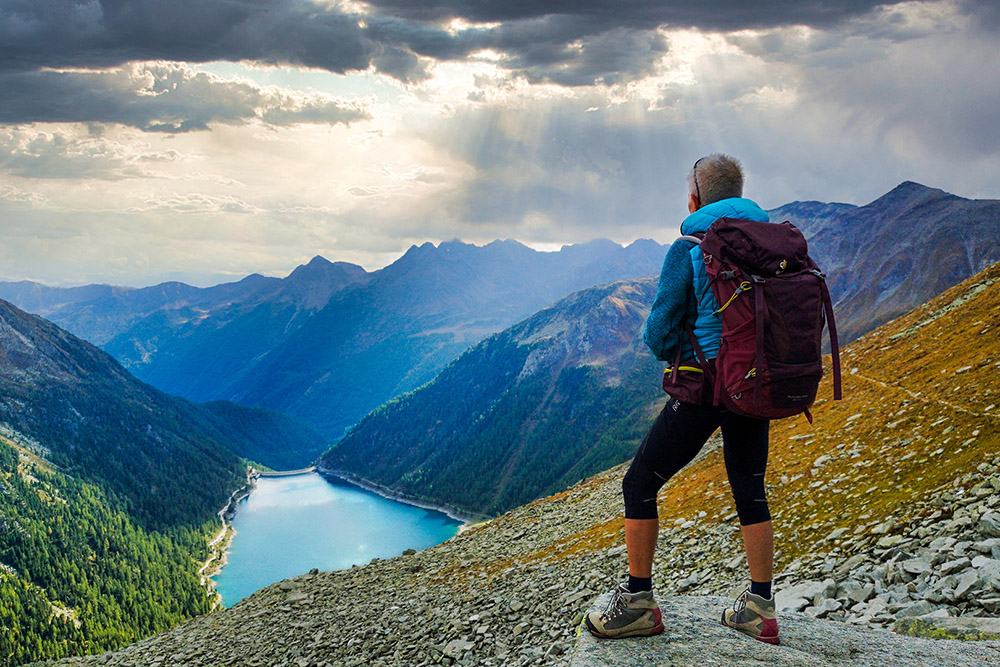
Vista sul Lago di Neves
Il Rifugio Ponte di Ghiaccio
Si scende al Lago di Neves
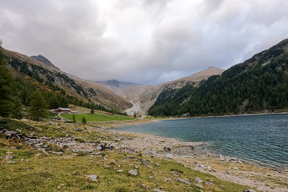
Tornati al Lago di Neves
La Malga Neves


