


![]()


Durata
 4:35 h
Distanza
 11 km
11 km Ascesa
 998 m
998 mDiscesa
 998 m
998 mH Max
 1765 m
H Min
 1259 m
Sentiero del Ventrar
DESCRIPTION
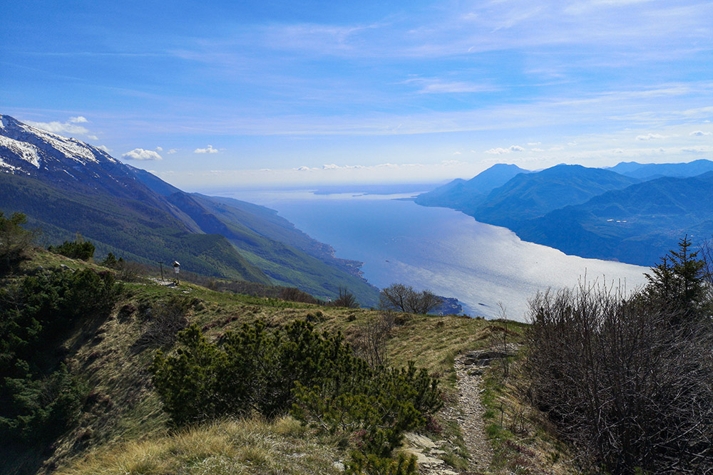
This itinerary will take you on one of the most beautiful and panoramic routes of Monte Baldo.
Those who love alpine views cannot miss this opportunity. During the excursion you will have the opportunity to see Lake Garda in its entirety and also enjoy the view of the beautiful mountains, especially in the Trentino area, that surround the lake.
The Sentiero del Ventrar is classified by the CAI for EE (expert hikers), therefore it requires a minimum of physical training and is not suitable for too small children or for people suffering from vertigo. It is advisable to avoid hiking in the winter in the snow, because it is too dangerous.
ITINERARY
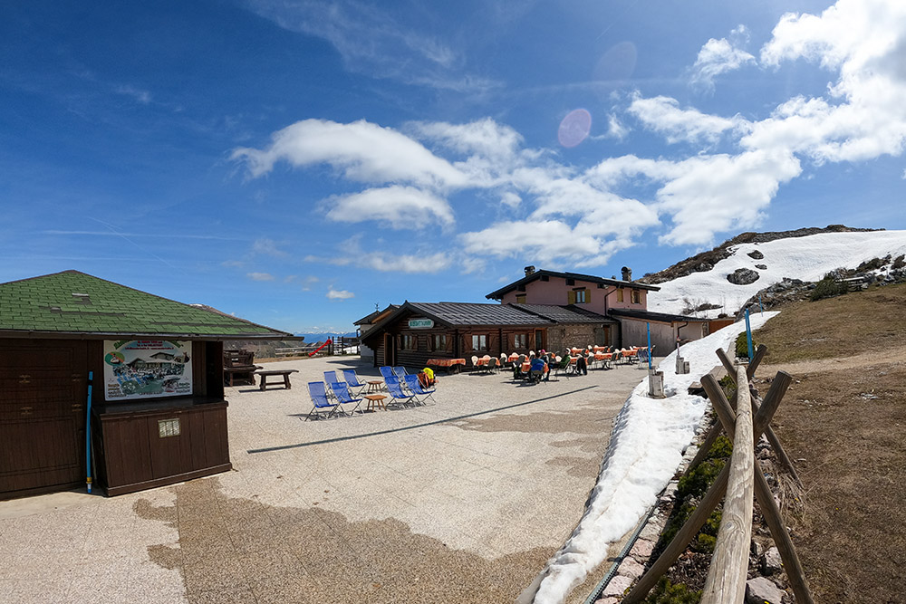
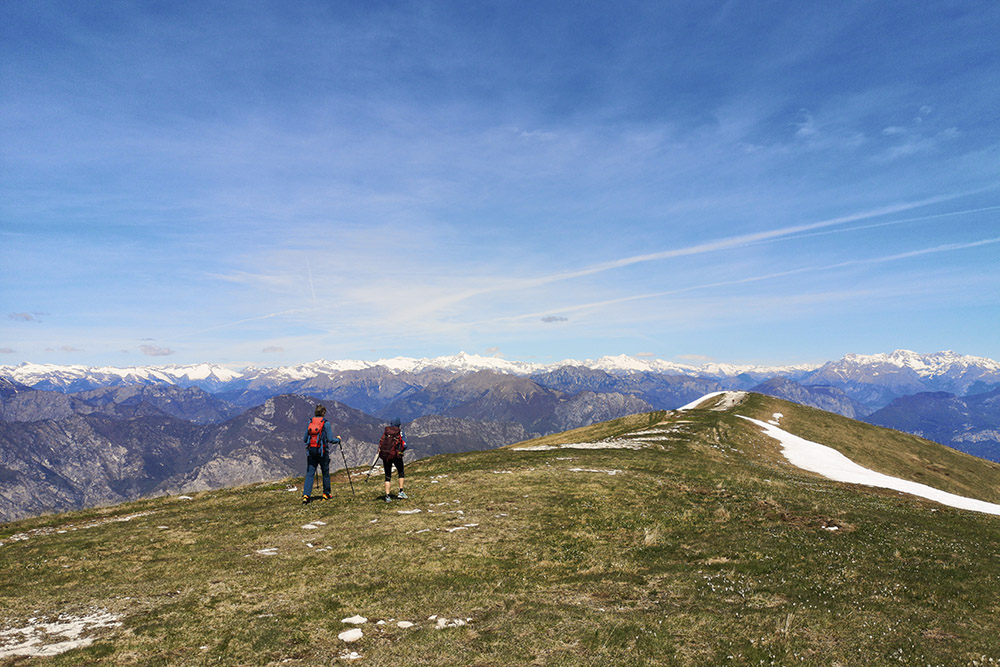
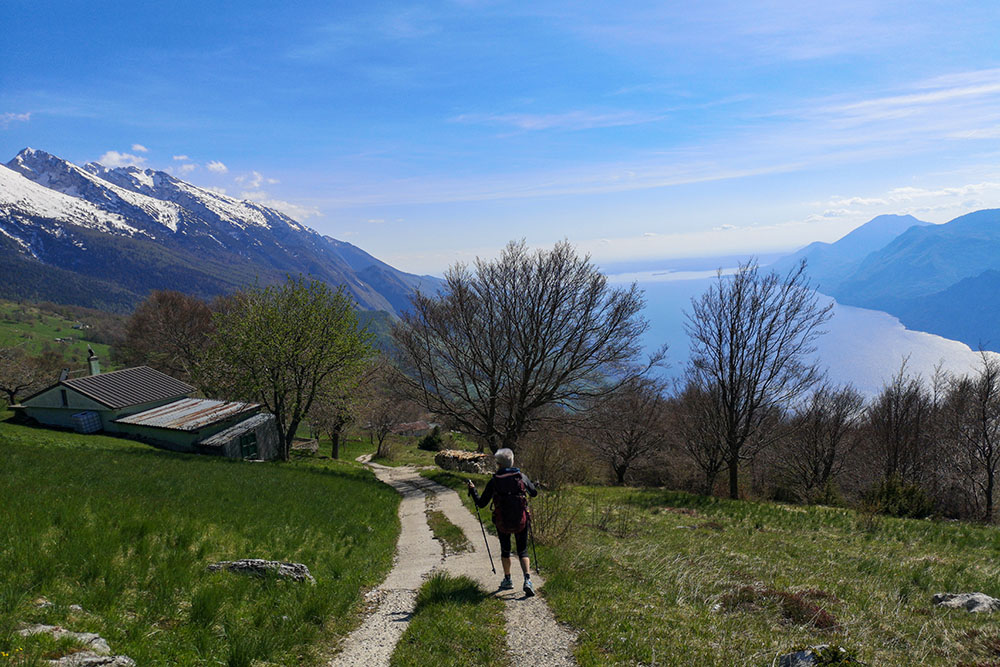
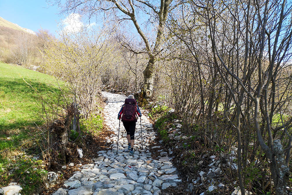
From the car park (1469 m), take the paved road towards Lake Garda for 200 m and then go up a path to the right - be careful because there are no signs. Going up you arrive at the Baita Dei Forti Restaurant Bar (1738 m) and at the mountain station of the Monte Baldo cable car (1750 m). Here you take path 651 and stay at high altitude passing through the La Capannina Bar restaurant (1763 m) and arriving at a beautiful panoramic point (1730 m). Continue the downhill path and shortly after you arrive at the start of the Ventrar Path (1588 m) trail no. 3. At the end of the aided section, go down and continue on path 3. At an altitude of 1259 m, take path 11 - Tratto Spino nature trail on the left - returning to the Baita Dei Forti Bar Restaurant (1738 m). Now you return to the starting point for the same path.
EXCURSION DATE
May 8, 2021
STARTING POINT
At the Malga Prà Alpesina car park
REFRESHMENT POINT
Restaurant Bar Baita Dei Forti (1738 m) and Bar restaurant La Capannina (1763 m)
AUTHOR’S SUGGESTIONS
It is advisable to follow the route counterclockwise and from May to October when there is no snow.
SAFETY TIPS
The viability of the proposed itinerary, like all mountain morphology, is subject to environmental changes due to natural events and weather conditions. Therefore, before leaving, consult the competent tourist offices and / or the refuges of reference.
Our GPX tracks are only indicative, that is, the route was carried out at best with the conditions of the trails and weather of that day. So always consider what to do on site.
Also remember to evaluate the route based on your physical abilities, training and the equipment you have.
You should leave someone the route you intend to do told.
Remember that the emergency number is 112.
EQUIPMENT
It is recommended to have the appropriate equipment for the route, weather conditions and season: windproof and / or rain jacket, map and / or GPS device, goggles, sunscreen, boots, first aid kit, specific clothing, gloves, backpack with food and drink.
RECOMMENDED MAPS
061 ALTO GARDA - LEDRO - MONTE BALDO NORD
INTERESTING LINKS
https://funiviedelbaldo.it/
HOW TO ARRIVE
A22 Ala-Avio exit. SP90 and you arrive in Avio (3.5 km). Now take the SP208 and climb up to Lake Pra da Stua (11.5 km). Here you go up the SP230 and arrive at Malga Prà Alpesina (6.3 km).
PARKING AREA
Free at the Malga Prà Alpesina
GPS coordinates: 45.763190, 10.877150
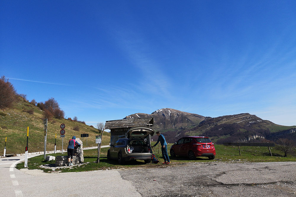
Parcheggio presso la Malga Prà Alpesina
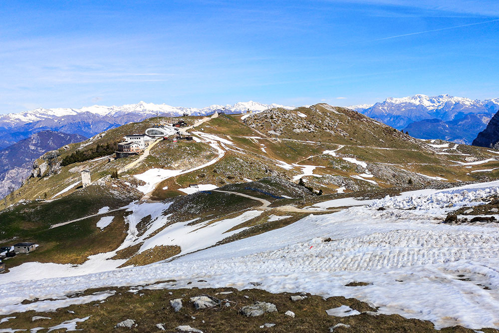
In lontananza la Stazione a monte della funivia
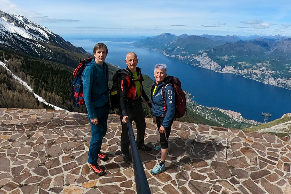
Panorama dalla Stazione a monte della funivia Monte Baldo
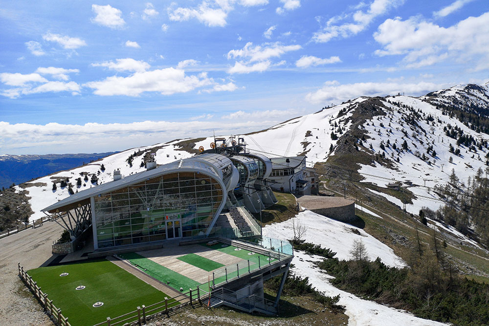
La Stazione a monte della funivia Monte Baldo
Bar ristorante La Capannina
Verso l'attacco del Sentiero del Ventrar
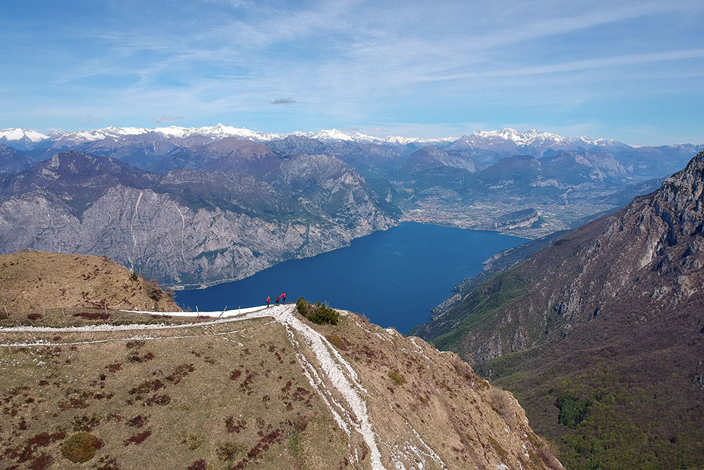
Fantastico punto panoramico sul Lago di Garda
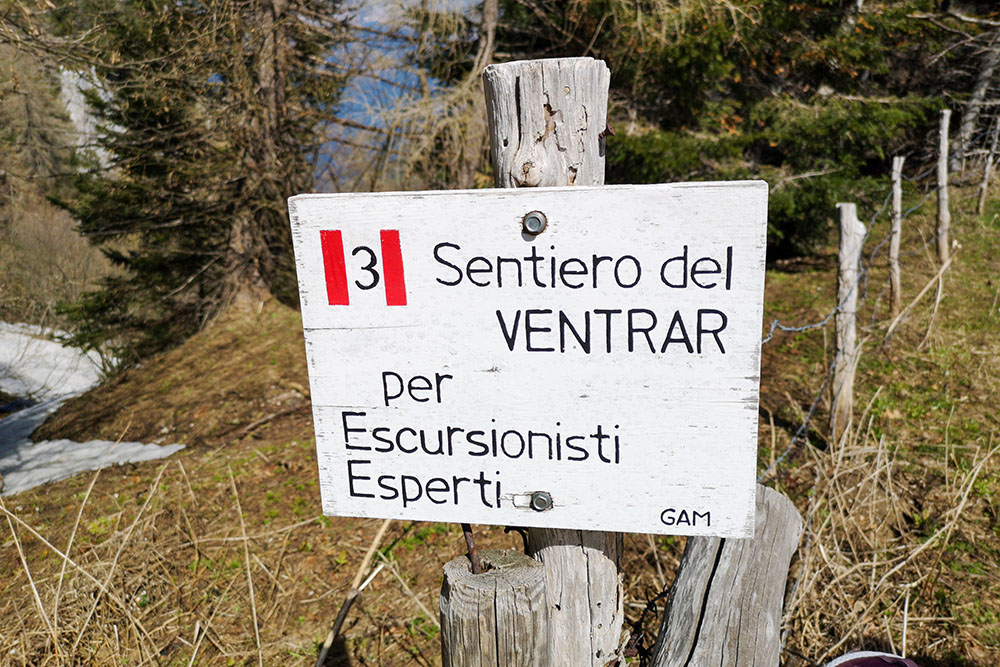
Segnaletica dell'inizio del Sentiero del Ventrar
Termine del tratto attrezzato
Si passa per alcune case e fienili
Si risale per il sentiero Tratto Spino


