


![]()


Durata
 3:40 h
Distanza
 9,1 km
 Ascesa
 657 m
657 mDiscesa
 657 m
657 mH Max
 2622 m
H Min
 2068 m
Tour of the lakes in Val Nambrone: of Cornisello, Vedretta and Nero
DESCRIPTION
Beautiful area full of wonderful alpine lakes.
In a single, non-demanding excursion you can see 4 fantastic lakes: the two of Cornisello, of Vedretta and Nero. This itinerary is suitable for photography enthusiasts, because the naturalistic scenarios that arise are truly formidable. The only unknown is time. It is advisable to choose a sunny day, perhaps September, so you are more likely to have no clouds.
ITINERARY
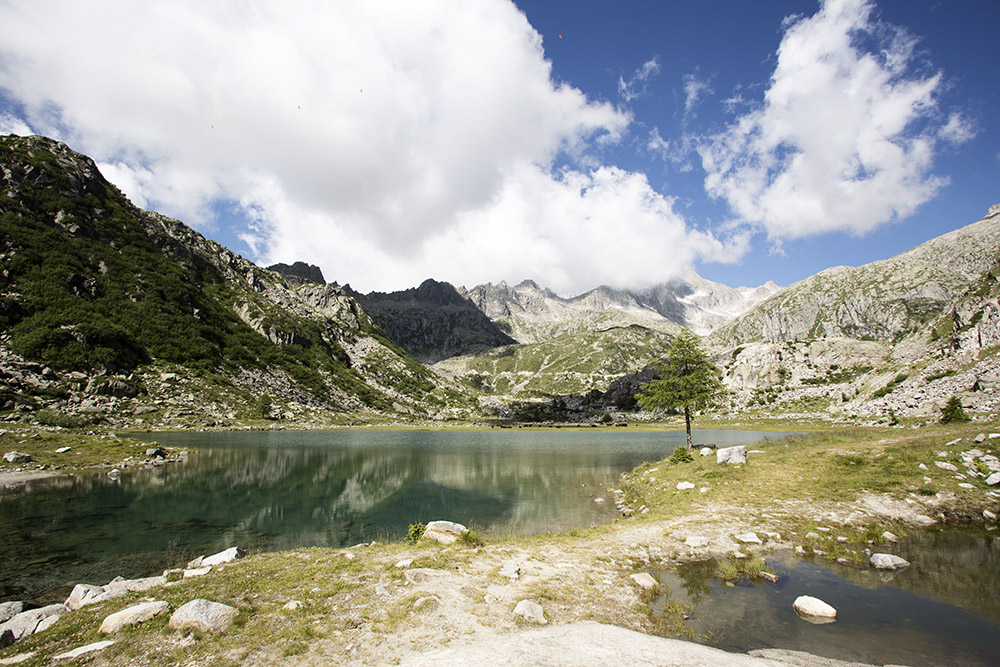
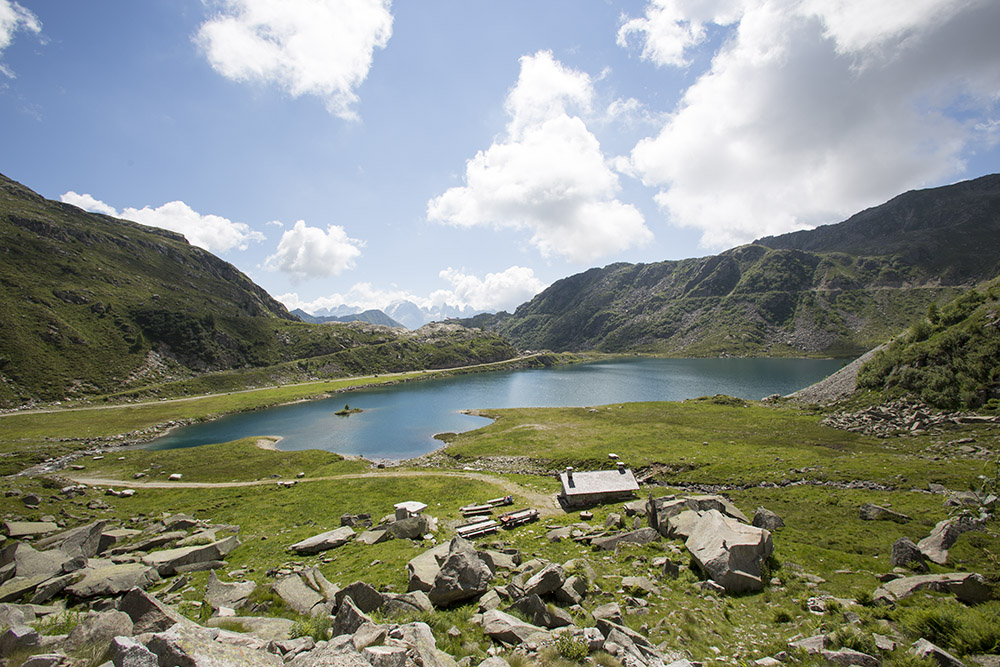
From the car park (2068 m), take the 239 and passing through the two Cornisello lakes, you will reach Malga Cornisello (2122 m). A little above, at the crossroads, continue along the 239 up to Lago Vedretta (2612 m). You return by the same road to the upper Cornisello Lake. Here you take the 216 and go towards the Bocchetta dell’uomo. At the first crossroads, turn left onto the 238. After a few minutes you will arrive at Lago Nero (2236 m). Now you always return on 238 to the parking lot passing through the Rifugio Cornisello (2120 m).
STARTING POINT
Parking at the Rifugio Cornisello
REFRESHMENT POINT
Rifugio Cornisello
AUTHOR’S SUGGESTIONS
On the Adamello Group, time is always variable. It is advisable to take the excursion early in the morning.
SAFETY TIPS
The viability of the proposed itinerary, like all mountain morphology, is subject to environmental changes due to natural events and weather conditions. Therefore, before leaving, consult the competent tourist offices and / or the refuges of reference.
Our GPX tracks are only indicative, that is, the route was carried out at best with the conditions of the trails and weather of that day. So always consider what to do on site.
Also remember to evaluate the route based on your physical abilities, training and the equipment you have.
You should leave someone the route you intend to do told.
Remember that the emergency number is 112.
EQUIPMENT
It is recommended to have the appropriate equipment for the route, weather conditions and season: windproof and / or rain jacket, map and / or GPS device, goggles, sunscreen, boots, first aid kit, specific clothing, gloves, backpack with food and drink.
RECOMMENDED MAPS
Kompass 71 ADAMELLO-PRESANELLA
INTERESTING LINKS
https://www.rifugiocornisello.it/it/
HOW TO ARRIVE
From Tione di Trento SS239 towards Madonna di Campiglio. Before arriving in Sant’Antonio di Mavignola, on a hairpin bend, take the road to the left for Val Nambrone. Continue for about 12 km and arrive at the parking lot at the Rifugio Cornisello.
PARKING AREA
At the Rifugio Cornisello
GPS coordinates: 46.220958, 10.739830
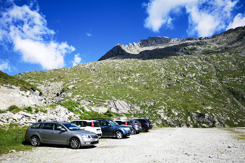
Parcheggio sotto il Rifugio Cornisello
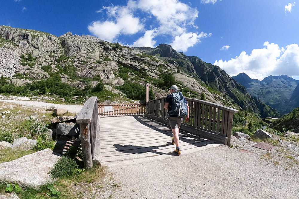
Si parte per i Laghi di Cornisello
Lago di Cornisello inferiore
Il Lago di Cornisello superiore con la Malga Cornisello
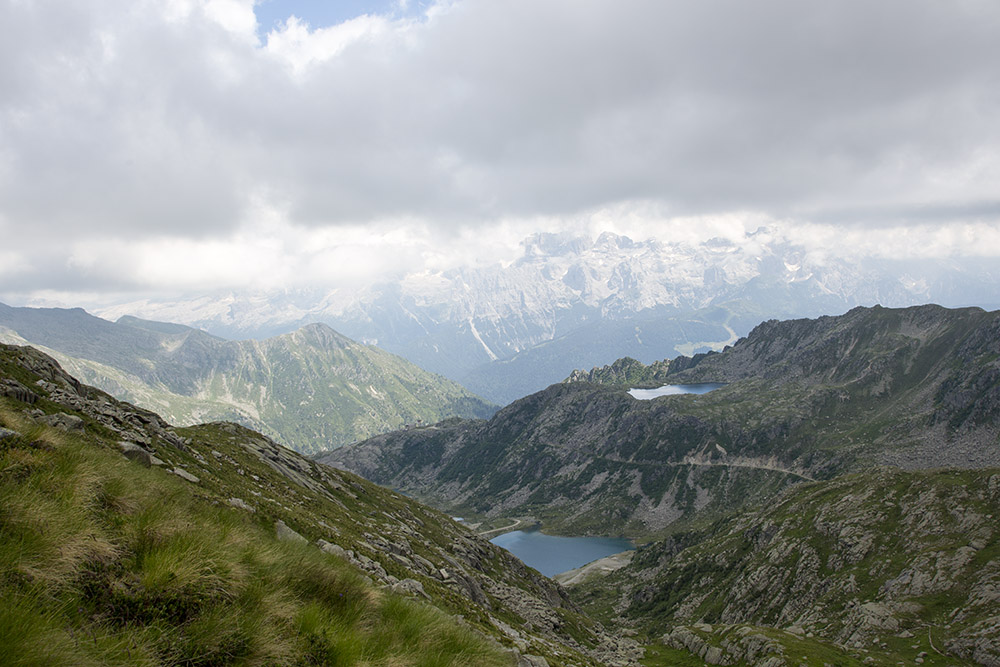
Il panorama durante la salita
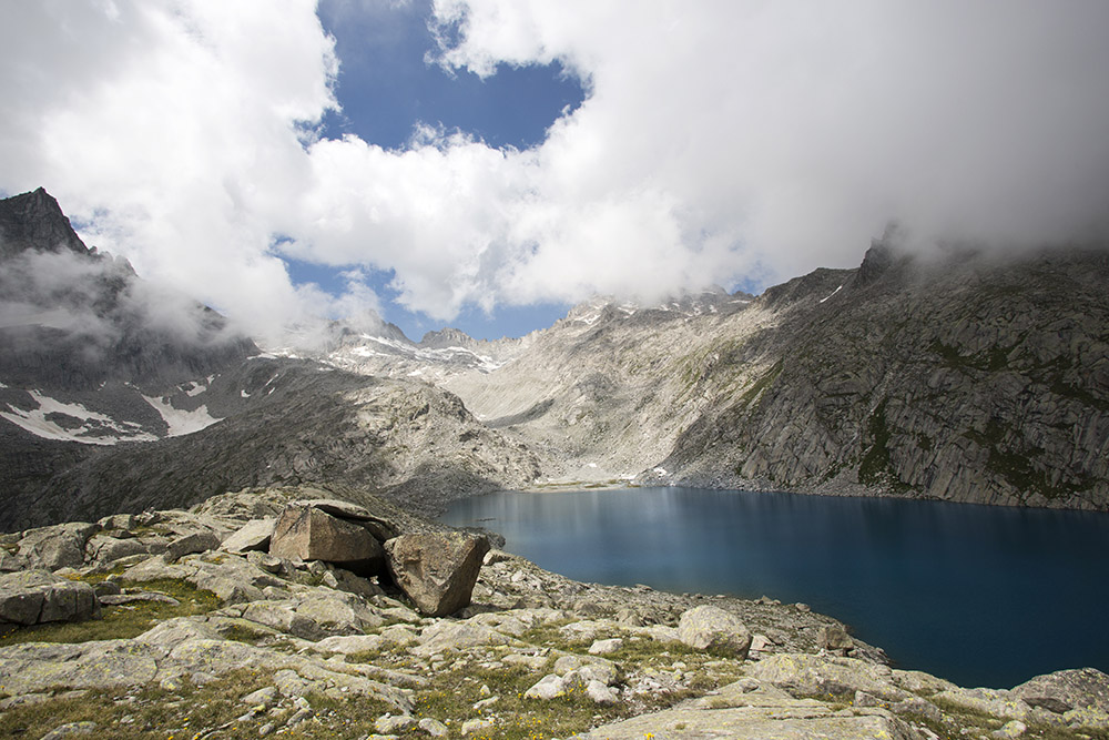
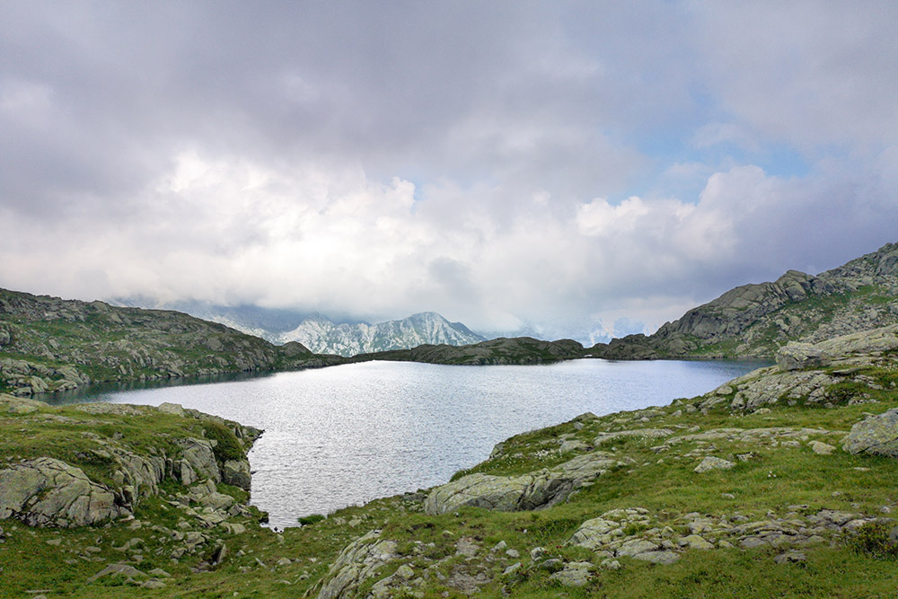
Il Lago Vedretta
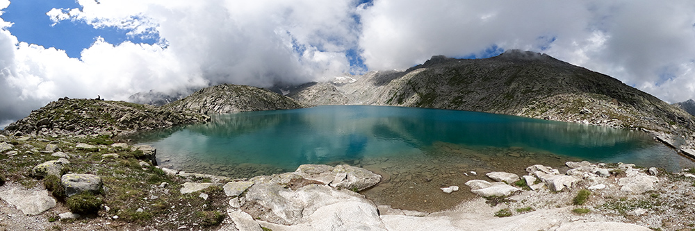
Il Lago Vedretta
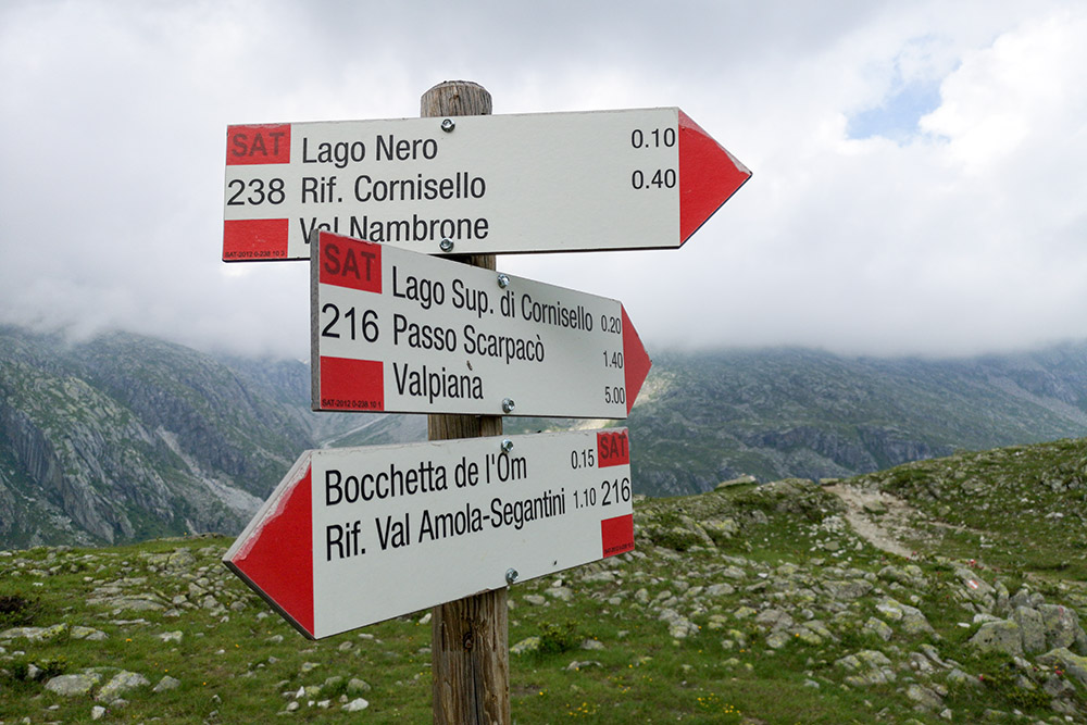
Segnavia
Il Lago Nero e sullo sfondo il Gruppo del Brenta
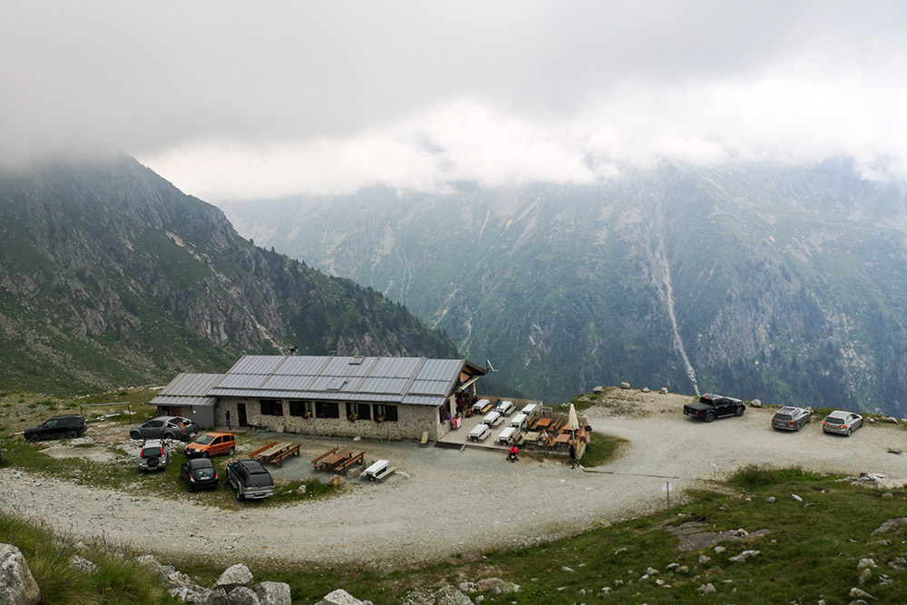
Il Rifugio Cornisello


