


![]()


Durata
 5:00 h
Distanza
 9,8 km
 Ascesa
 890 m
890 mDiscesa
 890 m
890 mH Max
 1226 m
H Min
 462 m
462 mMonte Caviojo and Monte Cimone di Tonezza Hike
DESCRIPTION
Between memorials and forests: A meditative walk on Monte Cimone di Tonezza.
Geographical Location
Monte Cimone di Tonezza overlooks the confluence of the Astico and Posina streams in the northeastern part of Vicenza province. This prealpine peak, located near Arsiero, forms a crucial geographical junction between the Asiago Plateau and Astico Valley, which gave it strategic importance during World War I.
The Hike
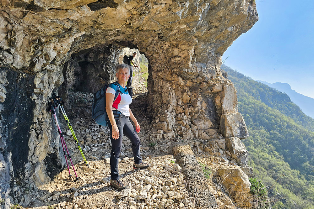
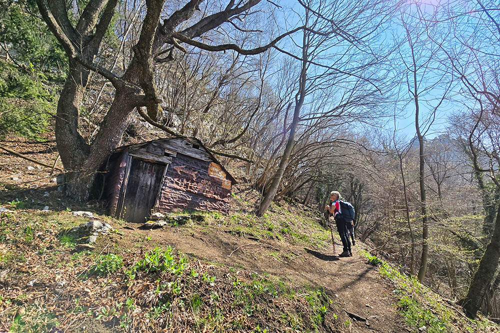
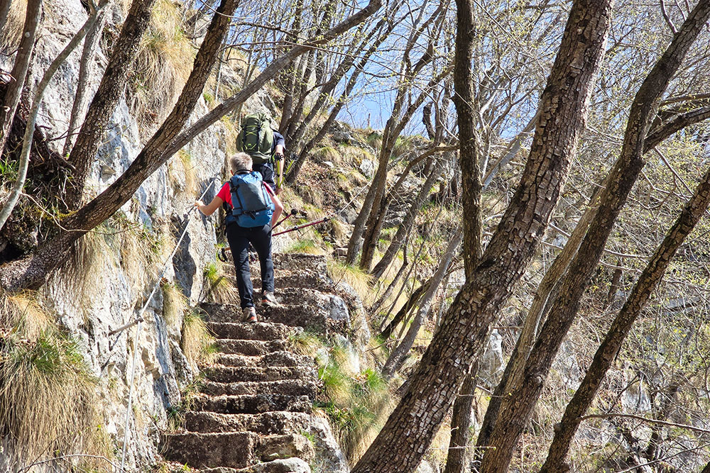
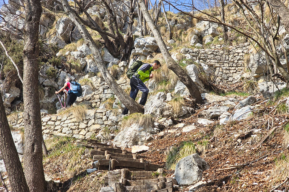
This itinerary combines natural beauty with history, offering a rare opportunity to explore one of the most significant WWI theaters on the Italian front. The trail mainly winds through beech forests, with an easy path that becomes slightly more challenging only on the final approach to Monte Caviojo's summit, where there's a short equipped section (EEA).
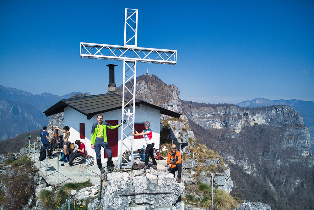
The hike allows visitors to explore an exceptional defensive system including trenches, rock-carved artillery positions, and the imposing Ossuary of Cimone. Two main viewpoints stand out: Monte Caviojo's summit offering an aerial view of the plateau, and the military memorial atop Cimone, dominating the surrounding valleys.
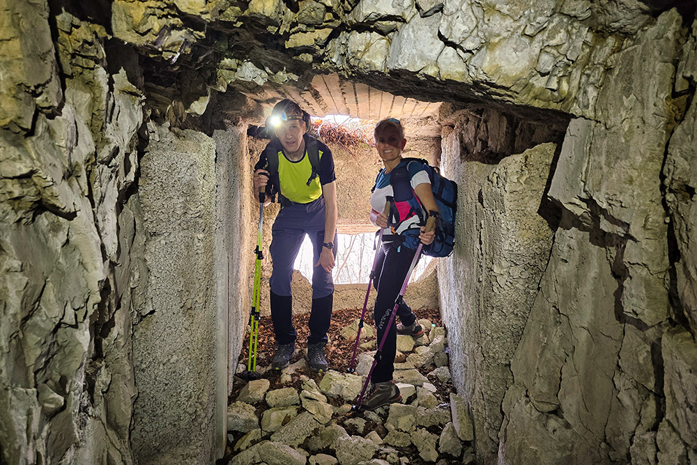
The Galleria Cima Neutra is undoubtedly the most thrilling section. This 350-meter military engineering masterpiece, dug in 1917 to connect Italian positions on Caviojo, features a spiral layout with numerous side passages leading to storerooms, observation posts, and firing positions – creating a veritable mountain labyrinth.
History and Highlights
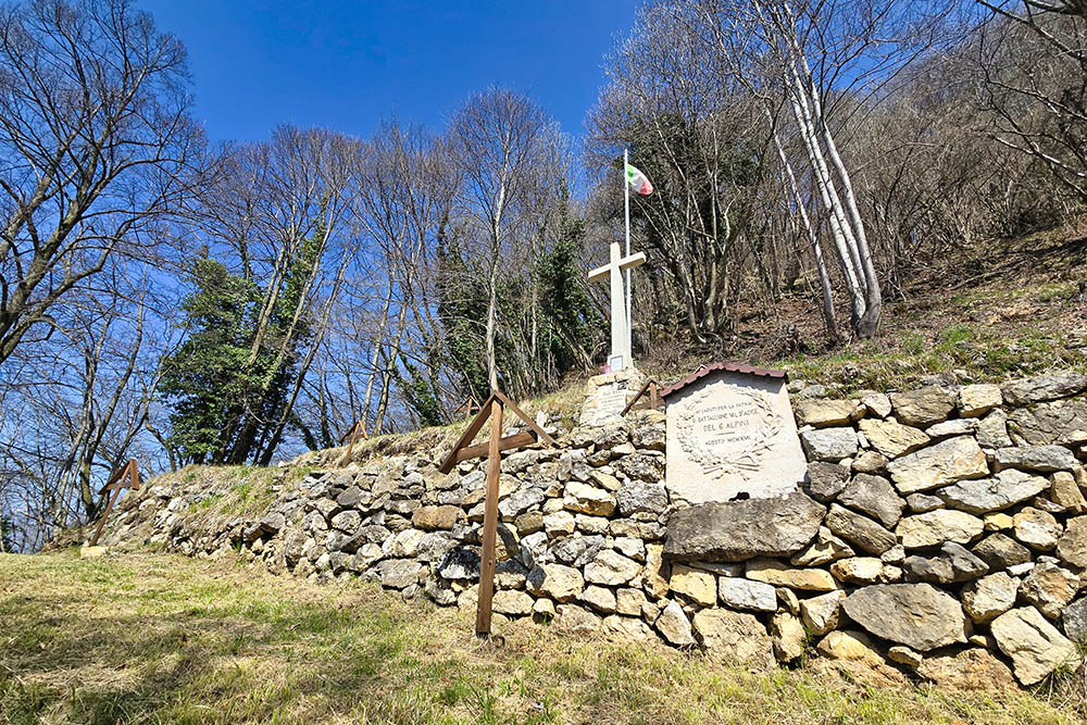
These mountains were forever marked by the dramatic events of September 23, 1916, when Austro-Hungarian troops detonated 14 tons of explosives under Cimone's summit, completely obliterating the peak and claiming the entire Sele Brigade. Today, the 1929 Military Memorial houses the remains of 1,210 fallen soldiers.
The defensive system is completed by the Strada degli Alpini, built between 1909-1910 by the Vicenza Battalion. This perfectly preserved mule track represents an exceptional example of high-altitude military infrastructure and forms the backbone of the entire hiking route.
This itinerary particularly suits those seeking an introspective experience, where forest silence and still-visible war traces invite reflection on history and the conflict-transformed mountain landscape.
ITINERARY
From Church of Saint Rocco (461 m) follow trails 541 and 542 to the Italian War Cemetery at Cima Neutra (1,000 m), then proceed to Malga Smaniotto (1,020 m). Turn right here for the ascent to Monte Caviojo (1,120 m) – the final section is an easy equipped climb (EEA).
Returning to the malga, continue on trail 542 toward Monte Cimone di Tonezza (1,226 m), passing through a short tunnel and the impressive Galleria Cima Neutra. From the summit dominated by the ossuary, descend following marker 636 to Piazzale degli Alpini (1,109 m), then complete the loop via the Strada degli Alpini (540) and Callieron (540A) back to the starting point.
EXCURSION DATE
April 5, 2025
STARTING POINT
Church of Saint Rocco in Arsiero
REFRESHMENT POINT
None available along the route
AUTHOR'S SUGGESTIONS
Remember to bring a flashlight. If time allows, visit Arsiero's Military Cemetery too.
SAFETY ADVICE
Trail conditions, like all mountain terrain, are subject to environmental changes and weather. Always check with local tourist offices or mountain huts before departure.
Our GPX tracks are indicative only, recorded during optimal conditions. Always assess conditions on-site.
Evaluate the route according to your fitness level, training, and equipment. Inform someone about your planned itinerary.
Emergency number: 112
ESSENTIAL GEAR
Weather/season-appropriate equipment: wind/rain jacket, map/GPS device, sunglasses, sunscreen, hiking boots, first-aid kit, gloves, backpack with food/water.
RECOMMENDED MAPS
Tabacco Map 056 Piccole Dolomiti - Carega Pasubio
USEFUL LINKS
https://avgg.provincia.vicenza.it/esperienze/ecomusei/
HOW TO ARRIVE
From Vicenza take SR53 and SS53. Enter A31 highway and exit at Piovene Rocchette. Continue on SP349 to Mosson, then follow signs to Cogollo del Cengio. Take SP350 and SP81. After Arsiero, before the tunnel, turn right onto Via Cella to reach Church of Saint Rocco.
PARKING AREA
At Church of Saint Rocco in Arsiero
GPS coordinates: 45.805764, 11.339316
Parcheggio presso la chiesetta di San Rocco
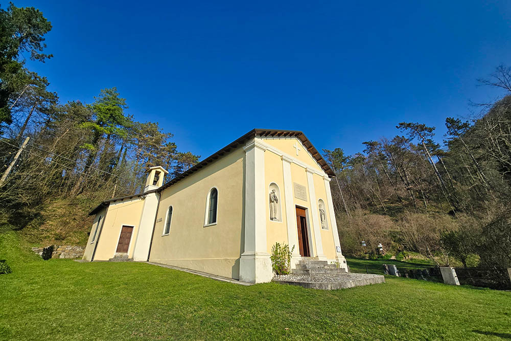
La chiesetta di San Rocco
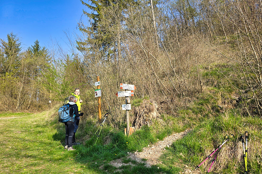
Inizia il sentiero 541
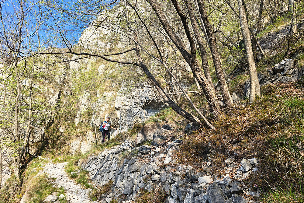
Si sale su mulattiera militare
Prime gallerie
Prime gallerie
Cimitero italiano di Cima Neutra
Baito Smaniotto
Scala per Cima Caviojo
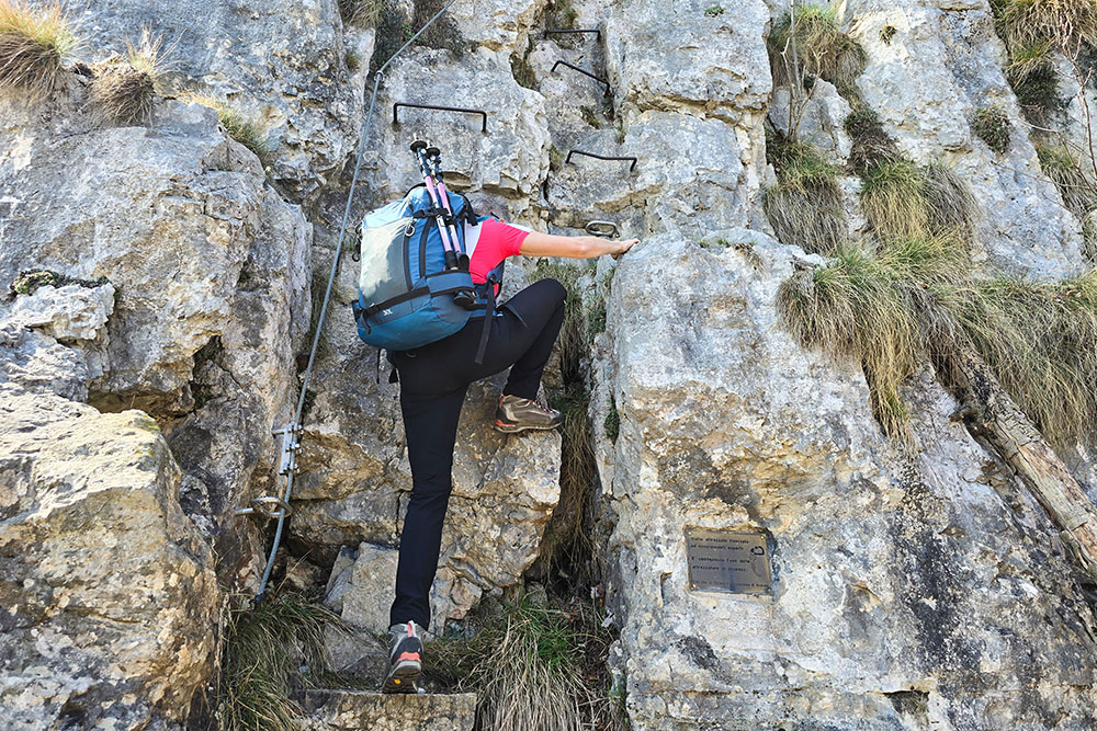
Tratto attrezzato
In cima al Monte Caviojo
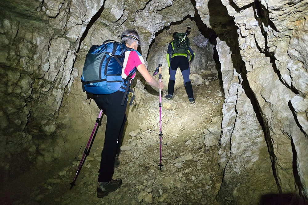
Galleria Quota Neutra
Ultimo tratto per la Cima Cimone di Tonezza
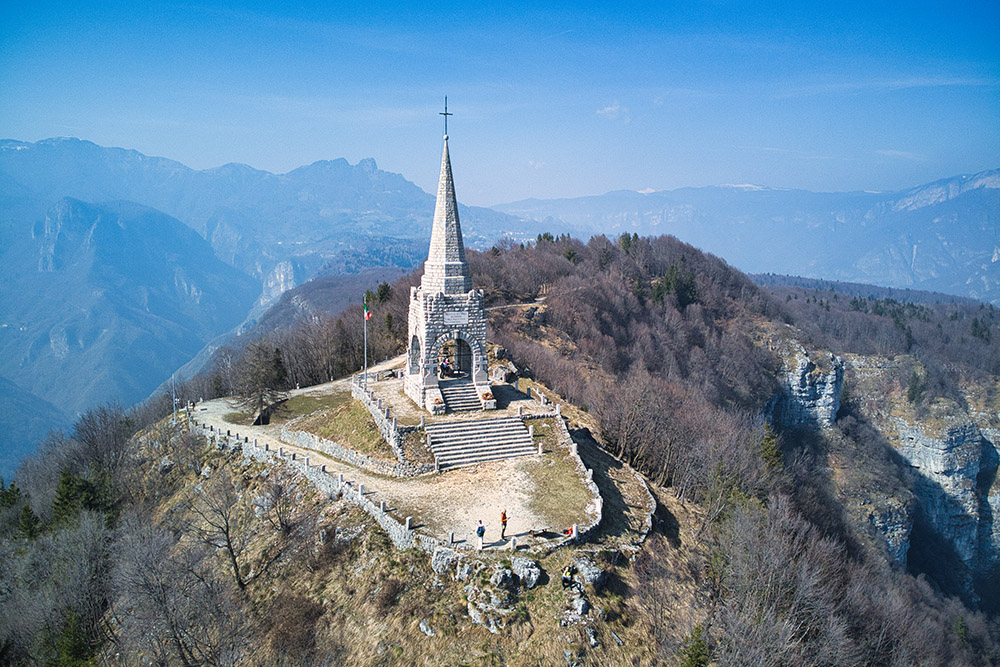
Cima Cimone di Tonezza
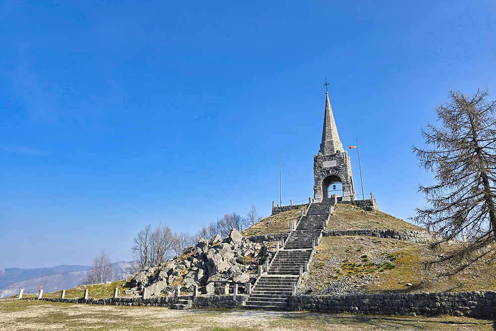
Ossario del Monte Cimone


