


![]()


Durata
 5:25 h
Distanza
 11,3 km
 Ascesa
 1001 m
Discesa
 1001 m
H Max
 2384 m
H Min
 1448 m
Monte Migon and the Crest Path
DESCRIPTION
Hike to Monte Migon: a challenge between wild nature and history.
Geographical Location
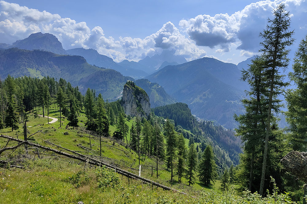
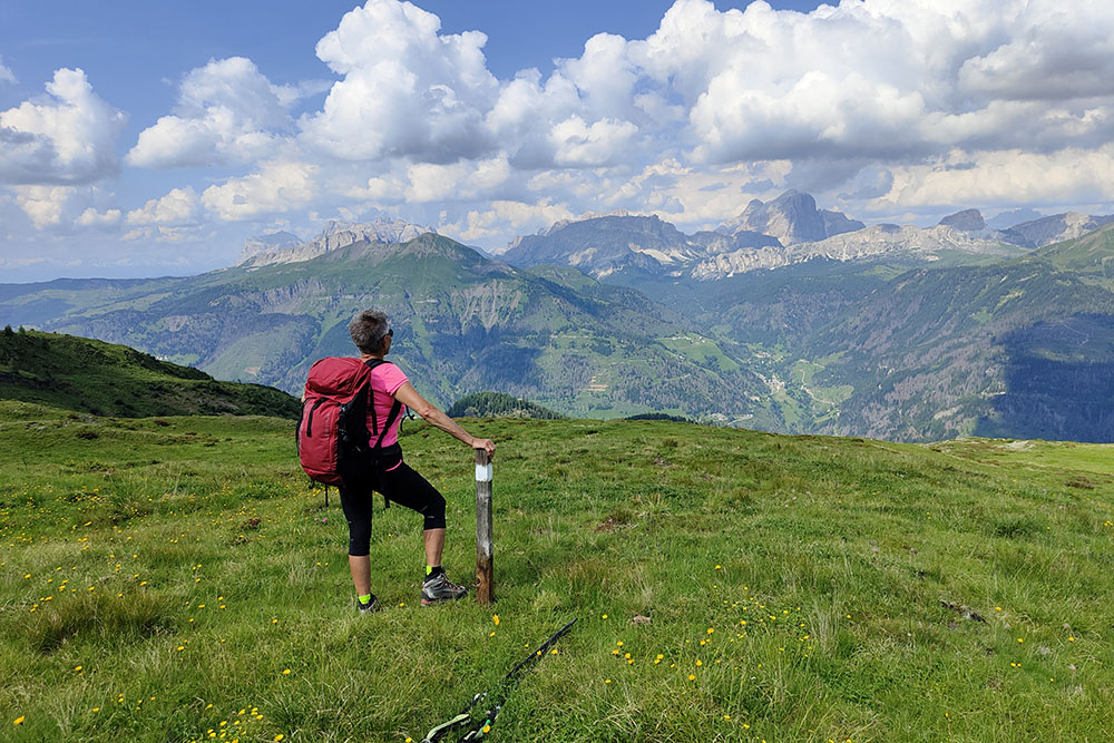
Monte Migon, also known as Migogn, rises majestically to 2,384 meters in the heart of the Dolomites, within the Marmolada Group. Located in the Province of Belluno, Veneto, it is part of the UNESCO World Heritage. This peak represents the eastern end of the Padon chain, overlooking Val Pettorina and the Alta Via delle Creste. Its slopes offer a fascinating contrast between the steep rocky cliffs to the west and the green grassy slopes to the south.
Hike
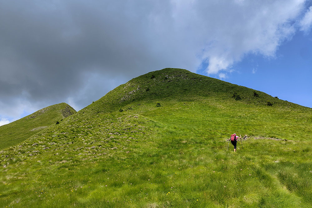
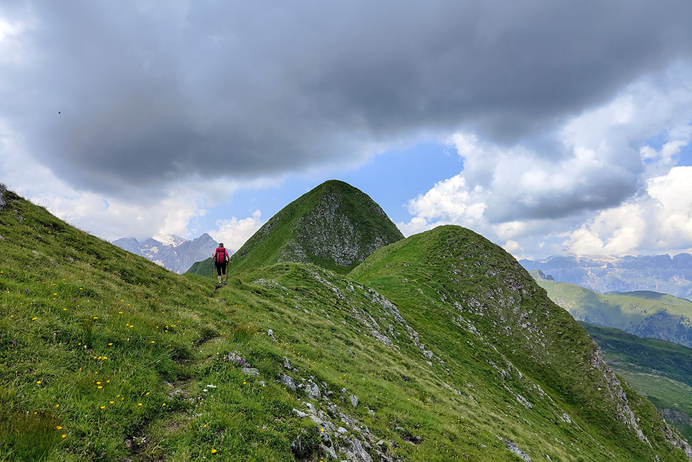
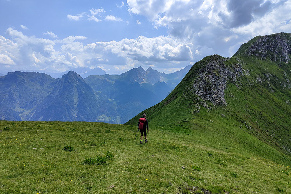
The hike to Monte Migon via trail 636 of the Alta Via delle Creste is an intense and rewarding experience. The path is very steep and challenging, recommended only for experienced hikers in good physical condition. During the winter, the risk of avalanches makes this route particularly dangerous. However, at other times of the year, the effort is more than compensated by a 360° panoramic view encompassing the entire Dolomites.
This itinerary, immersed in a secluded and less frequented environment, is ideal for those seeking tranquility and direct contact with wild nature. Along the way, you can admire extraordinary views including Sella, Conturines, Lagazuoi, Averau, Nuvolau, Antelao, Pelmo, Civetta, and Marmolada. The characteristic grassy humps of Monte Migon offer a unique visual contrast to the typical rocky landscapes of the Dolomites.
The path along the crest not only offers spectacular views but also requires a good level of physical preparation and surefootedness due to the exposure and significant elevation gain. It is important to pay attention, as signage may be insufficient in some sections, requiring experience in navigating less-traveled mountain trails.
History
Another fascinating aspect of Monte Migon is its historical significance. Along the Crest Path, it is possible to encounter war positions and tunnels dating back to World War I, transforming the hike into a sort of open-air museum. These historical testimonies provide a poignant insight into the harsh reality of the conflict that took place among these mountains, further enriching the hiker's experience.
ITINERARY
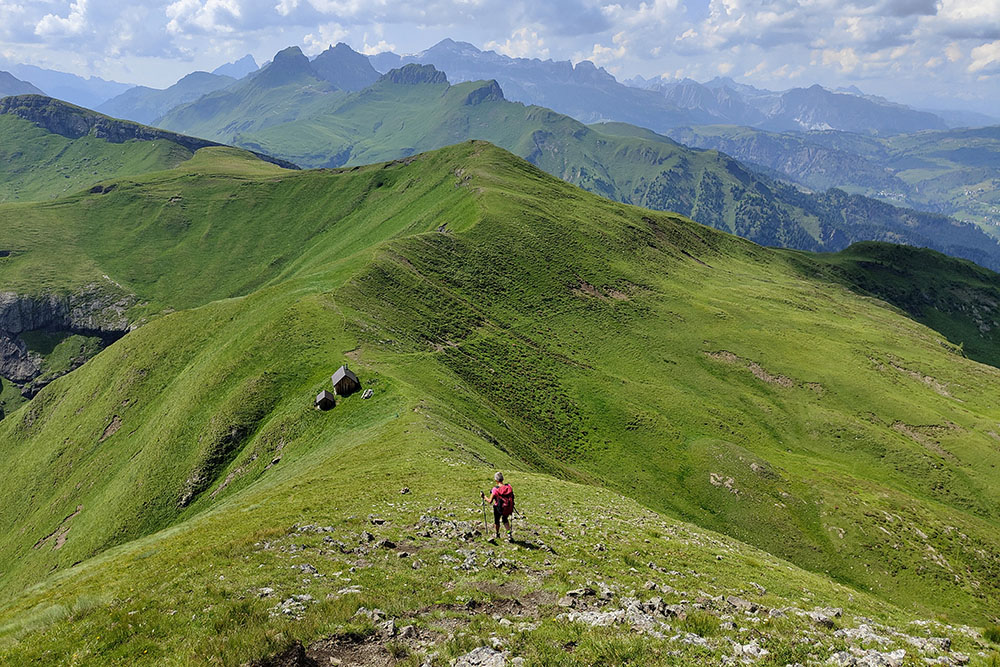
From Soppera (1,448 m), ascend on an asphalt road passing the hamlets of Dagai, Val, and Davare. Upon reaching the last available parking area, take the trail that leads to Sass de la Gusela. Here, you will find the first sign for Monte Migon - Crest Path. Shortly after, join trail 636 coming from Ronch and continue ascending to the summit of Monte Migon (2,384 m). Continue along the crests to Tabié dal Lof (2,322 m) and then descend to Malga Laste (1,868 m). The return journey takes you past Rifugio Migon (1,660 m).
EXCURSION DATE
July 18, 2024
STARTING POINT
Soppera, hamlet of Laste (municipality of Rocca Pietore)
REFRESHMENT POINT
Malga Laste and Rifugio Migon
AUTHOR’S SUGGESTIONS
As the trails are not very visible and almost devoid of signage, we recommend downloading the GPX track to avoid difficulties in following them.
SAFETY TIPS
The feasibility of the proposed itinerary, like the entire mountain morphology, is subject to environmental changes due to natural events and weather conditions. Therefore, before setting out, consult the relevant tourist offices and/or the respective refuges.
Our GPX tracks are only indicative, meaning the route was followed under the best trail and weather conditions on that day. Always assess the situation locally.
Additionally, remember to evaluate the route based on your physical abilities, fitness level, and the equipment you have.
It is advisable to inform someone of the itinerary you plan to follow.
Remember that the emergency number is 112.
EQUIPMENT
It is recommended to have the appropriate equipment for the route, weather conditions, and season: windproof and/or rain jacket, map and/or GPS device, sunglasses, sunscreen, hiking boots, first aid kit, specific clothing, gloves, backpack with food and drinks.
RECOMMENDED MAPS
Tabacco 07 Alta Badia - Arabba - Marmolada
INTERESTING LINKS
https://www.caiveneto.it/rifugio/migon
HOW TO ARRIVE
From Alleghe, take the SR203 towards Caprile. After passing Caprile, continue on SP563. Before reaching Digonera, turn left onto the road to Laste. After about 3.5 km, you will reach the hamlet of Soppera.
PARKING AREA
Free parking in Soppera
GPS Coordinates: 46.453142, 11.971697
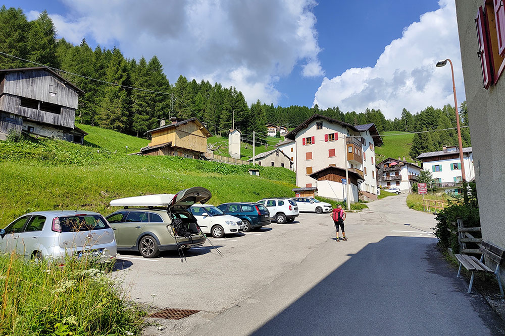
Parcheggio a Soppera
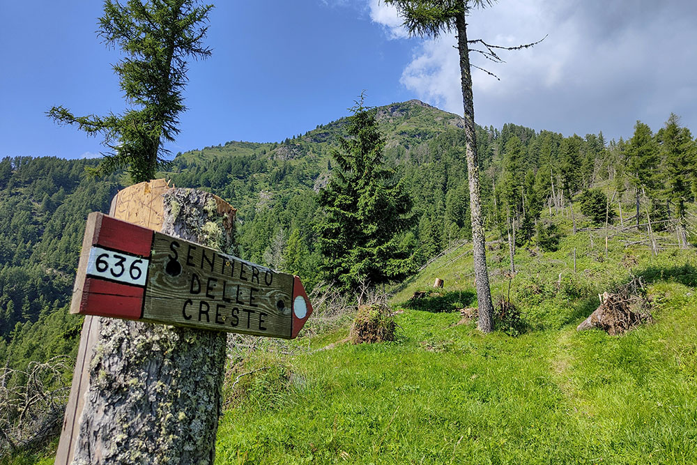
Inizia il Sentiero delle Creste
Vista verso il punto di partenza
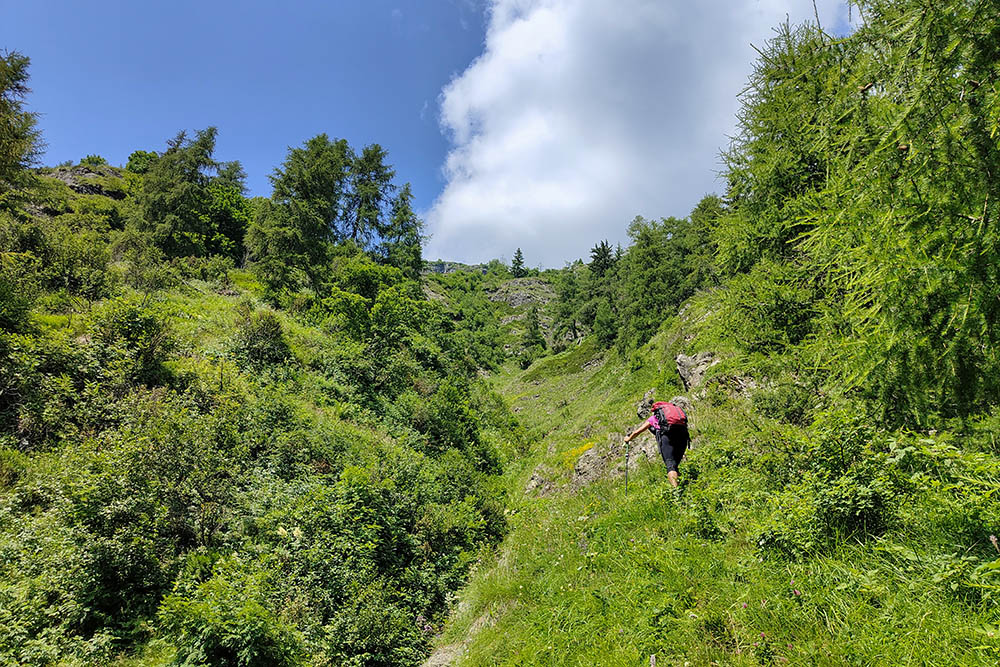
Si sale su sentiero impervio
Finalmente vediamo la vetta
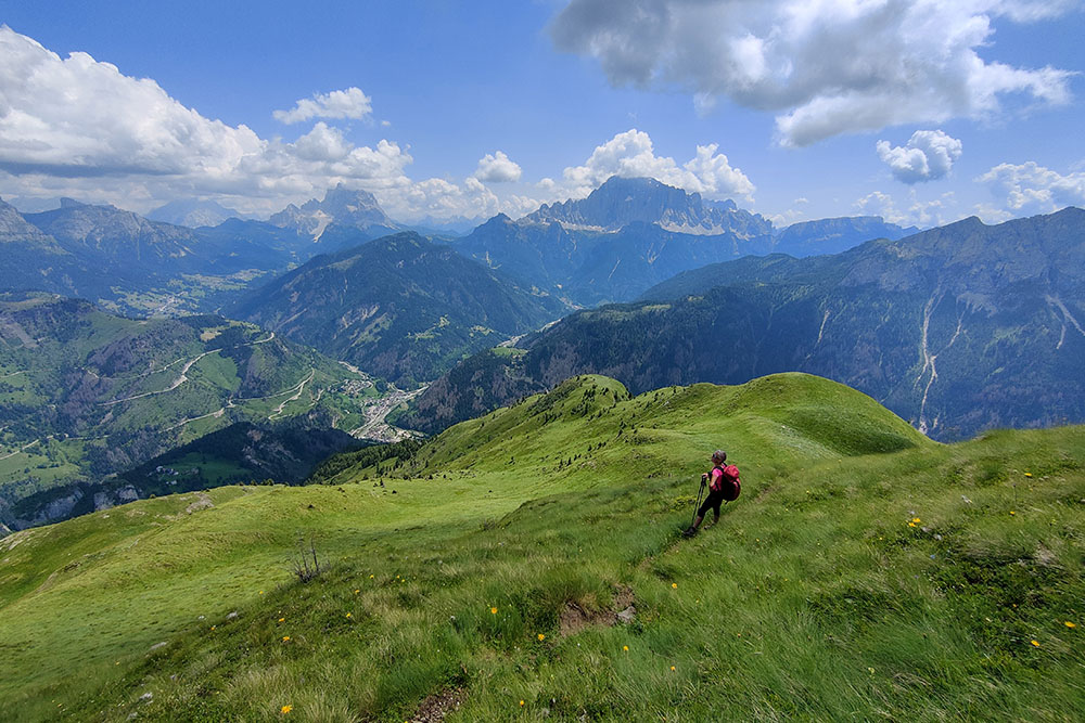
Ci giriamo per gustarci il panorama
Ultimo tratto
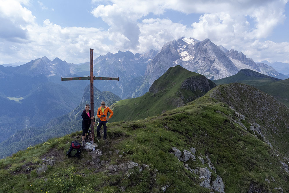
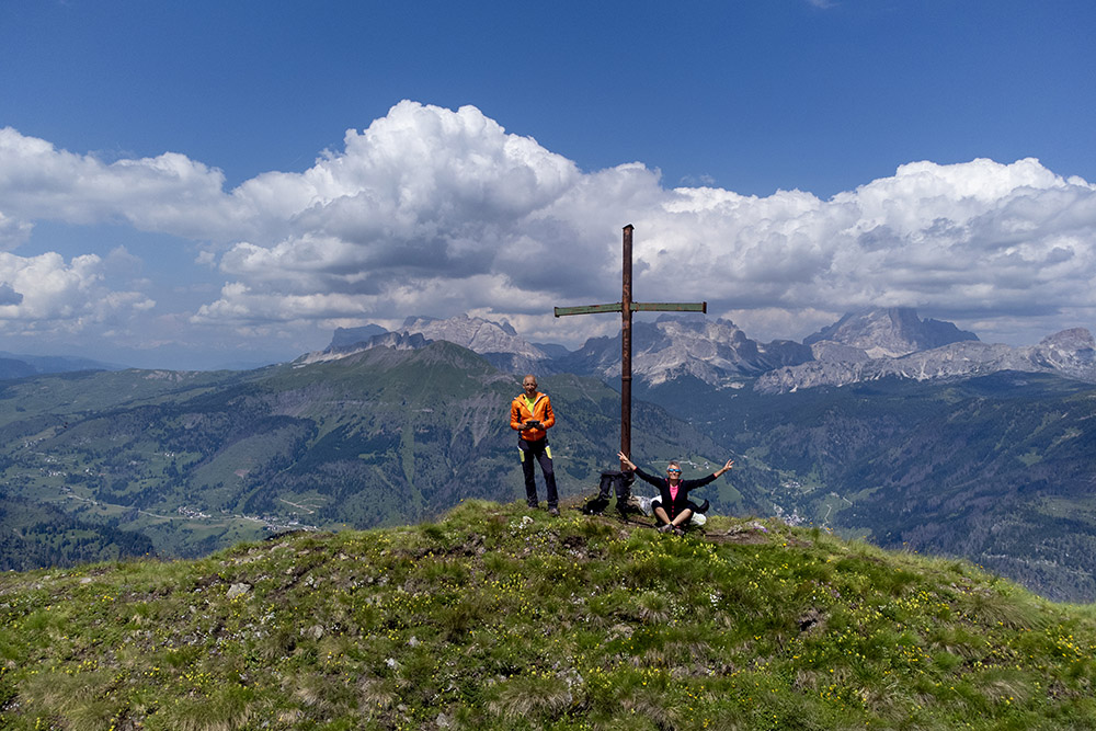
Siamo in vetta al Monte Migon con alle spalle la Marmolada
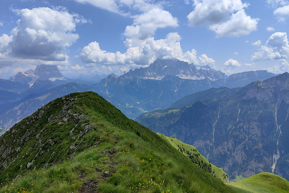
Vista verso il Civetta e Pelmo
Alle spalle Conturines, Lagazuoi e Tofane
Si continua in cresta
Si continua in cresta
Sosta per ammirate il panorama
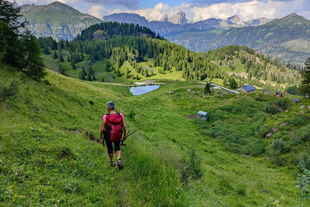
Stiamo arrivando alla Malga Laste
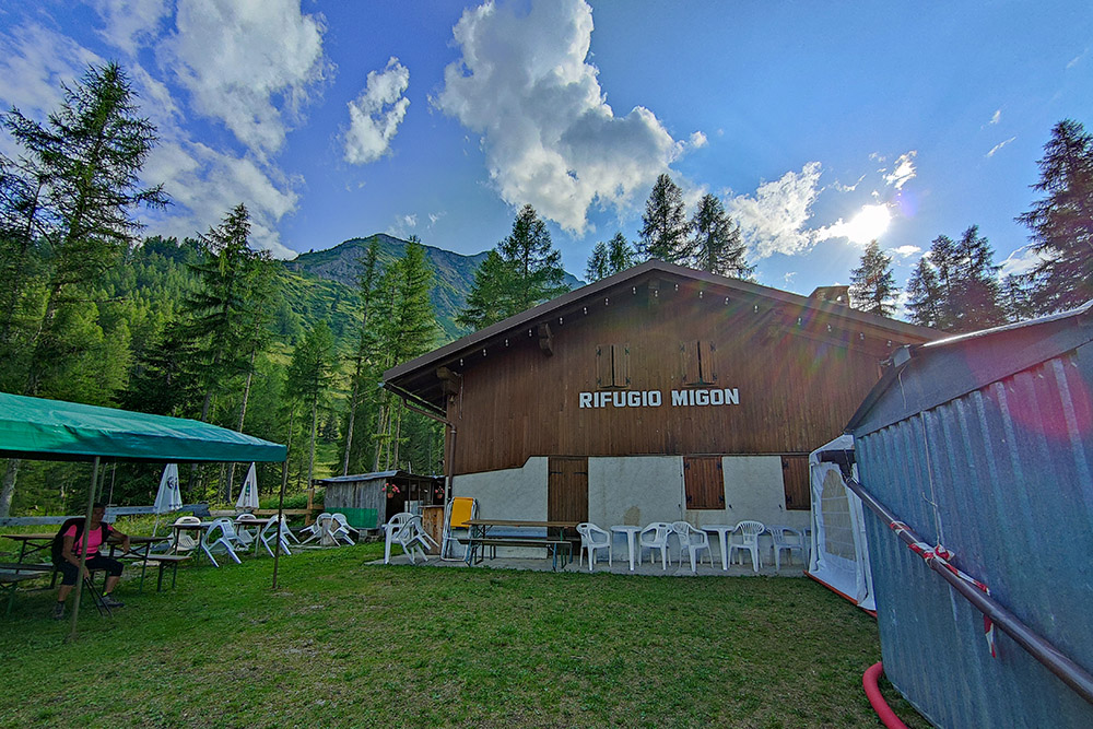
Il Rifugio Migon


