


![]()


Durata
 5:05 h
Distanza
 11,2 km
 Ascesa
 879 m
879 mDiscesa
 879 m
879 mH Max
 871 m
871 mH Min
 65 m
65 mBocca d'Enzima from Riva del Garda
DESCRIPTION
Excursion above Riva del Garda on routes from the Great War: from the Bastione to Bocca d'Enzima.
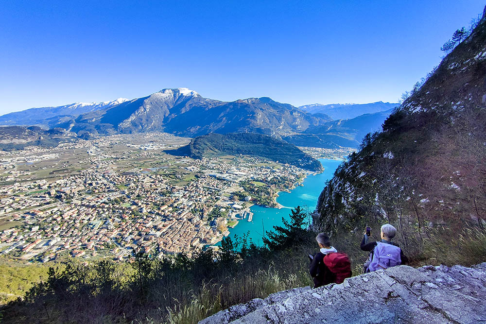
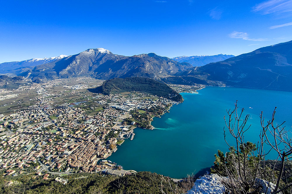
The route offers an extraordinary panorama, offering a splendid view of the Busa, an area that extends from Arco to Riva del Garda, and of the suggestive Trentino Lake Garda. During this pleasant walk, you will come across historic buildings of considerable importance for the region, including the Bastion, the Church of Santa Barbara and the imposing fortifications dating back to the Great War.
The Bastion, the undisputed symbol of Riva del Garda, was built at the beginning of the 16th century with the aim of guaranteeing greater safety for the village below and its inhabitants. In 1703, it suffered serious damage at the hands of French troops under General Vendome, who undermined the central body, making the fort unusable. Recently, it was restored by the Superintendence for Architectural Heritage of the Autonomous Province of Trento and connected to the town below via a fast rack, allowing it to be reached effortlessly in just a few minutes.
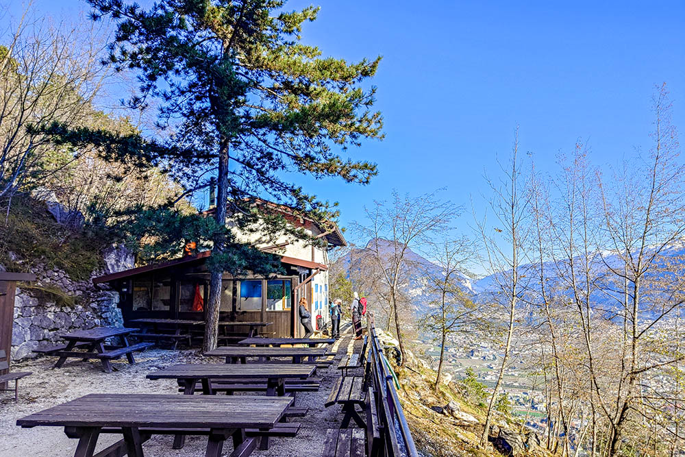
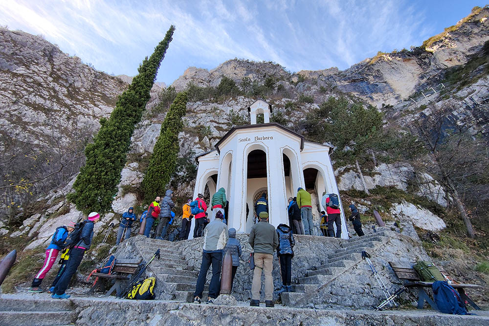
The Church of Santa Barbara, built in 1927 during the construction of the hydroelectric power plant and water pipelines, is dedicated to the patron saint of miners. Just 10 minutes' walk further down the valley, there is the suggestive Capanna Santa Barbara managed by Sat of Riva del Garda.
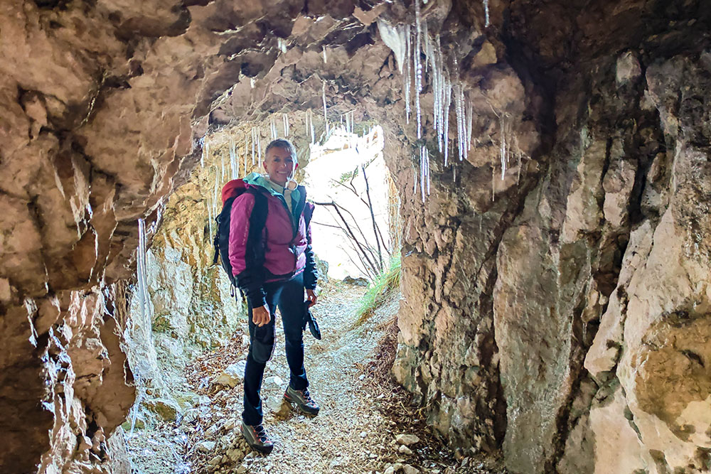
This place also preserves multiple testimonies of the First World War, including trenches, walkways and tunnels, offering a fascinating journey into the war past of the area.
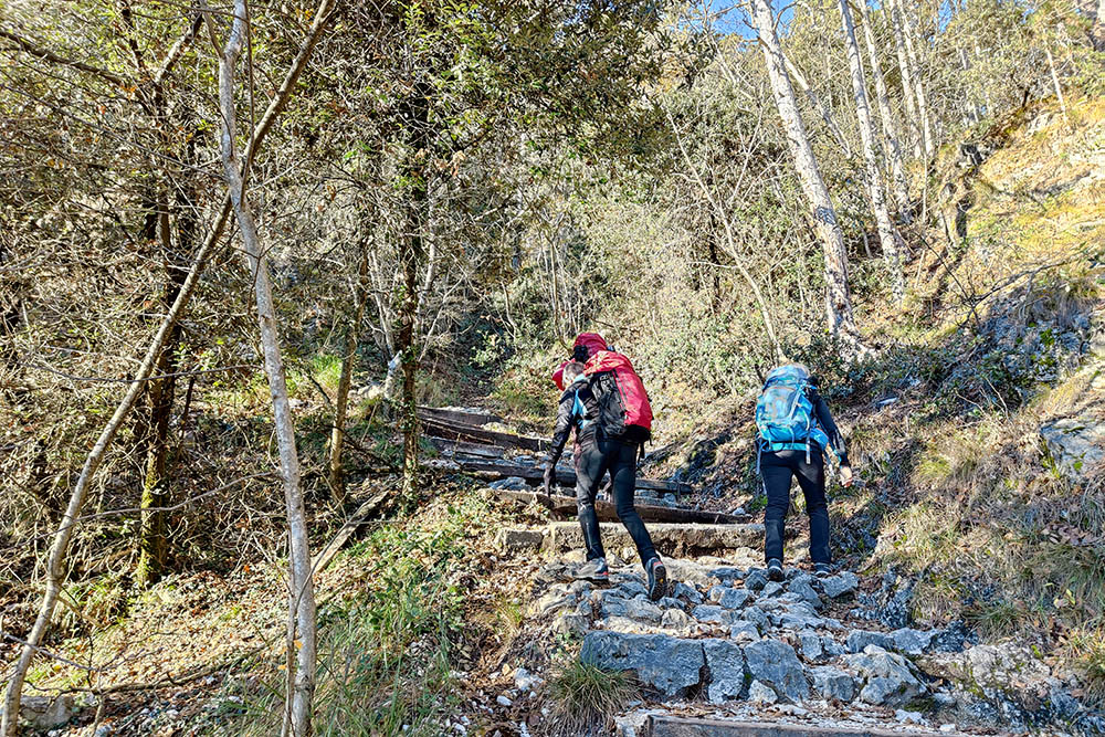
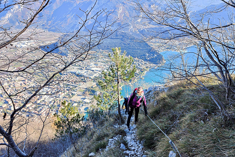
The difficulty of the route is classified as EE (expert hikers). Both on the outward and return journey, there are some equipped sections, but they are easy to follow, requiring only a steady foot and no fear of heights.
ITINERARY
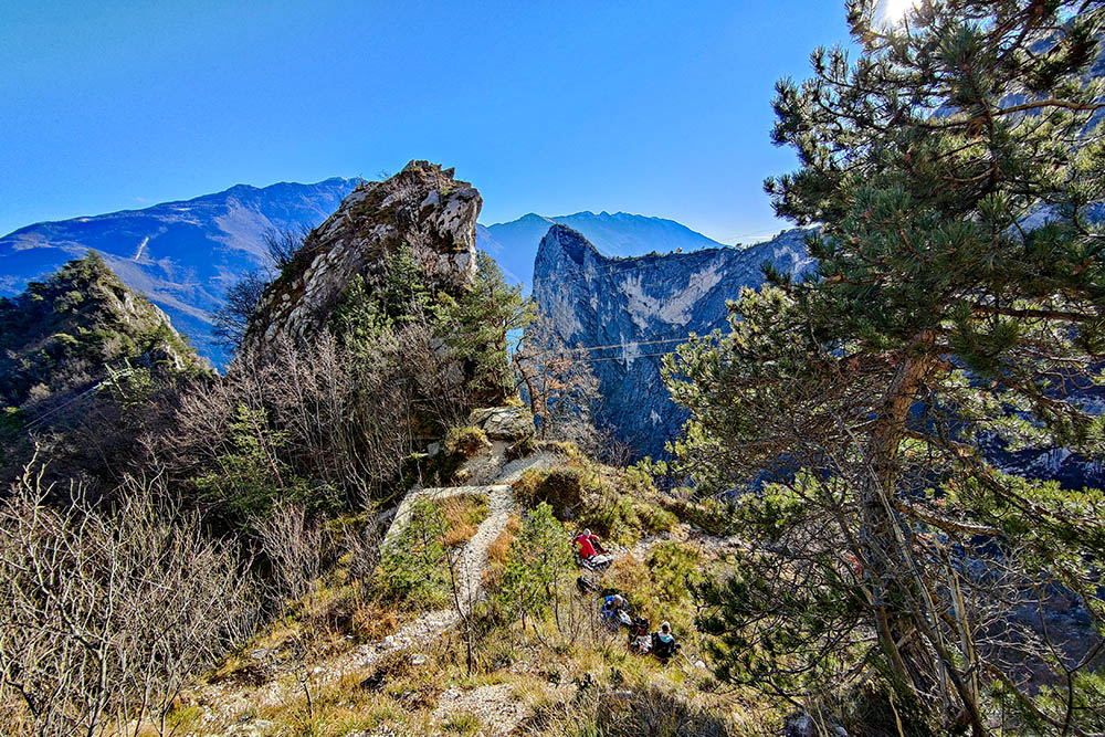
From the car park in Riva del Garda (81 m) we move to Via Monte Oro (87 m) where we follow the Passeggiata al Bastione trail sign. Going up a paved road you reach the Bastione (210 m). Continuing you reach a crossroads. Turn right, signpost 404, and go up first to Capanna Santa Barbara (560 m) and then to the Chiesetta di Santa Barbara (630 m). Shortly after you come across the metal staircase (690 m) and arriving at the highest point, at an altitude of 871 m, take the 404A and descend slightly to a crossroads. Here you go up the 405 up to Bocca d'Enzima (863 m). You return to the crossroads and continue to descend along the 405 returning to the starting point.
EXCURSION DATE
December 3, 2023
STARTING POINT
Riva del Garda
REFRESHMENT POINT
At the Bastion
AUTHOR’S SUGGESTIONS
It is recommended to do the excursion in spring or autumn.
SAFETY TIPS
The viability of the proposed itinerary, like all mountain morphology, is subject to environmental changes due to natural events and weather conditions. Therefore, before leaving, consult the competent tourist offices and / or the refuges of reference.
Our GPX tracks are only indicative, that is, the route was carried out at best with the conditions of the trails and weather of that day. So always consider what to do on site.
Also remember to evaluate the route based on your physical abilities, training and the equipment you have.
You should leave someone the route you intend to do told.
Remember that the emergency number is 112.
EQUIPMENT
It is recommended to have the appropriate equipment for the route, weather conditions and season: windproof and / or rain jacket, map and / or GPS device, goggles, sunscreen, boots, first aid kit, specific clothing, gloves, backpack with food and drink.
RECOMMENDED MAPS
Tabacco 061 Alto Garda - Ledro - Monte Baldo Nord
INTERESTING LINKS
https://www.gardatrentino.it/it/outdoor/trekking/garda-trek
HOW TO ARRIVE
A22 in Rovereto, exit Rovereto Sud/Lago di Garda Nord and then the SS240 to Riva del Garda. The car park is located in Largo Guglielmo Marconi, 2-5, 38066 Riva del Garda TN.
PARKING AREA
Former hospital parking in Riva del Garda, free.
GPS coordinates: 45.889715, 10.842268
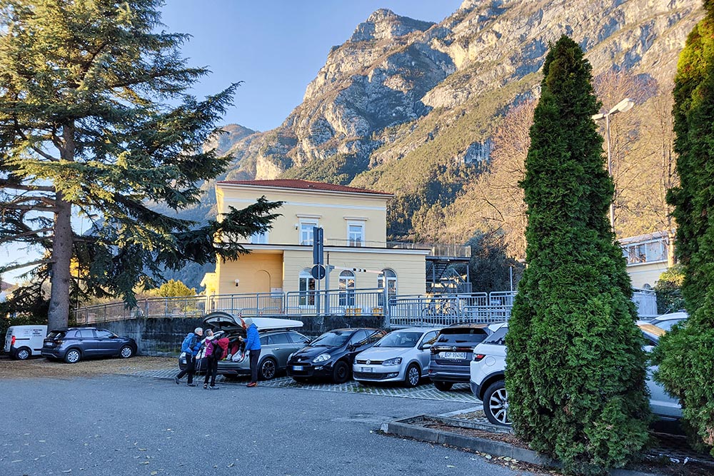
Parcheggio ex Ospedale

Primo tratto di salita

Arrivati al Bastione
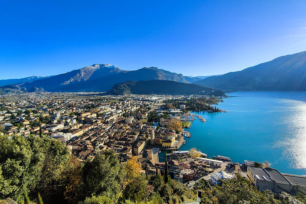
Vista dal Bastione
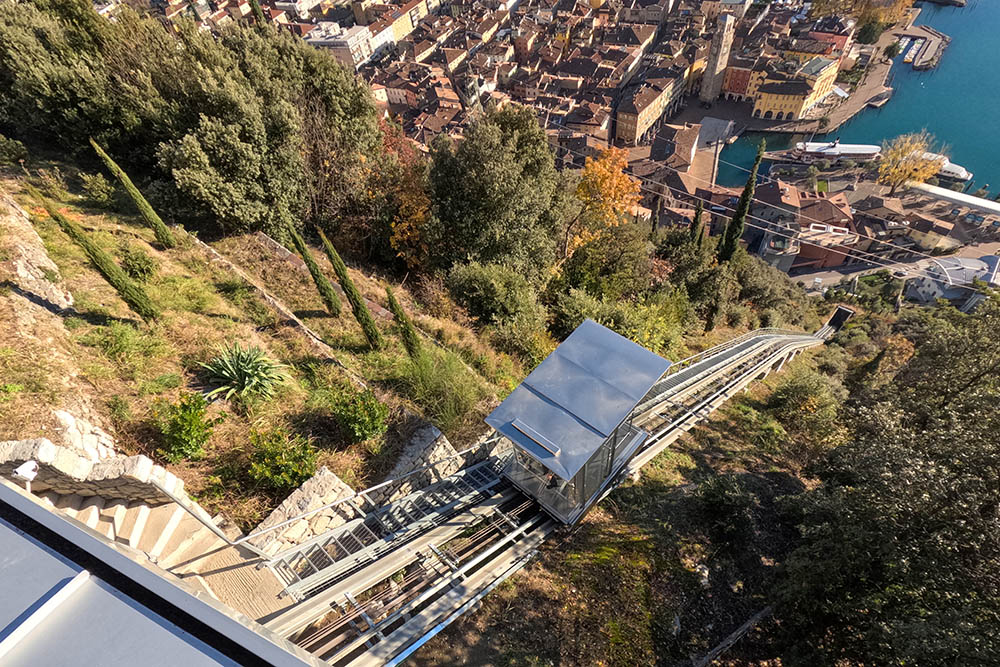
Cremagliera che sale da Riva del Garda
Si continua sul sentiero 404
Capanna Santa Barbara
Chiesetta di Santa Barbara
Panorama dalla chiesa
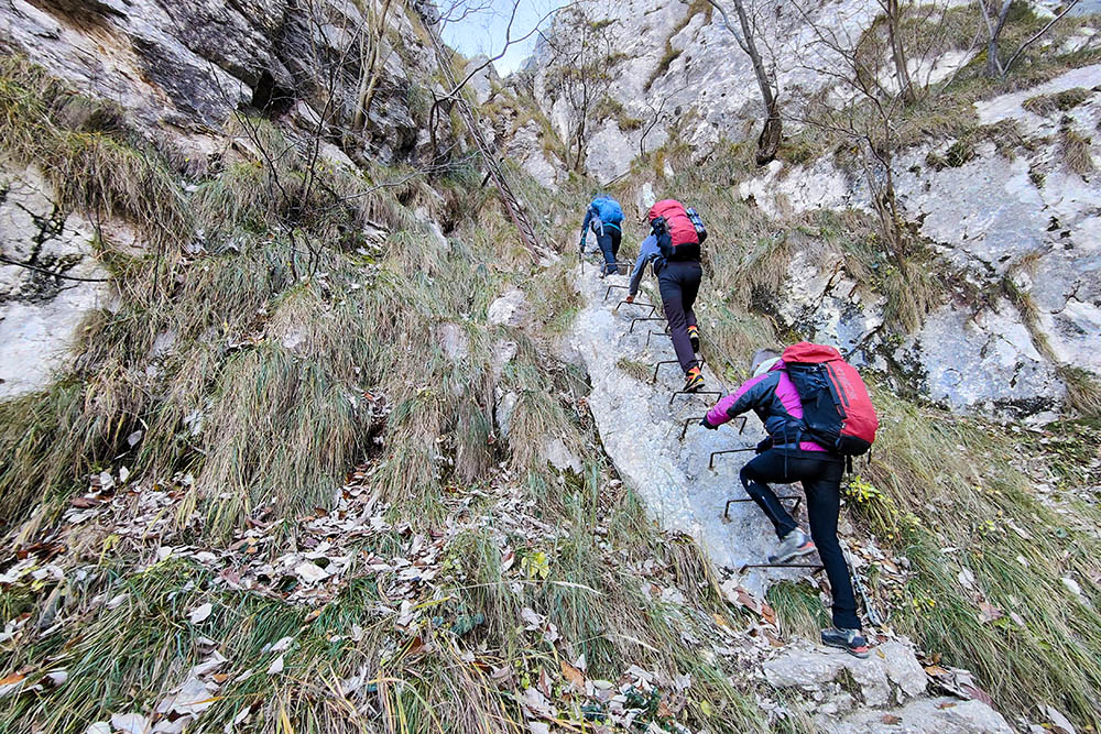
Scale metalliche
Il panorama diventa sempre più bello
Tratto attrezzato con cordino metallico
All'interno di gallerie della Grande Guerra
Arrivati a Bocca d'Enzima
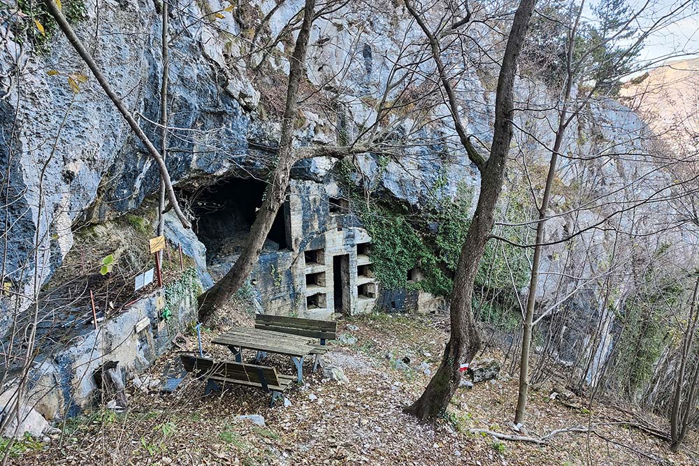
Nella discesa si incontrano manufatti della Prima Guerra Mondiale


