


![]()


Durata
 3:45 h
Distanza
 9,3 km
 Ascesa
 680 m
680 mDiscesa
 680 m
680 mH Max
 1770 m
H Min
 1092 m
The Beautiful Malga Polinar
DESCRIPTION
Malga Polinar in winter: explore Val di Rabbi with snowshoes on your feet.
Geographical Location
Malga Polinar is located in the beautiful Val di Rabbi, in Trentino, at an altitude of 1,770 meters, on the right orographic side of the valley.
Hike
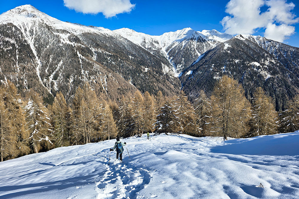
The route to Malga Polinar follows a comfortable forest road that winds through a dense woodland, with no significant technical difficulties. The path is well-marked and suitable even for less experienced hikers. The ascent is gradual, while the descent includes some steeper sections that require caution, especially in case of snow or wet terrain.
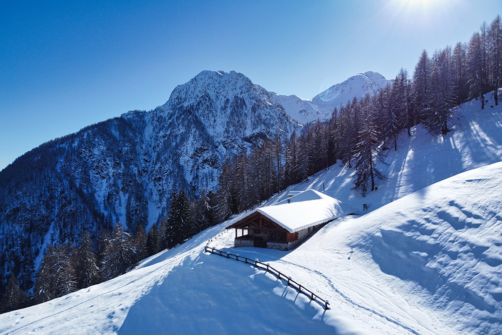
This malga, one of the most secluded in the area, offers an authentic immersion in the alpine environment, surrounded by forests and towering peaks. From the structure, a breathtaking panorama opens up over the valley and the surrounding mountains, making it an ideal destination for those seeking tranquility and a deep connection with nature.
In summer, it serves as the starting point for wonderful hikes, such as a visit to the spectacular Valorz Waterfalls or the picturesque Lago Rotondo, both destinations of great natural charm.
Malga Polinar is open from early June to mid-September, while it remains closed during the winter months.
ITINERARY
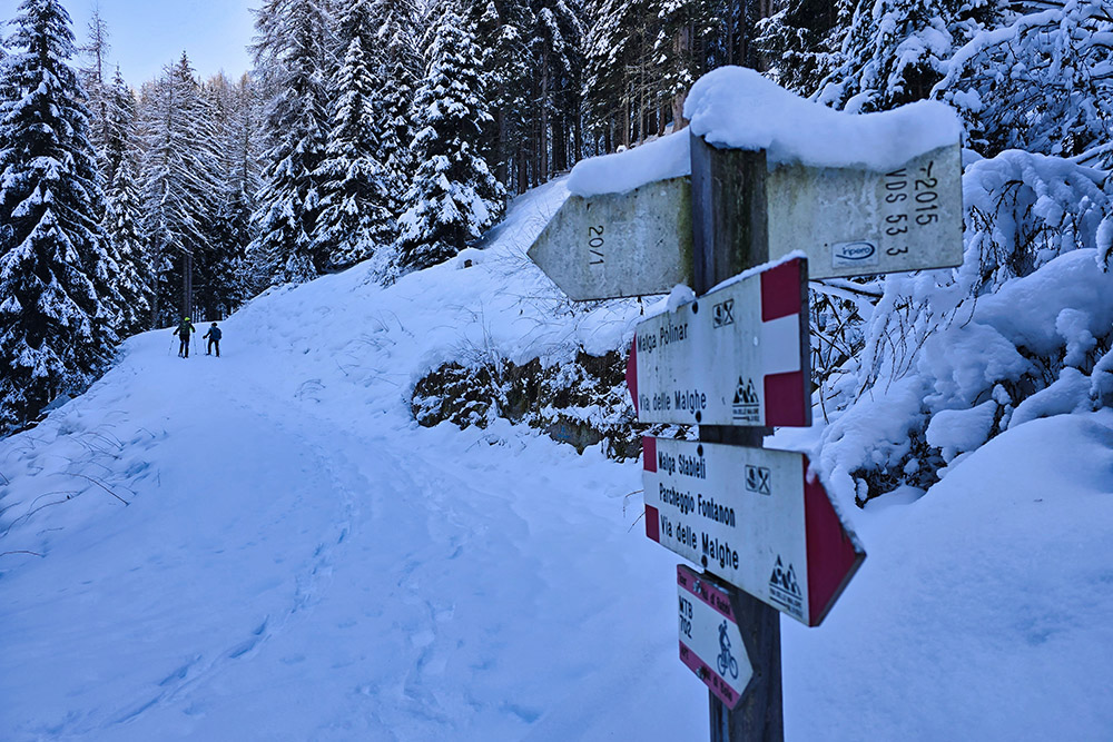
From the Plaze dei Forni parking area (1,193 m), follow a comfortable forest road that winds through the woods, leading to Malga Polinar (1,770 m). From here, trail 171 descends rapidly towards the valley, where you continue along trail markers 171A and 121 until reaching Valorz di San Bernardo (1,092 m). The return follows a scenic path along the banks of the Rabbies Stream, surrounded by the beauty of the natural landscape.
EXCURSION DATE
February 2, 2025
STARTING POINT
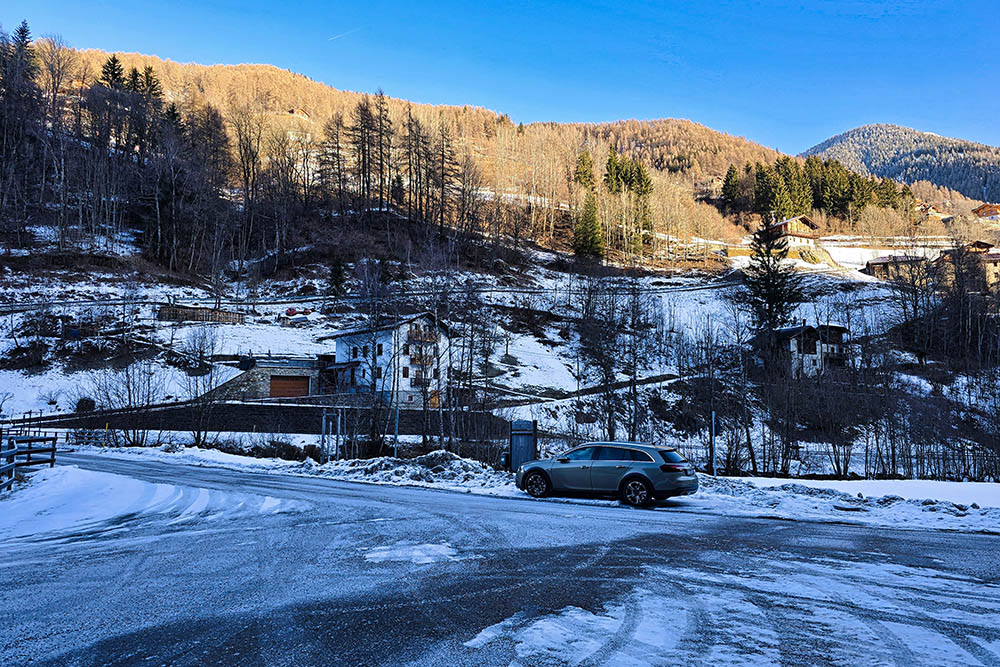
Plaze dei Forni parking area, in the locality of Piazzola.
REFRESHMENT POINT
None in winter.
AUTHOR'S SUGGESTIONS
Check the avalanche bulletin before departure.
SAFETY TIPS
The stability of the snowpack is subject to sudden and unpredictable changes. For your safety, always check the avalanche bulletin, as snow conditions can change rapidly, and seek information from local authorities.
Our GPX tracks are only indicative, meaning the route was completed under the best possible snow and weather conditions on that day. Always assess the situation on-site before proceeding.
Additionally, evaluate the route based on your physical capabilities, fitness level, and available equipment. It is advisable to inform someone about your planned itinerary.
Remember that the emergency number is 112.
EQUIPMENT
It is recommended to carry the appropriate gear: avalanche safety kit (including transceiver, shovel, and probe), snowshoes, trekking poles, crampons, sunglasses, sunscreen, trekking boots, winter clothing, gloves, hat, and a backpack with hot beverages.
RECOMMENDED MAPS
Tabacco 048 Val di Peio - Val di Rabbi - Val di Sole
USEFUL LINKS
https://www.valdirabbi.com/it
HOW TO ARRIVE
From Cles (Val di Non), follow the SS43, then take the SS42 into Val di Sole. Before reaching Malè, turn right onto the SP86. The parking area is located 600 meters before Bagni di Rabbi, on the left.
PARKING AREA
Plaze dei Forni parking area, in the locality of Piazzola.
GPS Coordinates: 46.407499, 10.816626
Il parcheggio Plazze dei Forni
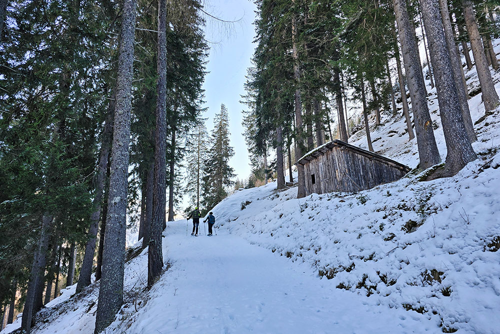
Si sale per una strada forestale innevata
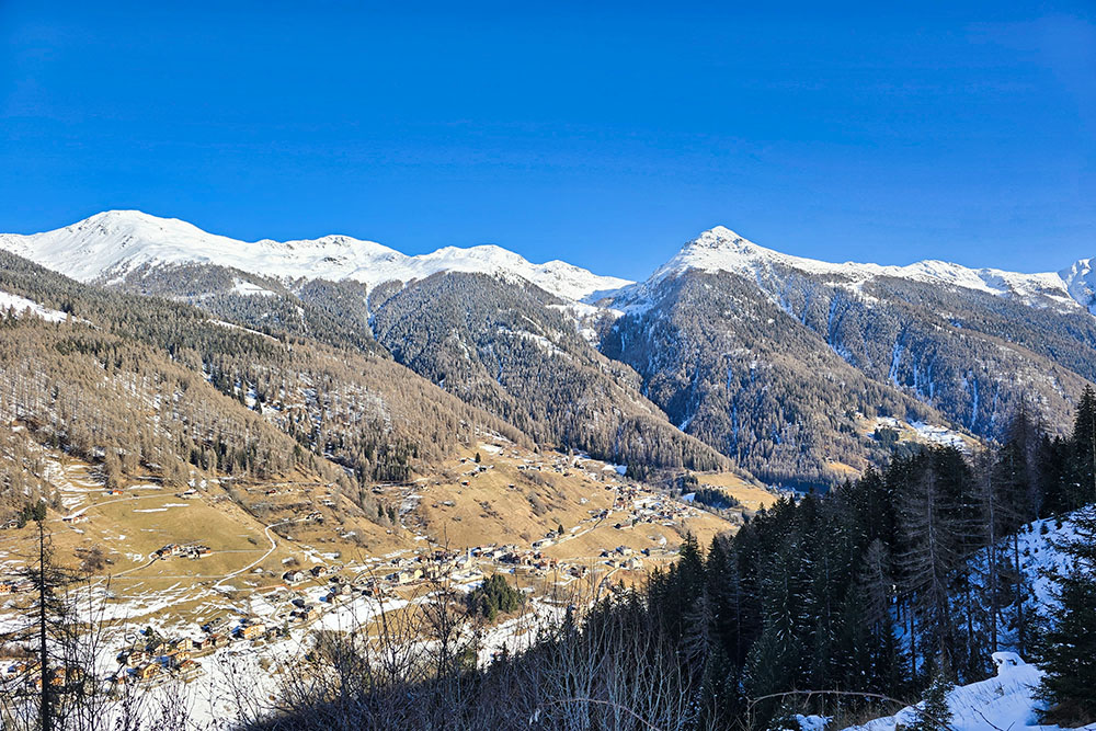
Inizia un bel panorama
La neve è ancora sugli alberi
Continuiamo la salita
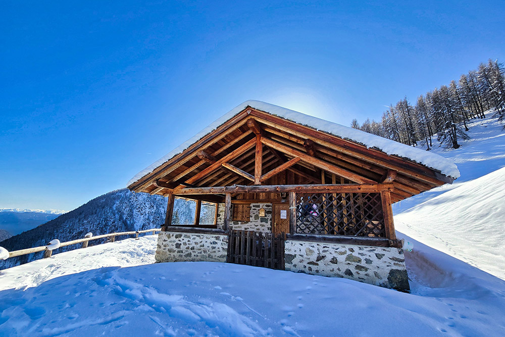
Arrivati alla Malga Polinar
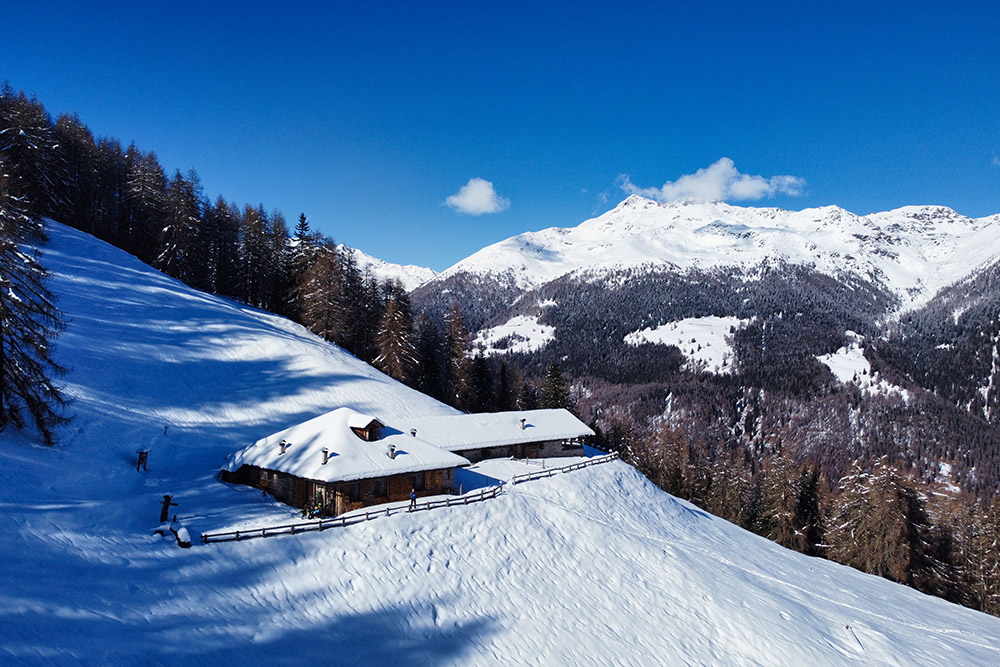
La malga vista dall'alto
La malga vista dall'alto
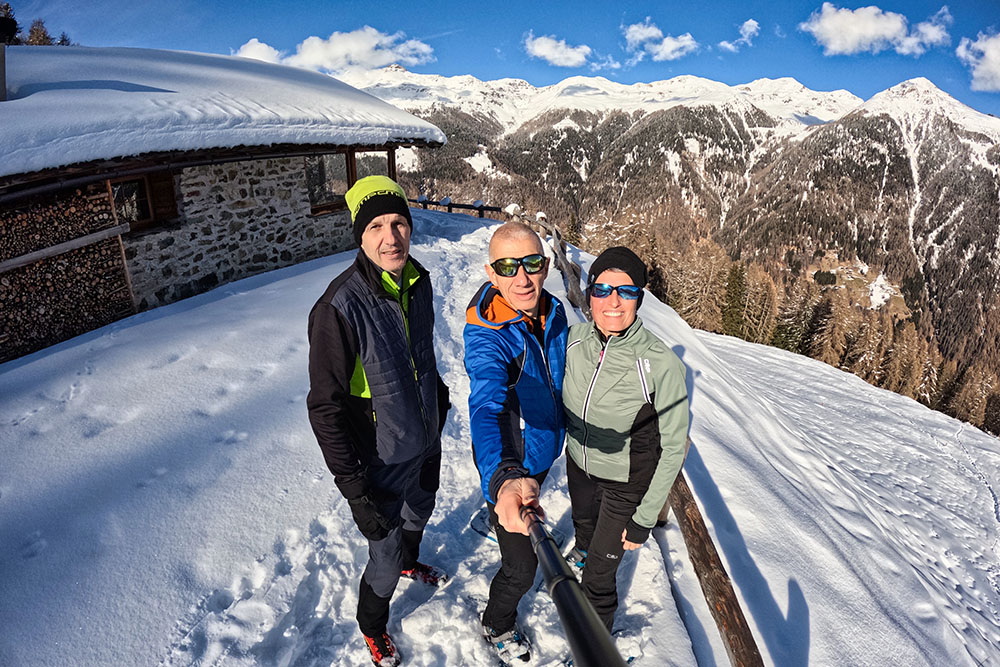
Alla malga
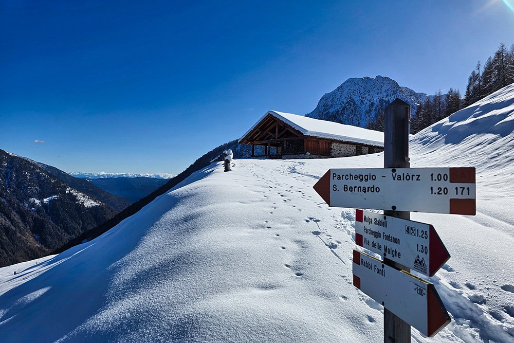
Imbocchiamo il sentiero 171
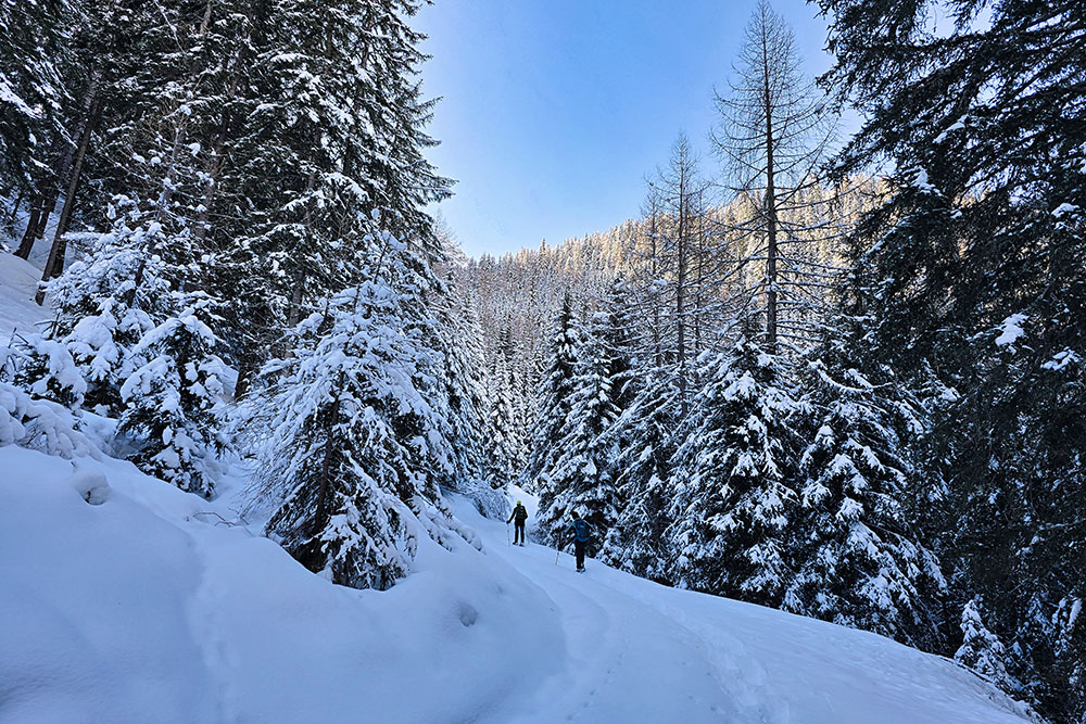
Scendiamo su neve fresca
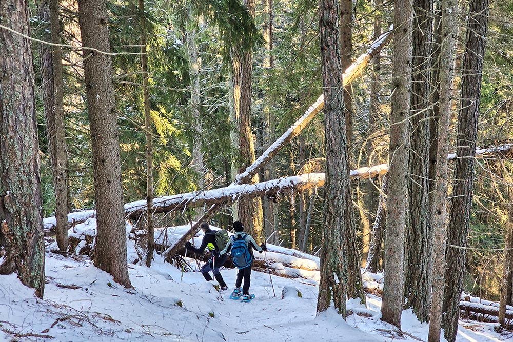
Troviamo alberi a terra
Arrivati a Valorz
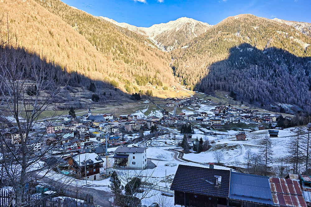
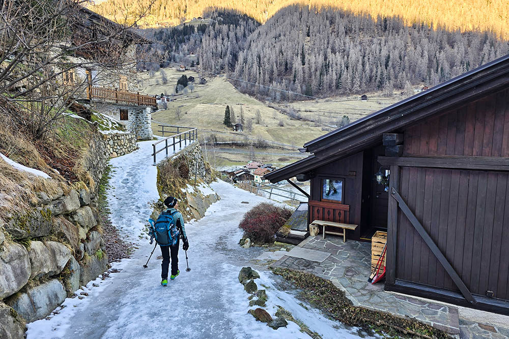
Il paese di San Bernardo

Si ritorna al punto di partenza


