


![]()


Durata
 5:07 h
Distanza
 10 km
10 km Ascesa
 768 m
768 mDiscesa
 768 m
768 mH Max
 2370 m
H Min
 1632 m
Serodoli Lake from Malga Nambino
DESCRIPTION
A winter hike offering beautiful views of the Brenta Group.
Geographical Location
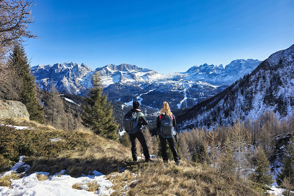
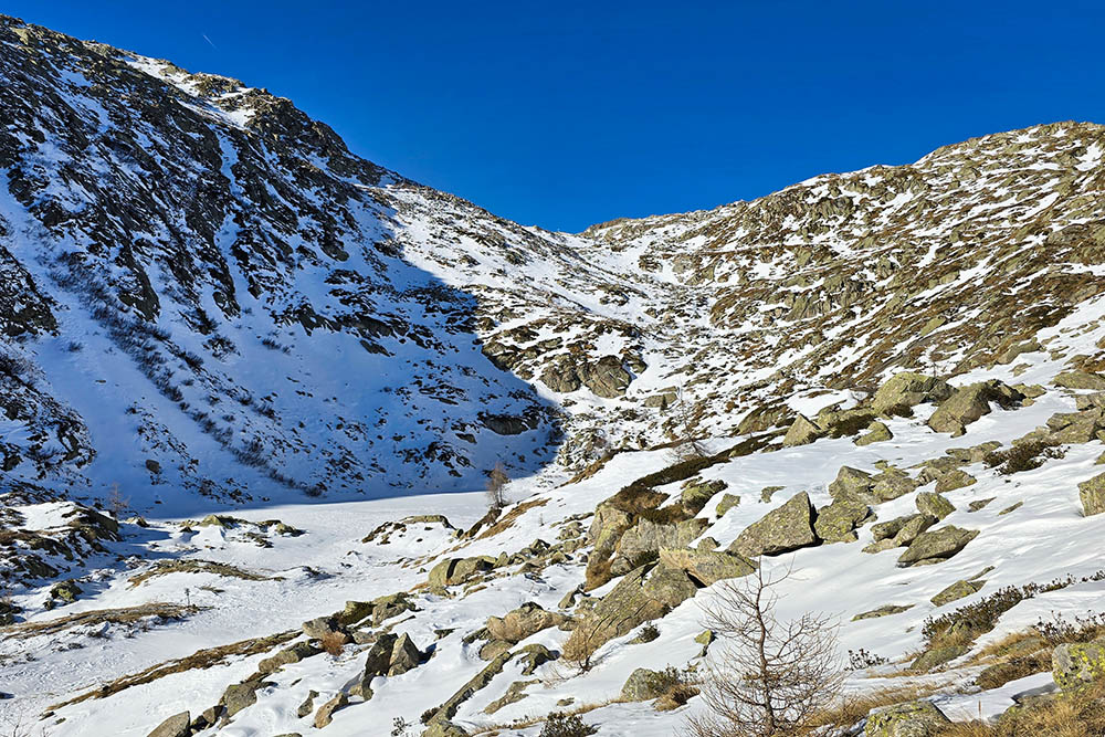
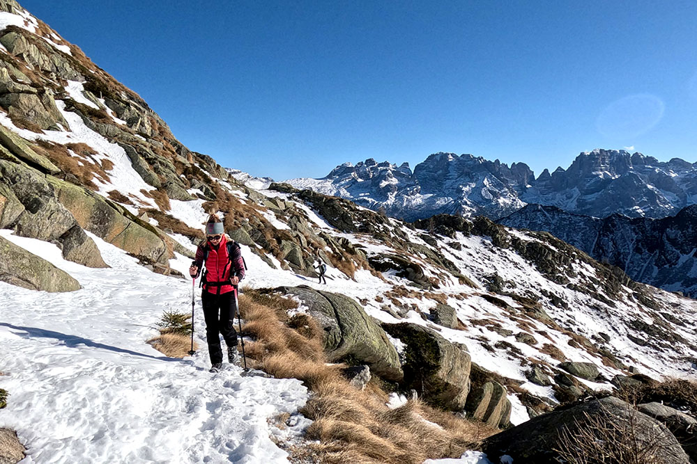
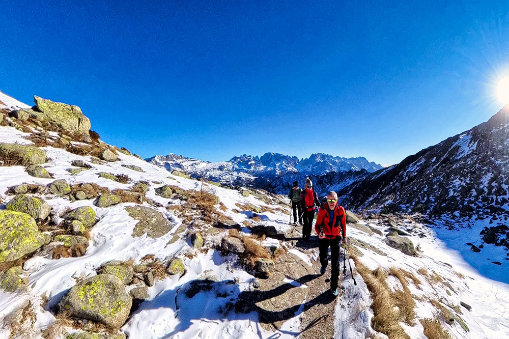
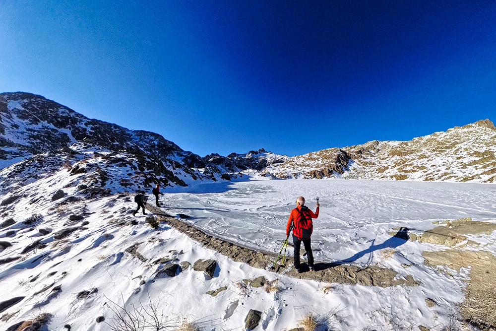
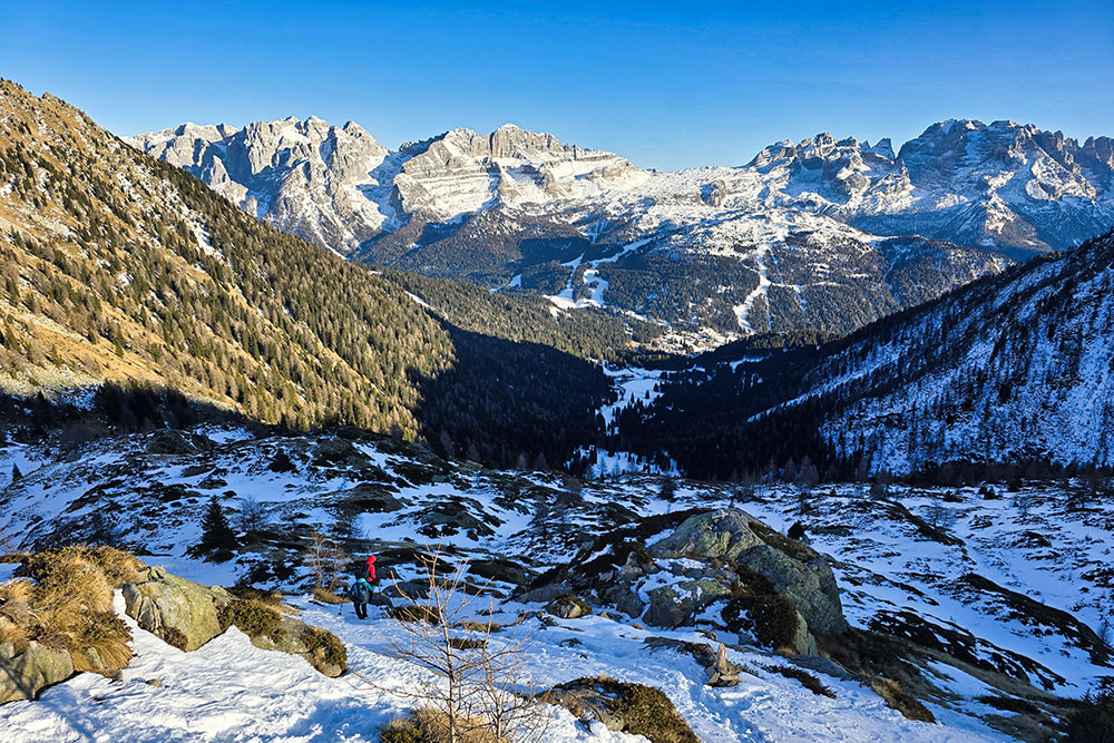
Serodoli Lake, located at an altitude of 2370 meters, is one of the picturesque Five Lakes (Ritorto Lake, Lambìn Lake, Gelato Lake, Serodoli Lake, and Nero Lake) in the Presanella Group in Trentino. This alpine lake is set in a nearly lunar landscape, characterized by tonalite rocks typical of the Adamello and Presanella areas, and offers panoramic views of the majestic Brenta Dolomites.
The Hike
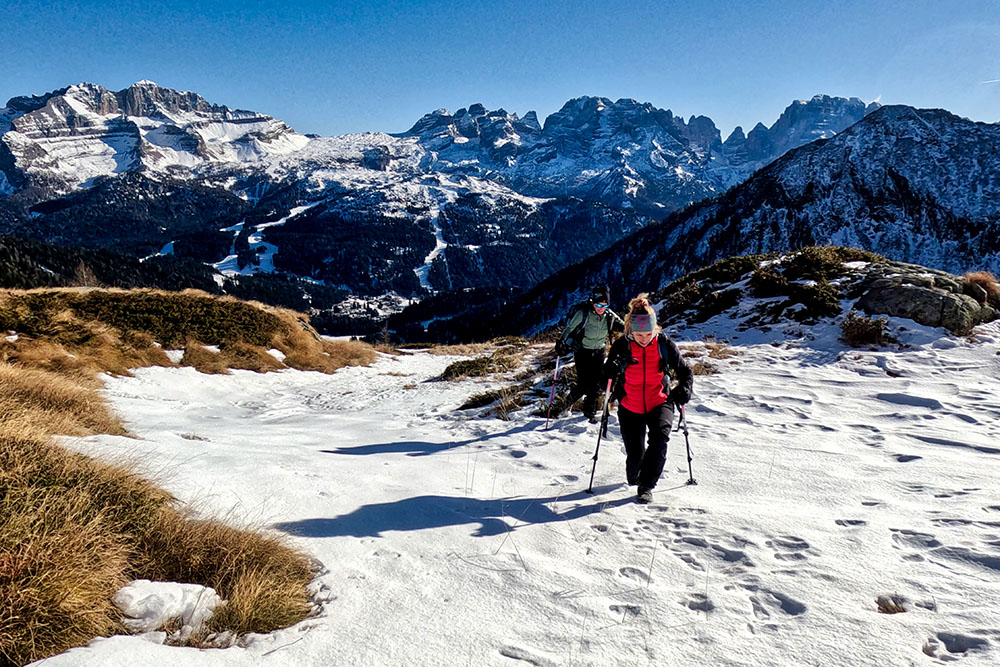
The hike to Serodoli Lake is a must for anyone starting from Madonna di Campiglio. The varied, moderately challenging route passes through forests and valleys, offering spectacular views of the Brenta Dolomites. The trail is usually well-marked and frequented, making it relatively safe. The ascent takes approximately 3 hours and 30 minutes, while the descent is about 1 hour and 30 minutes.
History
The Nambino Mountain Hut, located on the shores of the lake bearing the same name at 1768 meters, is a place rich in history and tradition. Built in 1933 by siblings Giovanni and Maria Serafini, the hut has remained in the hands of the Serafini family to this day.
ITINERARY
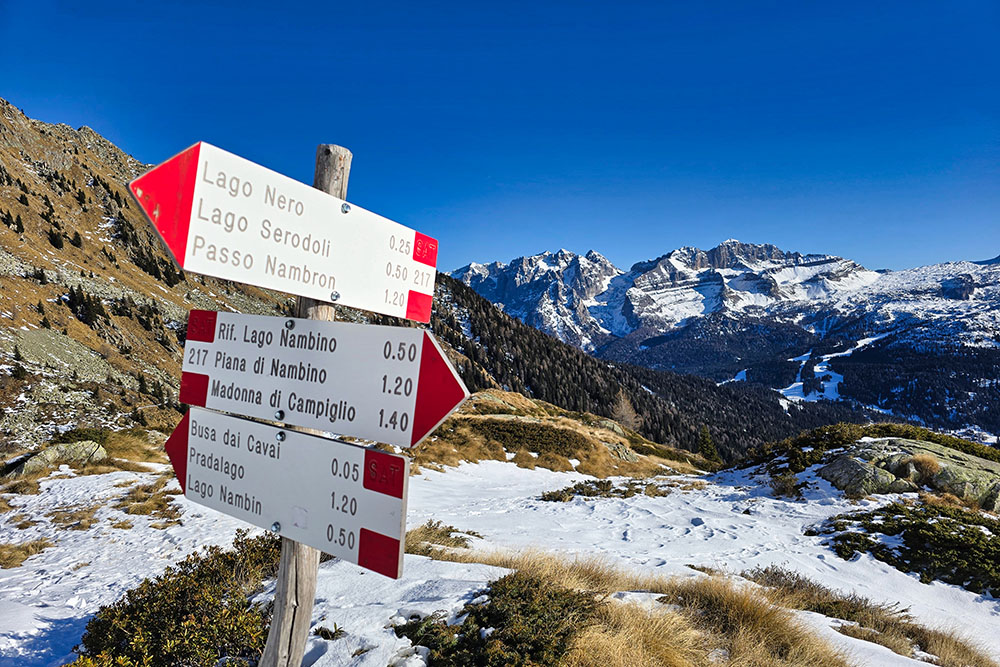
From the parking area (1632 m), follow the signs for the Nambino Mountain Hut along the trail marked with signpost 217. Upon reaching the Nambino Mountain Hut (1768 m), turn left and continue on the same path. During the climb, you will pass a water intake of the aqueduct before arriving at Nero Lake (2246 m). From there, it is about 30 minutes of walking to reach Serodoli Lake (2370 m). To return, follow the same trail back to the starting point.
EXCURSION DATE
January 3, 2025
STARTING POINT
Malga Nambino
REFRESHMENT POINT
Nambino Mountain Hut
AUTHOR'S SUGGESTIONS
Check the avalanche bulletin before setting off.
SAFETY TIPS
The accessibility of the proposed itinerary, like all mountain terrain, is subject to changes due to natural events and weather conditions. Therefore, before starting, consult the relevant tourist offices and/or the huts along the route.
Our GPX tracks are for guidance only; the hike was carried out under the best conditions of the trail and weather on that specific day. Always assess the situation on-site.
Additionally, evaluate the route based on your physical abilities, fitness level, and available equipment. Inform someone about your intended itinerary. Remember that the emergency number is 112.
EQUIPMENT
It is recommended to carry equipment suitable for the hike, weather conditions, and season: windproof and/or rainproof jacket, map and/or GPS device, sunglasses, sunscreen, hiking boots, first aid kit, appropriate clothing, gloves, backpack with food and drinks.
RECOMMENDED MAPS
Tabacco 053 Dolomiti di Brenta
USEFUL LINKS
https://www.campigliodolomiti.it/it
HOW TO ARRIVE
From Trento, take SS45bis to Sarche, then SS237 towards Tione. In Tione, take SS239 towards Madonna di Campiglio. Upon reaching Madonna di Campiglio, follow the signs for Passo Campo Carlo Magno, and after the tunnel, turn left following the signs to Val Nambino until you reach the parking area.
PARKING AREA
At the parking area for the Nambino Lake trail.
GPS coordinates: 46.237903, 10.817048
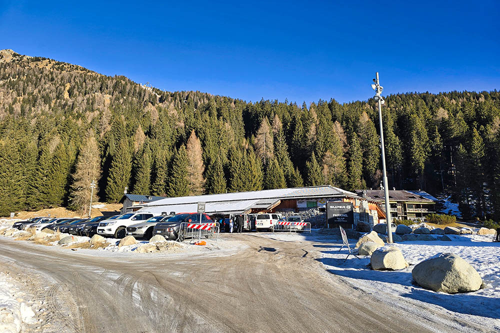
Parcheggio a Malga Nambino

Primo tratto di strada
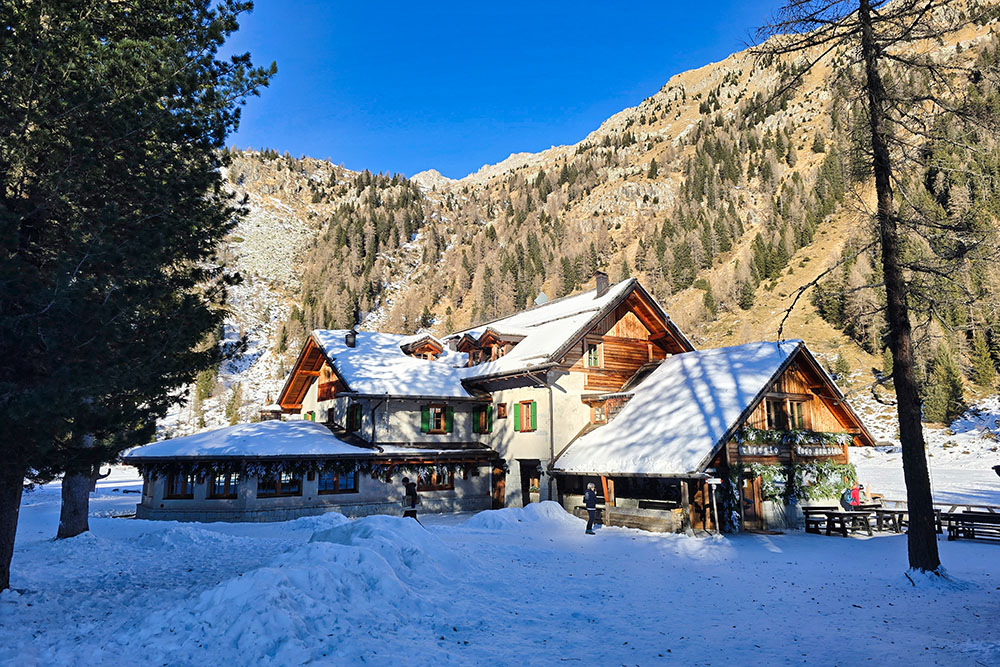
Rifugio Lago Nambino
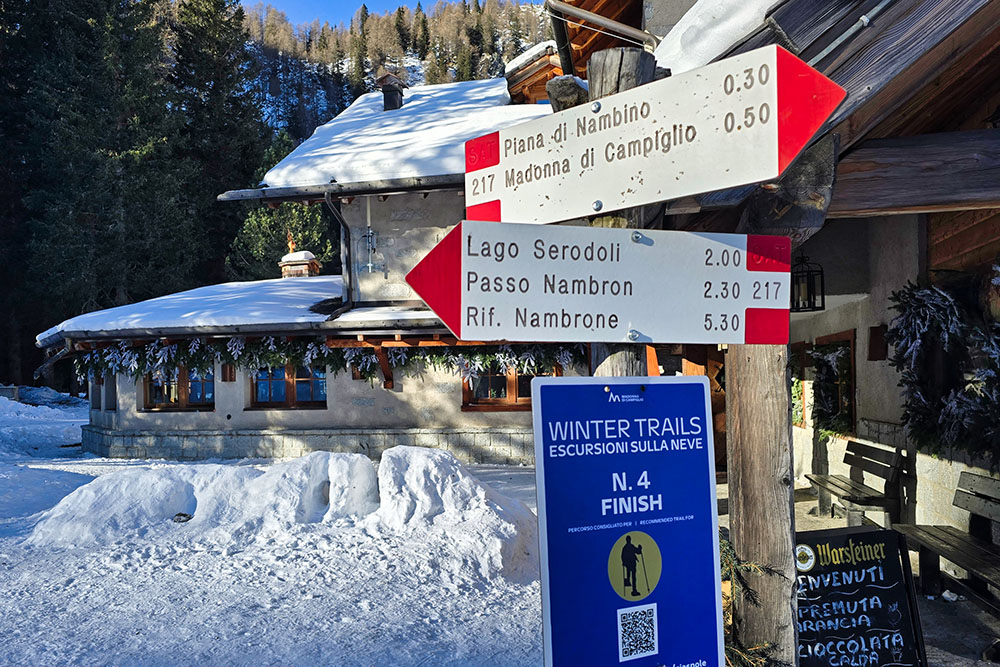
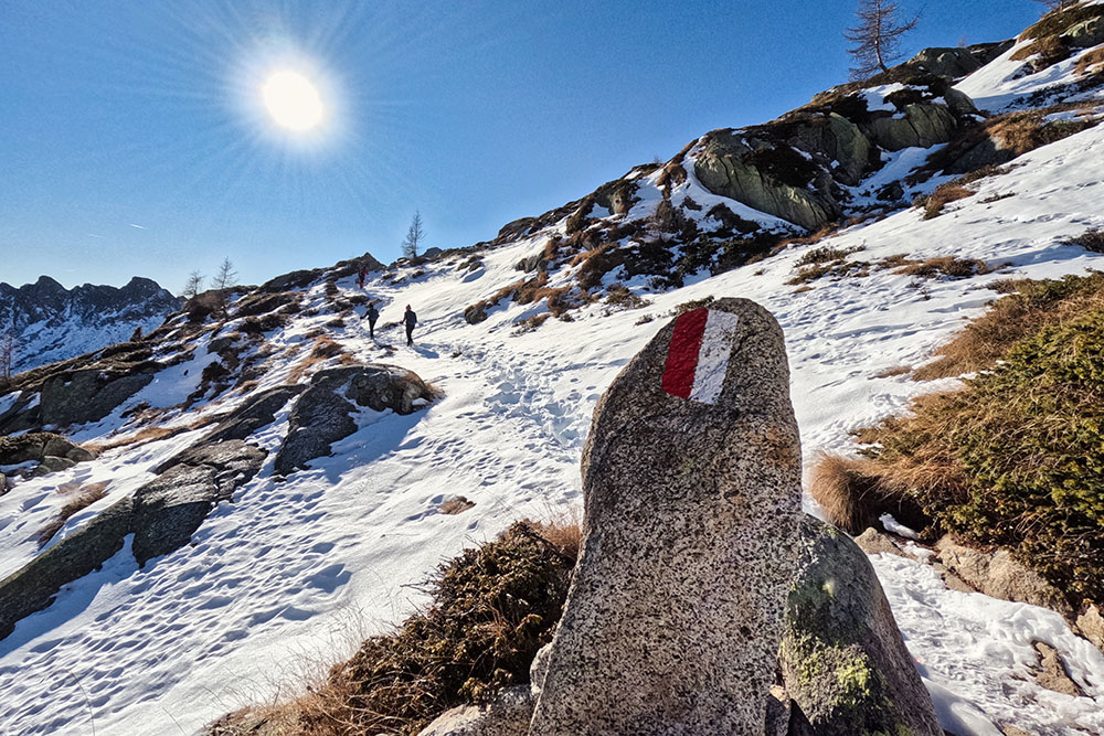
Prendiamo il segnavia 217
Inizia un bel panorama
Si sale faticosamente
Mancano ancora 50 minuti
Seguiamo sempre le tracce
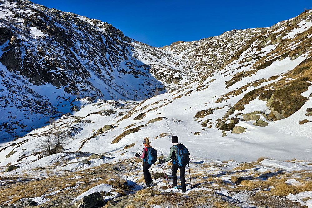
Il pianoro prima del Lago Nero
Il Lago Nero ghiacciato
Ultimo tratto di salita
Si sale sempre con il Gruppo del Brenta alla spalle
Arrivati a Lago Serodoli
Si ritorna in valle
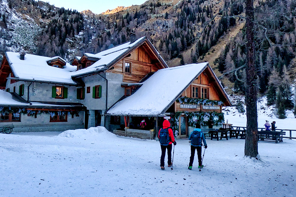
Ritornati al Rifugio Lago Nambino


