


![]()


Durata
 2:45 h
Distanza
 9,1 km
 Ascesa
 346 m
346 mDiscesa
 346 m
346 mH Max
 1835 m
H Min
 1529 m
Carezza - Radura di Mezzo
DESCRIPTION
The wonders of Carezza: a journey between suspension bridges and enchanted woods.
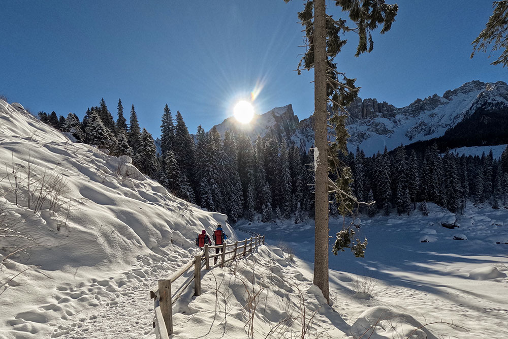
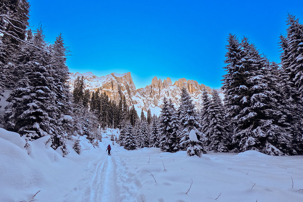
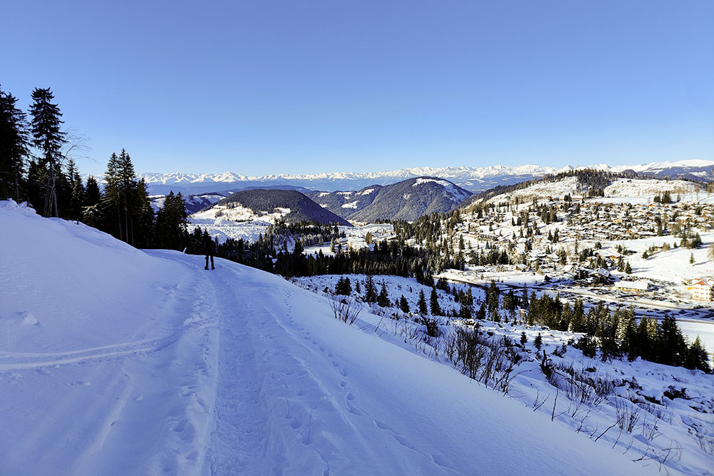
From the moment you leave your car in the car park, it is clear that the place is something extraordinary. On one side the Catinaccio stands out imposingly, kissed by the sunlight, while on the other the Latemar lets the sun's rays filter through, creating an evocative scenography. Just a few steps downhill are enough to come across a fascinating suspension bridge, a true paradise for selfie enthusiasts.
After passing the car park, you find yourself in front of the suggestive Lake Carezza. In the winter season, its surface is usually covered by ice and snow, turning it into a beautiful flat expanse. However, to admire it in all its magnificence, it is advisable to return in the warmer months.
Lake Carezza is renowned throughout the world for its color palette of polychrome tones, and it is no coincidence that in Ladin it is called Lech de l'Arcaboan, or Rainbow Lake.
From the enchanting lake, you enter the suggestive Carezza forest, unfortunately marked by the events of the Vaia storm in 2018. In the first part of the route, the damage caused by the wind is still visible, with trees felled along the way. However, walking through the Radura di Mezzo, you can feel the silence and serenity of the place, always surrounded by the majesty of the Latemar Group.
The itinerary is accessible to all, free of particular difficulties and with an extremely low risk of avalanches, giving those who follow it an experience surrounded by the authentic beauty of nature.
ITINERARY
From the car park (1602 m) follow trail sign no. 6 - Lake Carezza. You cross the suspension bridge and arrive at the paid car park - Lago di Carezza. After taking the underpass you arrive directly at Lake Carezza (1529 m). Go around the lake on the eastern part and then follow trail sign 11 reaching the Rifugio Mitterleger Forest (1835 m). You go back a little and then take path 21. Once you arrive between the Costalunga Pass and Carezza, take path 13 and 10 and return to the starting point.
EXCURSION DATE
January 20, 2024
STARTING POINT
Car park 2, Carezza.
REFRESHMENT POINT
Nobody
AUTHOR’S SUGGESTIONS
Do the tour in the middle of the day, because the entire route is in shadow.
SAFETY TIPS
Snowpack stability is subject to sudden and unpredictable changes. For your safety, always consult the avalanche bulletin, because the snowpack is subject to rapid changes, ask the competent local offices for information. Our GPX tracks are indicative only, that is, the route was best done with the snow and weather conditions of that day. So always evaluate what to do on site. Also remember to evaluate the route based on your physical abilities, training and the equipment you have. It is appropriate to let someone know the itinerary you intend to take. Remember that the emergency number is 112.
EQUIPMENT
It is recommended to have the appropriate equipment: kit for self-rescue in avalanches (consisting of Artva, shovel and probe), snowshoes, sticks, crampons, glasses, sunscreen, hiking boots, winter clothing, gloves, cap, backpack hot drinks.
RECOMMENDED MAPS
Tabacco 029 Schlern - Rosengarten / Sciliar - Catinaccio - Latemar
INTERESTING LINKS
https://eggental.com/it/dolomiti-natura/lago-di-carezza
HOW TO ARRIVE
A22 exit Bolzano Nord. Take the SP241 Val d'Ega up to the village of Carezza.
PARKING AREA
Parking 2 - free, Carezza.
GPS coordinates: 46.411903, 11.579310
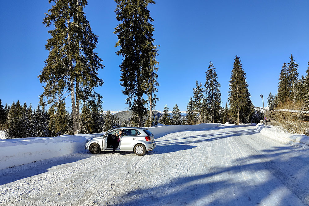
Parcheggio Carezza n. 2
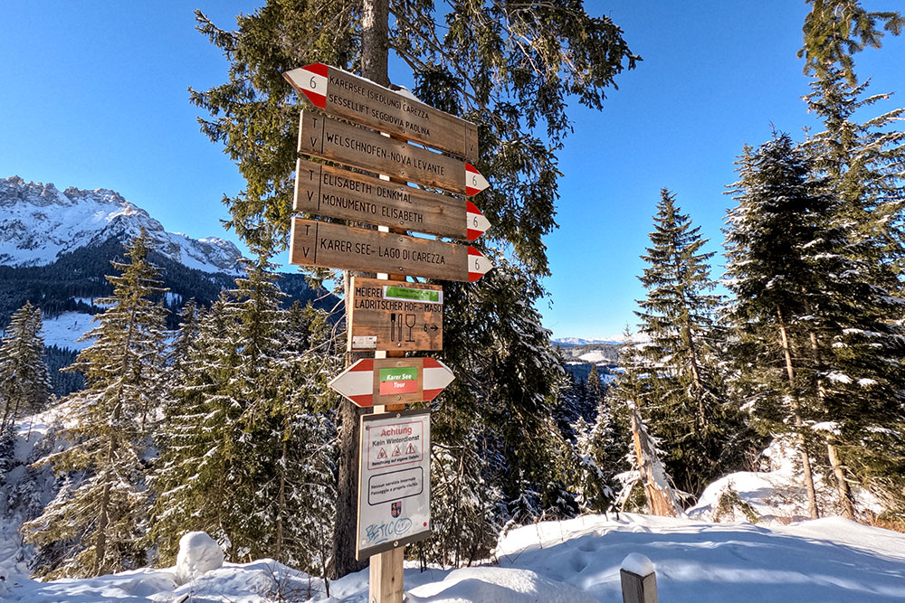
Si prende il sentiero 6
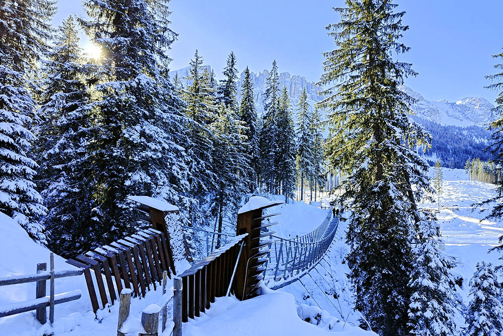
Ponte sospeso
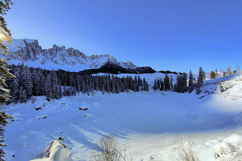
Il Lago di Carezza innevato
Si fa il giro del lago
Vista sul Catinaccio
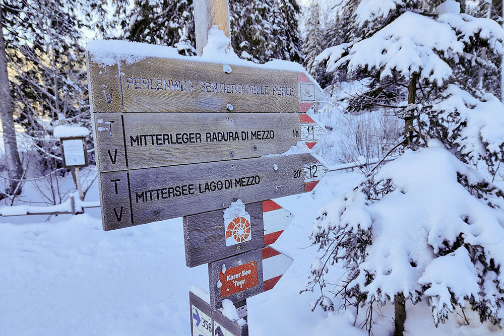
Si segue il sentiero 11 per la Radura di Mezzo
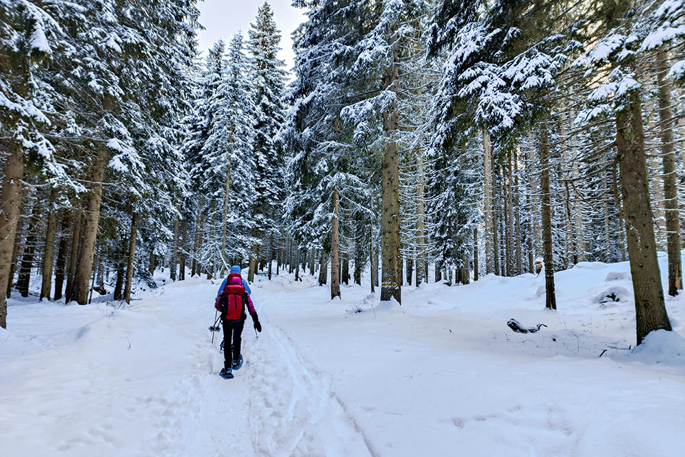
La Radura di Mezzo
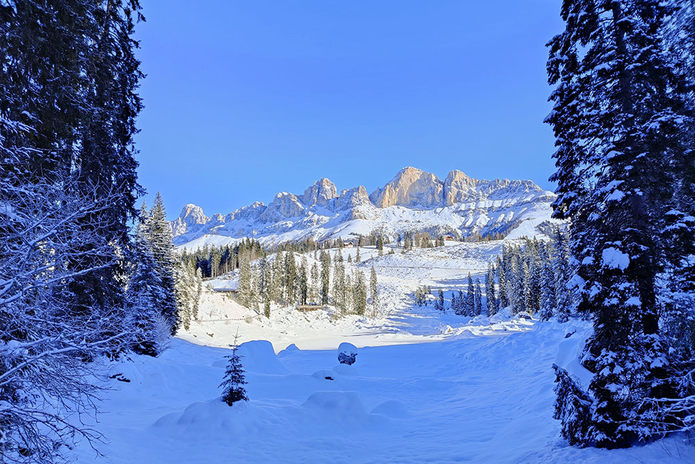
Si va ai piedi del Latemar
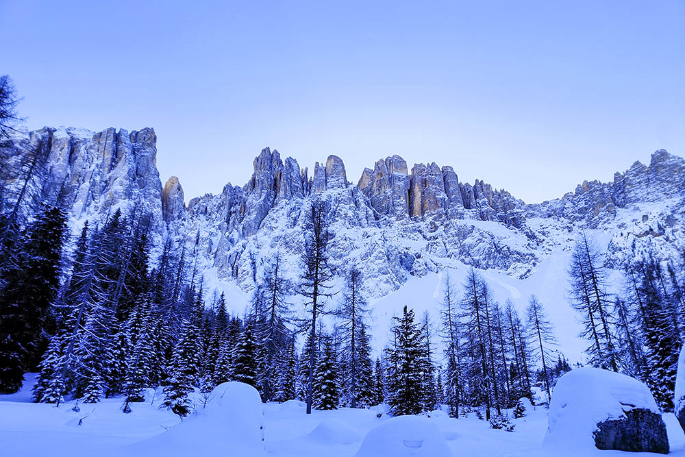
Il Gruppo del Latemar
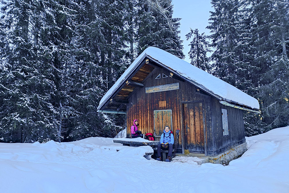
Il Rifugio Forestale Mitterleger

Il Gruppo del Catinaccio
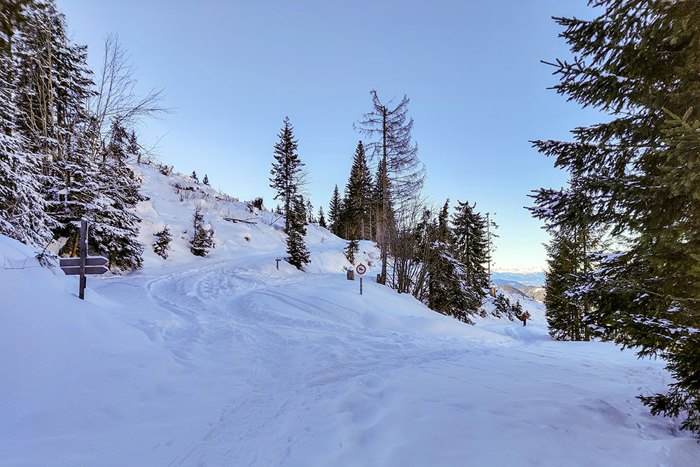
Adesso si prende il sentiero 13
Si rientra a Carezza
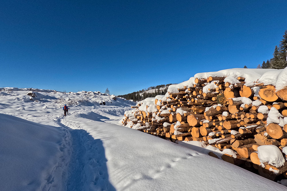
Ancora tracce di Vaia


