


![]()


Durata
 6:48 h
Distanza
 12,8 km
 Ascesa
 1192 m
Discesa
 1192 m
H Max
 3033 m
H Min
 2047 m
Martello Red Peak
DESCRIPTION
Itinerary between the world of glaciers with a peak of 3000 meters above sea level.
If you are looking for an excursion that takes you to the high mountains, then the Cima Rossa di Martello/Vorderer Rotspitz is the right destination for you! This peak rises imposingly on the right side of Val Martello, dominating Lake Gioveretto.
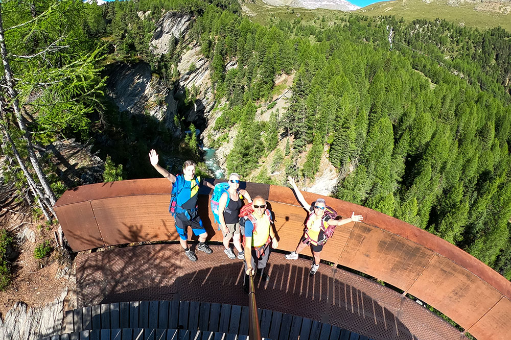
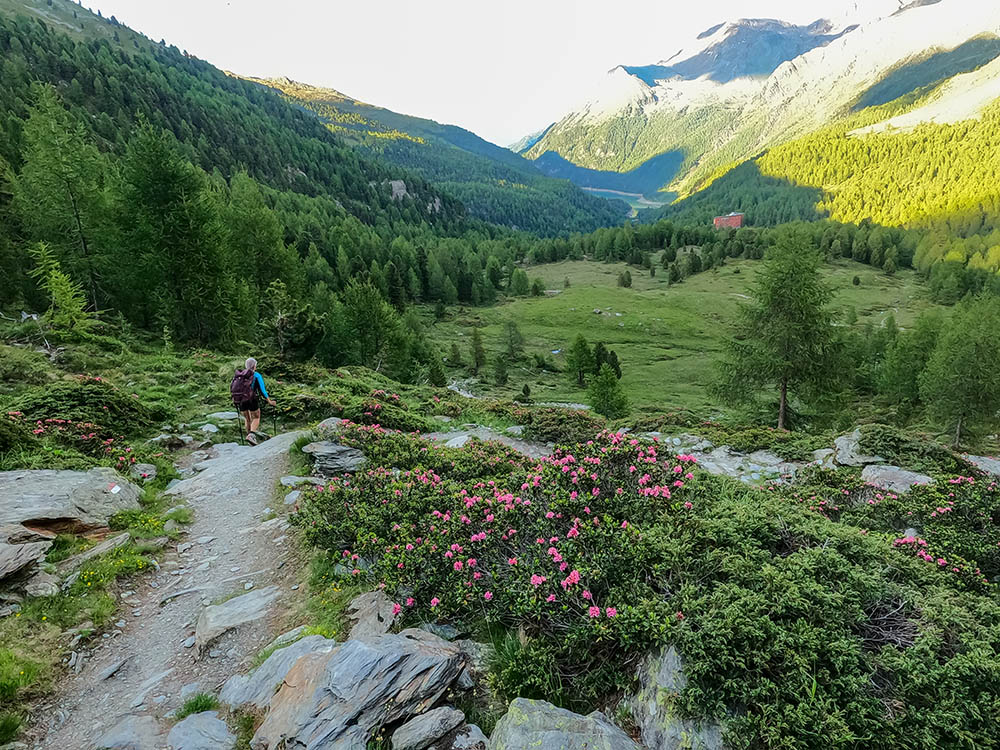
The excursion begins with a lovely walk immersed in nature, dotted with 4 panoramic points that offer splendid views of the Rio Plima Gorge.
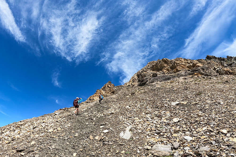
The climb to the top is within everyone's reach, without particular technical difficulties, with the exception of the last stretch where the path is equipped with wire ropes to ensure maximum safety.
But the real treasure of this excursion is the view from the top. The panoramic view towards the Cevedale will leave you breathless, and you will be able to admire the pristine beauty of the surrounding mountains.
On the return loop, don't miss the opportunity to walk the Glaciological Path, which will allow you to learn about the geological history of the area and to admire the traces left by the glaciers over thousands of years up close.
Ultimately, if you want to have an unforgettable experience, the excursion to the Cima Rossa di Martello/Vorderer Rotspitz is what you need!
ITINERARY
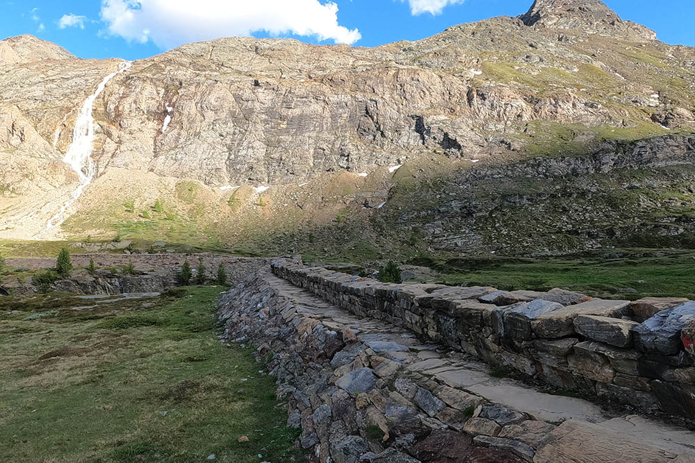
From the car park (2047 m) at the Albergo Genziana, take paths 37 and 31 in order and arrive at the summit of Cima Rossa di Martello/Vorderer Rotspitz (3033 m). Along the climb you can stop at 4 panoramic points over the Plima River Gorge.
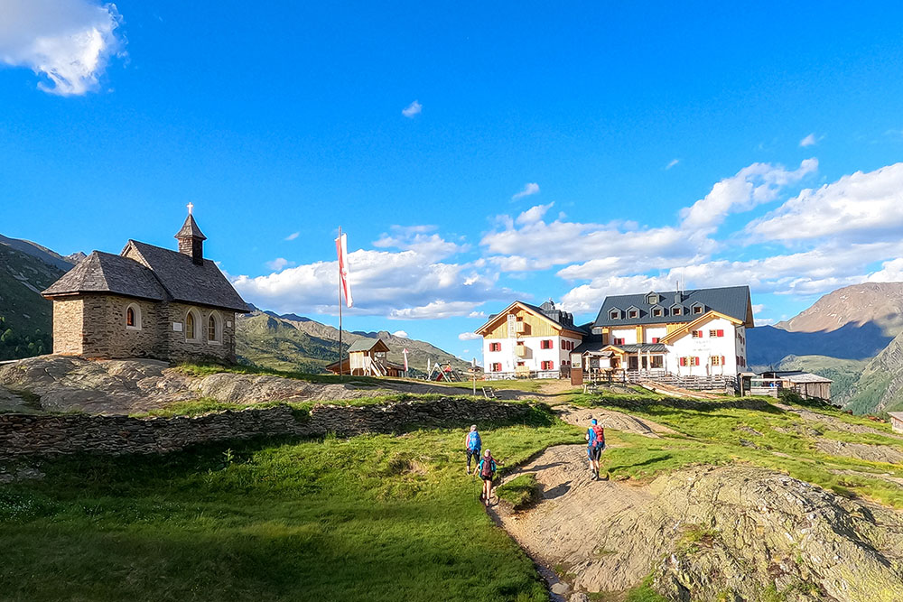
From the summit, take the 37A, pass to the left of the Cima Serena/Schran Spitze, continue on the path 37 - Glaciological path - up to the Rifugio Martello/Marteller Hütte (2610 m). Now descend to the Rifugio Nino Corsi/Zufallhütte (2264 m) from path no. 151, and then back to the starting point.
EXCURSION DATE
June 12, 2022
STARTING POINT
Parking (2047 m) at the Albergo Genziana.
REFRESHMENT POINT
Rifugio Martello/Marteller Hütte (2610 m) and Rifugio Nino Corsi/Zufallhütte (2264 m)
AUTHOR’S SUGGESTIONS
To see the 4 panoramic points on the gorge of the Rio Plima.
SAFETY TIPS
The viability of the proposed itinerary, like all mountain morphology, is subject to environmental changes due to natural events and weather conditions. Therefore, before leaving, consult the competent tourist offices and / or the refuges of reference.
Our GPX tracks are only indicative, that is, the route was carried out at best with the conditions of the trails and weather of that day. So always consider what to do on site.
Also remember to evaluate the route based on your physical abilities, training and the equipment you have.
You should leave someone the route you intend to do told.
Remember that the emergency number is 112.
EQUIPMENT
It is recommended to have the appropriate equipment for the route, weather conditions and season: windproof and / or rain jacket, map and / or GPS device, goggles, sunscreen, boots, first aid kit, specific clothing, gloves, backpack with food and drink.
RECOMMENDED MAPS
Tabacco 045 Laces - Val Martello – Silandro
INTERESTING LINKS
https://www.martellerhuette.com/it/
HOW TO ARRIVE
From Merano take the SS38 towards Passo Resia. At Coldrano, take the road to the Val Martello on the left. Continue uphill for 23 km. The Enzian car park is located 2.6 km from the end of the lake.
PARKING AREA
Parking at the Albergo Genziana.
GPS coordinates: 46.488479, 10.687455
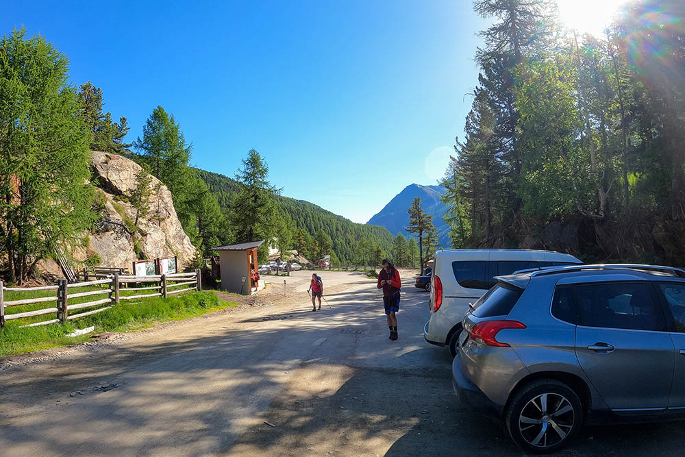
Parcheggio nei pressi dell'Albergo Genziana
Si inizia il percorso sul sentiero 37
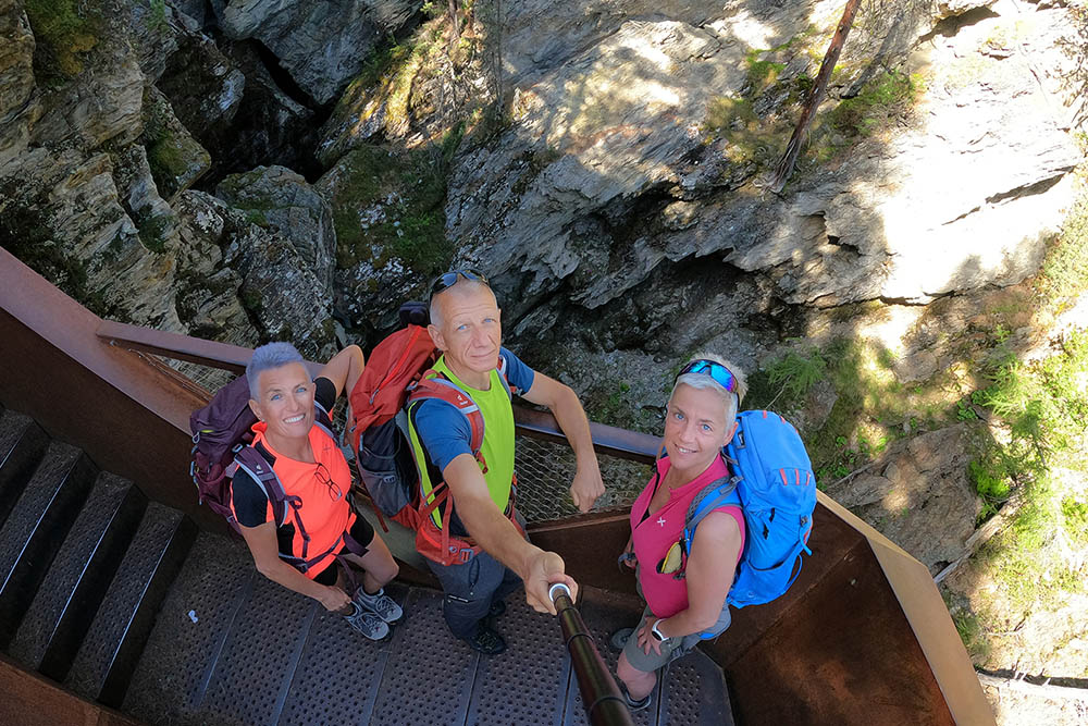
Punto panoramico sul la Gola del Rio Plima
Punto panoramico sul la Gola del Rio Plima
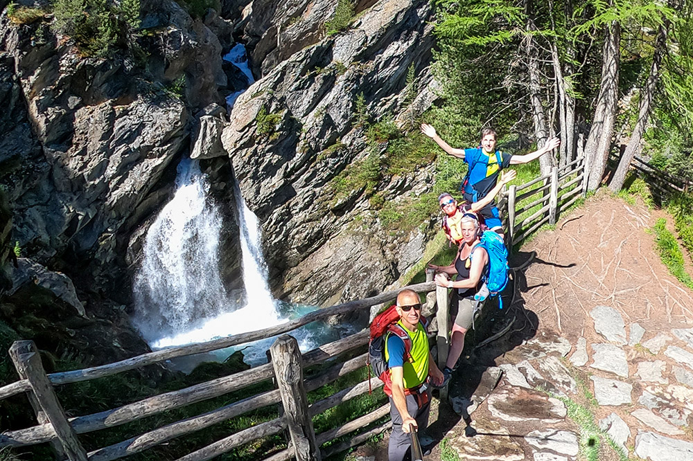
Punto panoramico sul la Gola del Rio Plima
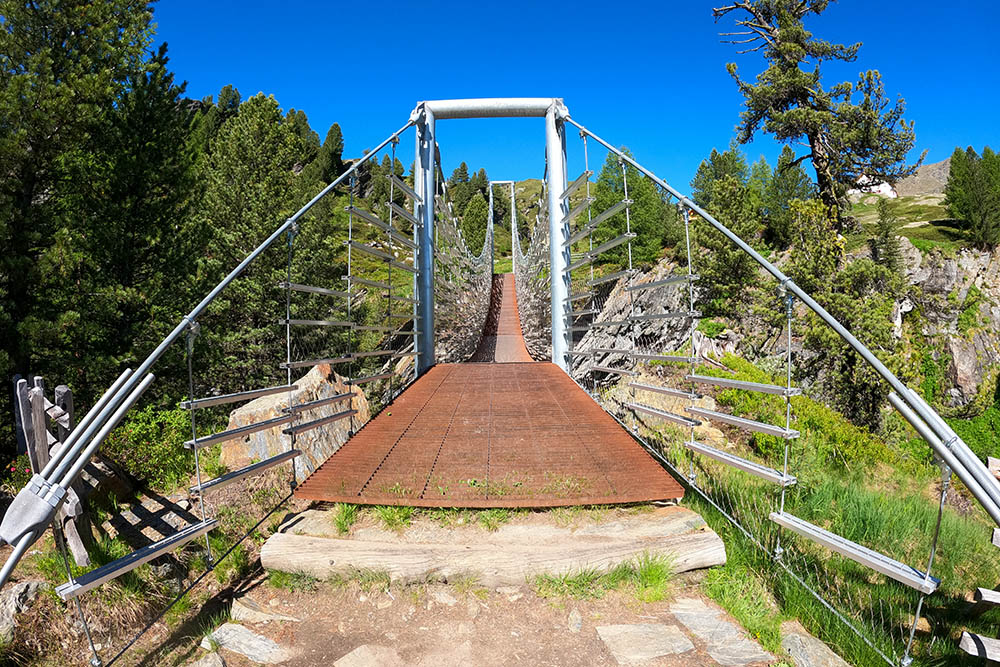
Ponte sulla Gola del Rio Plima
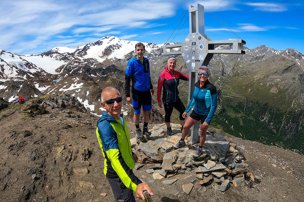
Cima Rossa Martello
Si scende dalla vetta
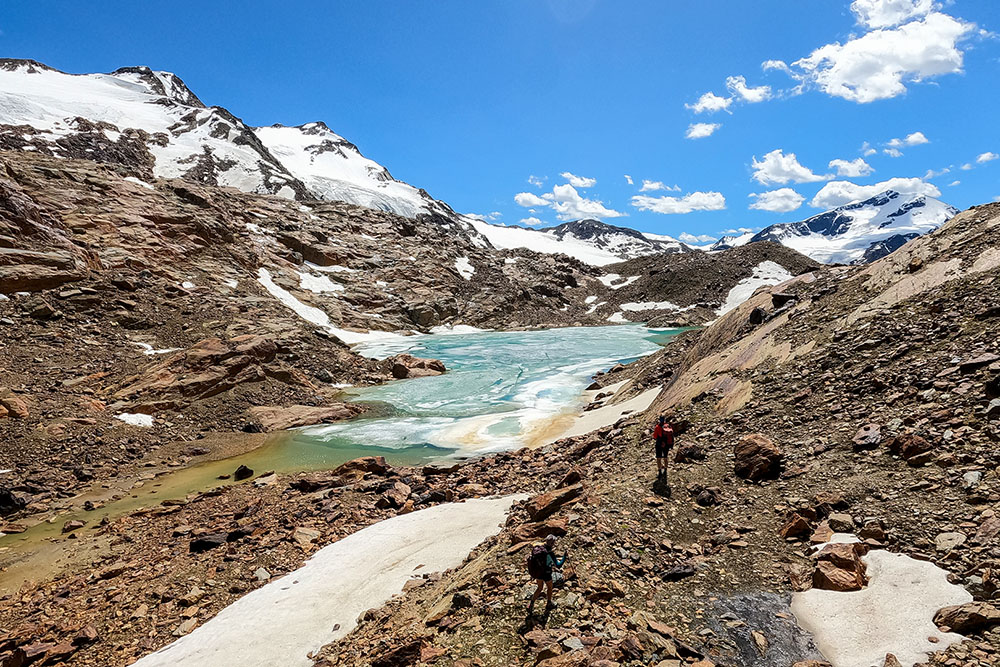
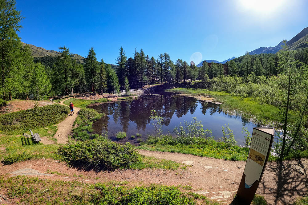
Laghetto glaciale
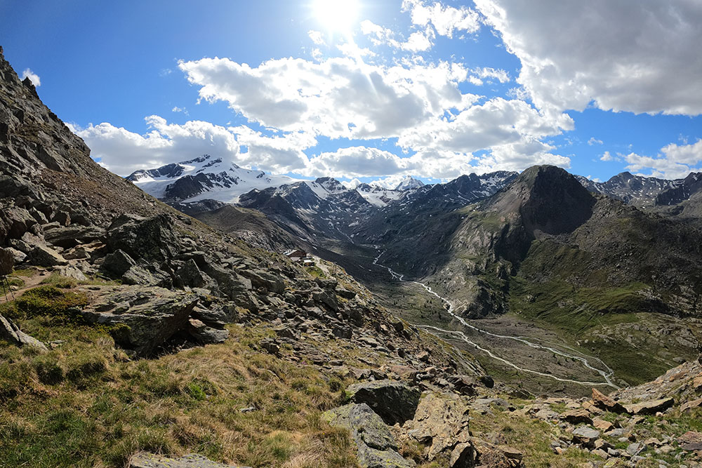
Vista verso il Cevedale
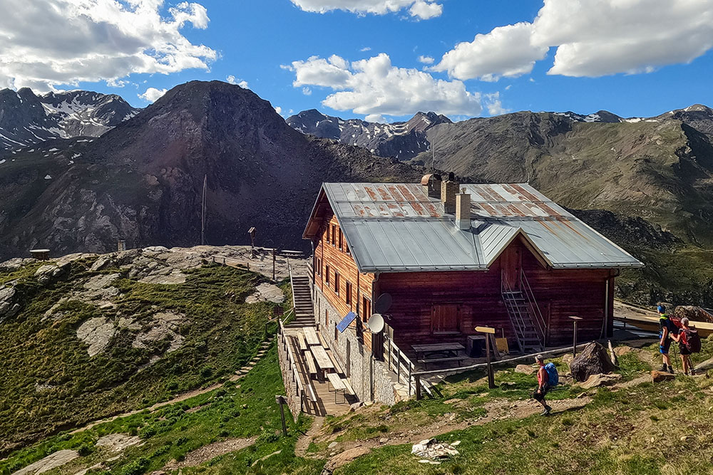
Rifugio Martello
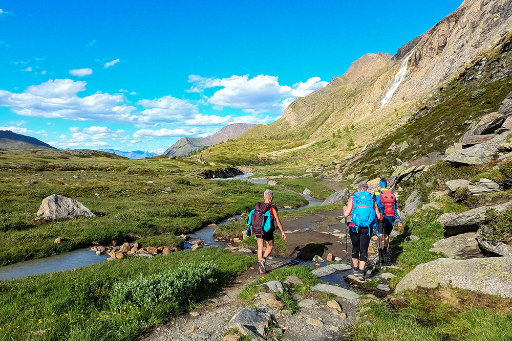
Si cammina in un bellissimo contesto naturalistico
Antica diga
Rifugio Nino Corsi
Si rientra sul sentiero 151


