


![]()


Durata
 10:55 h
Distanza
 16,8 km
 Ascesa
 1620 m
Discesa
 1620 m
H Max
 3011 m
H Min
 1513 m
Via Ferrata of the Bocchette Alte
DESCRIPTION
The Via Ferrata delle Bocchette Alte is the most demanding via ferrata of the Via delle Bocchette and is one of the most panoramic via ferratas in Trentino.
This excursion is challenging overall, requires good physical and mountaineering preparation. Its characteristics - length, technical difficulty and exposure - make it suitable only for expert hikers with good training and absence of vertigo. The duration of the via ferrata is about 4 hours, and for the entire itinerary it takes 10/11 hours.
Having said that, the Via Ferrata delle Bocchette Alte is one of the most beautiful in the Alps.
ITINERARY
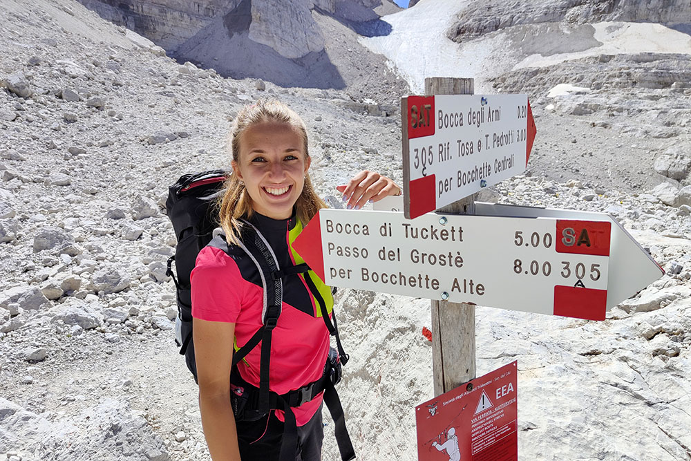
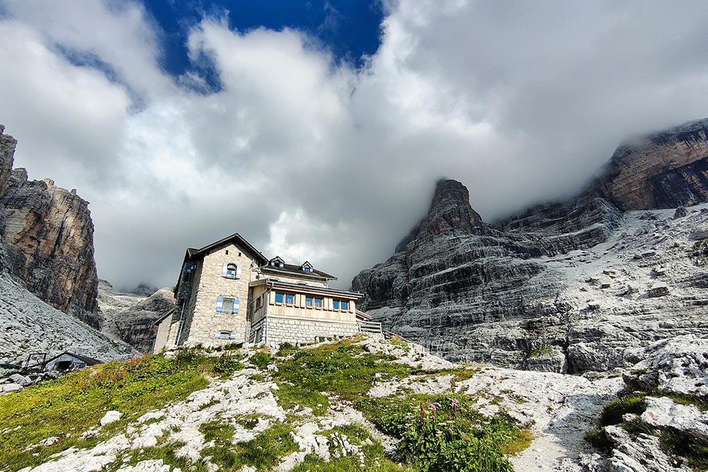
From the Rifugio Vallesinella (1513 m) we go up on path 317 to the Rifugio Casinei (1850 m). From here we take the path 318, also known as the Path of the Bogani Gallery, and we reach the Rifugio Ai Brentei (2182 m). Now we go up to the Rifugio Alimonta (2580 m) on the path 323 and then we continue towards the start of the via ferrata always on the 323. Near the Vedretta degli Sfulmini we take the 305. Once we arrive at the start of the Ferrate delle Bocchette Alte we remain in altitude, in an ups and downs, until you reach the Bocca di Tuckett (2648 m) where the via ferrata ends. Now going down the path n. 303 you arrive at the Rifugio Tuckett (2272 m). We just have to go back to the starting point following the path 317, passing through the Rifugio Casinei.
EXCURSION DATE
July 13, 2022
STARTING POINT
Rifugio Vallesinella
REFRESHMENT POINT
Rifugio Casinei (1850 m), Rifugio Ai Brentei (2182 m), Rifugio Alimonta (2580 m) and Rifugio Tuckett (2272 m)
AUTHOR’S SUGGESTIONS
For those who are not trained, it is recommended to do the excursion in two days.
SAFETY TIPS
The viability of the proposed itinerary, like all mountain morphology, is subject to environmental changes due to natural events and weather conditions. Therefore, before leaving, consult the competent tourist offices and / or the refuges of reference.
Our GPX tracks are only indicative, that is, the route was carried out at best with the conditions of the trails and weather of that day. So always consider what to do on site.
Also remember to evaluate the route based on your physical abilities, training and the equipment you have.
You should leave someone the route you intend to do told.
Remember that the emergency number is 112.
EQUIPMENT
It is recommended to have the appropriate equipment for the route, weather conditions and season: windproof and / or rain jacket, map and / or GPS device, goggles, sunscreen, boots, first aid kit, specific clothing, gloves, backpack with food and drink.
RECOMMENDED MAPS
Tabacco 053 DOLOMITI DI BRENTA
INTERESTING LINKS
https://www.rifugiobrentei.it/
HOW TO ARRIVE
SS239 up to Madonna di Campiglio then take the road to Vallesinella.
PARKING AREA
At the Rifugio Vallesinella
GPS coordinates: 46.206221, 10.851206
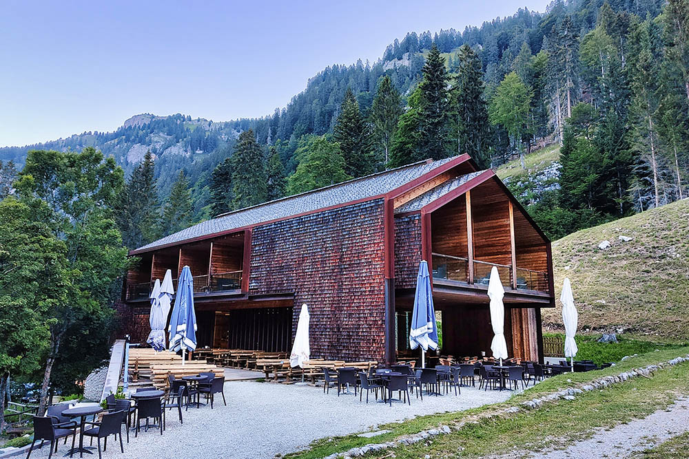
Rifugio Vallesinella
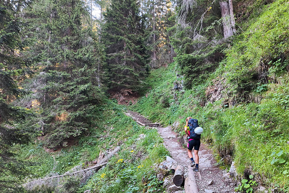
Si sale sul sentiero 317
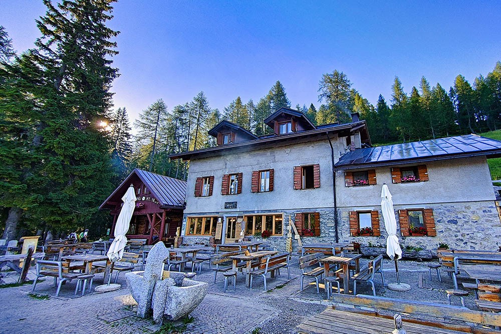
Rifugio Casinei
Si vede il Rifugio Ai Brentei
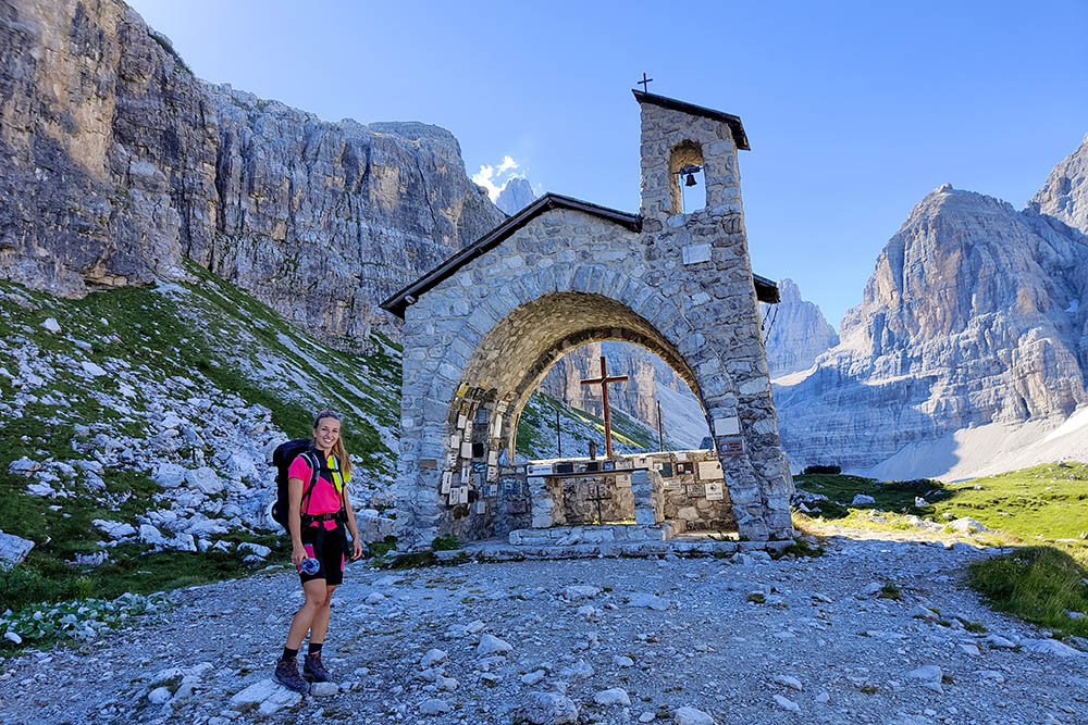
La chiesetta nei pressi del Rifugio Ai Brentei
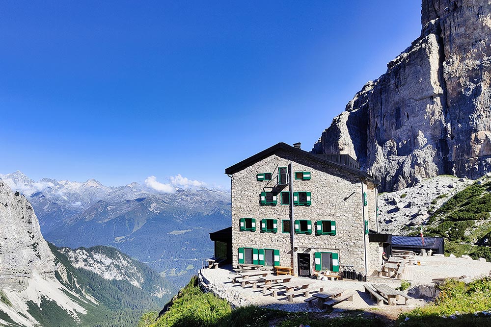
Il Rifugio Ai Brentei
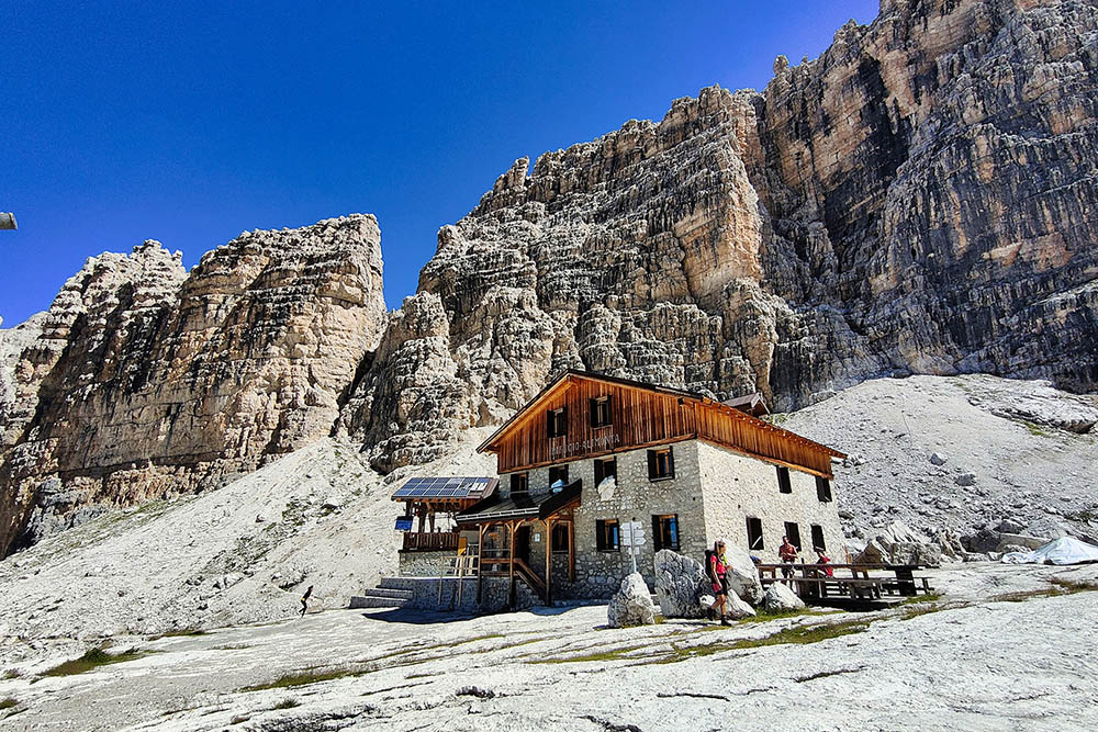
Il Rifugio Alimonta
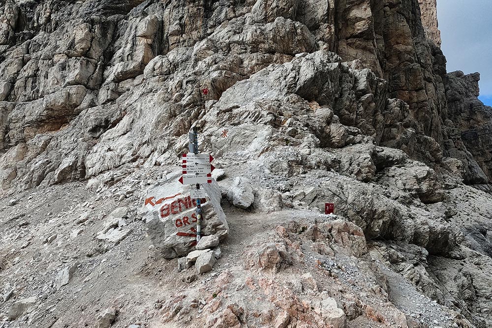
Bivio per la ferrata
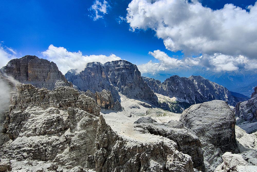
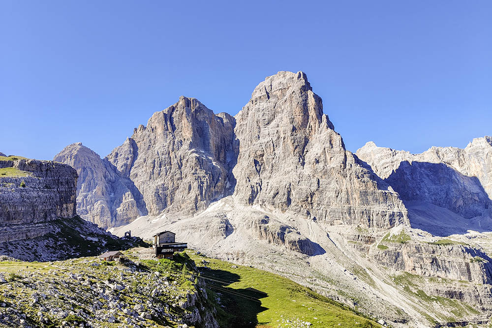
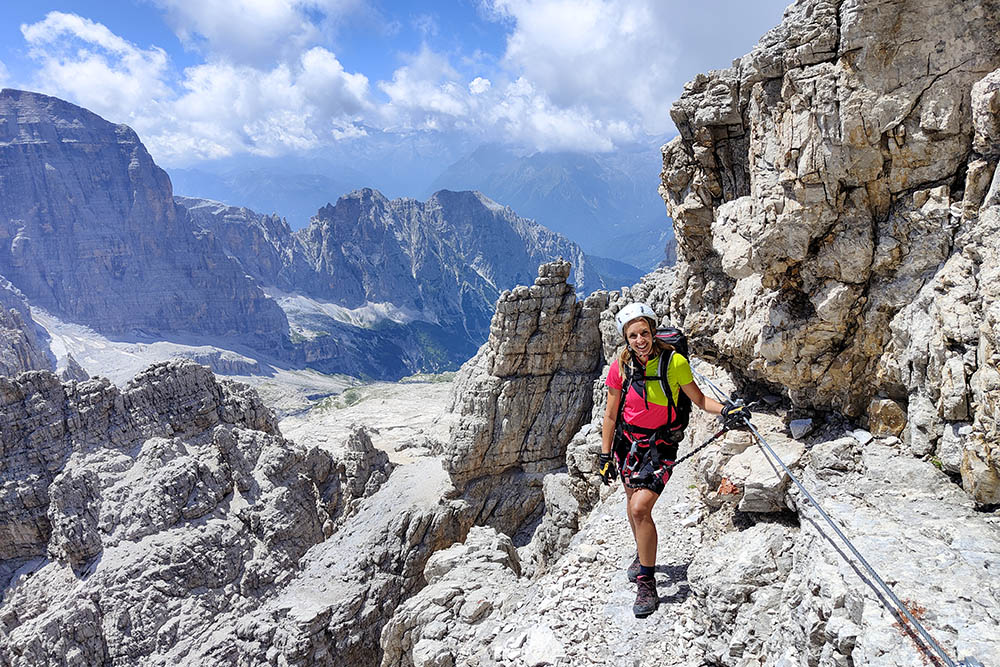
Panorama dalla ferrata
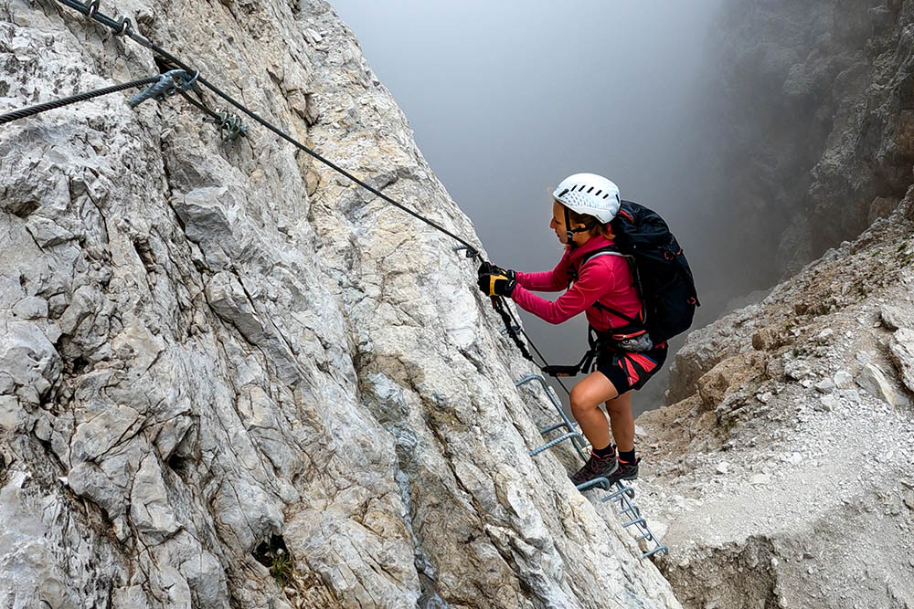
Ferrata Bocchette Alte
Ferrata Bocchette Alte
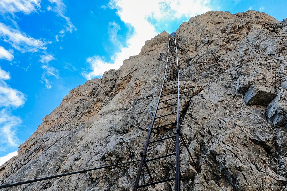
La Scala degli Amici
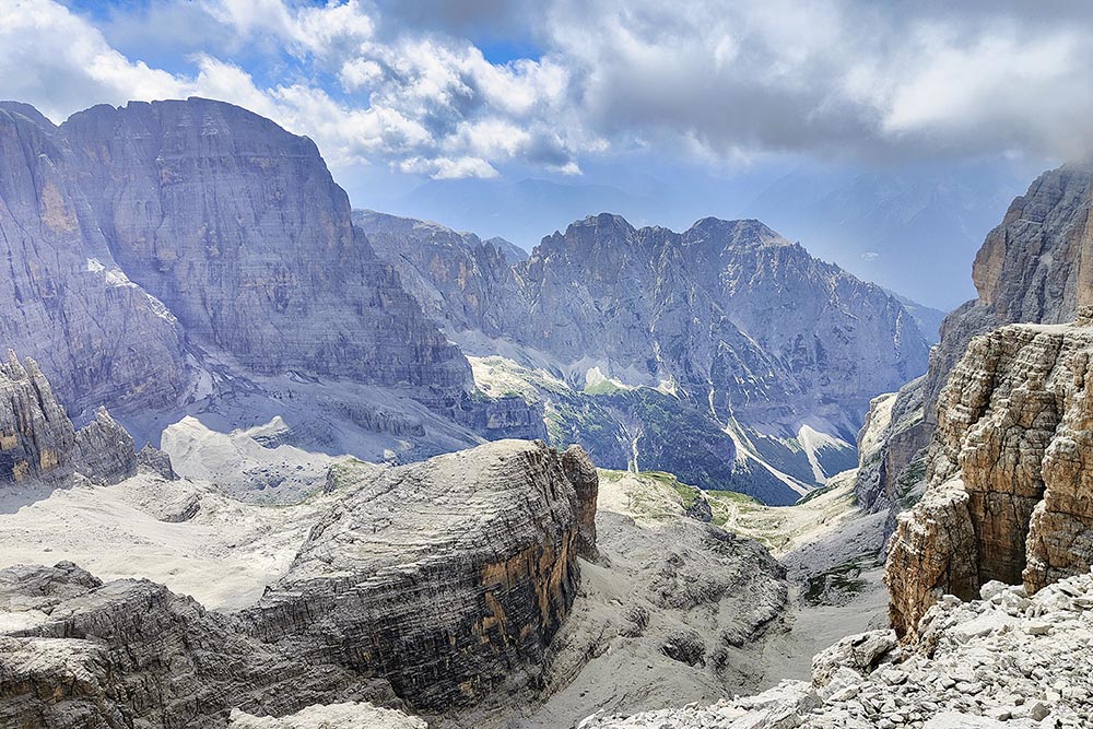
Panorama dalla ferrata
Bocca di Tuckett
Rifugio Tuckett


