


![]()


Durata
 4:15 h
Distanza
 5,2 km
 Ascesa
 370 m
370 mDiscesa
 370 m
370 mH Max
 1565 m
H Min
 1225 m
Via Ferrata Hans Kammerlander
DESCRIPTION
Wonderful, difficult, excellently crafted and with overhangs that take your breath away.
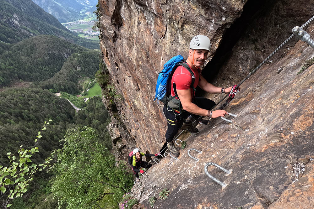
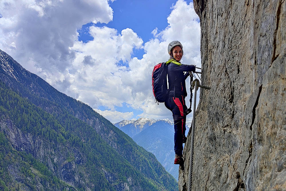
Inaugurated in 2022, the Hans Kammerlander via ferrata is a tribute to the famous mountaineer from Acereto, known for having climbed twelve eight-thousanders, seven of which with Reinhold Messner. This via ferrata extends for 600 meters, with a difference in altitude of approximately 300 meters, developing along a wall that exploits every natural difficulty without culminating in a peak.
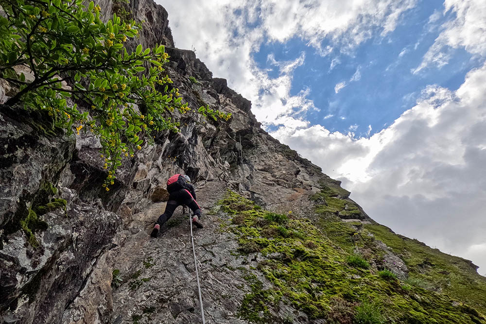
The via ferrata requires strong nerves and strength in the arms. It is unique in the panorama of the area: the degree of difficulty, mostly D and C, extends up to E. There are no escape routes: in case of emergency, it will be necessary to call the air ambulance.
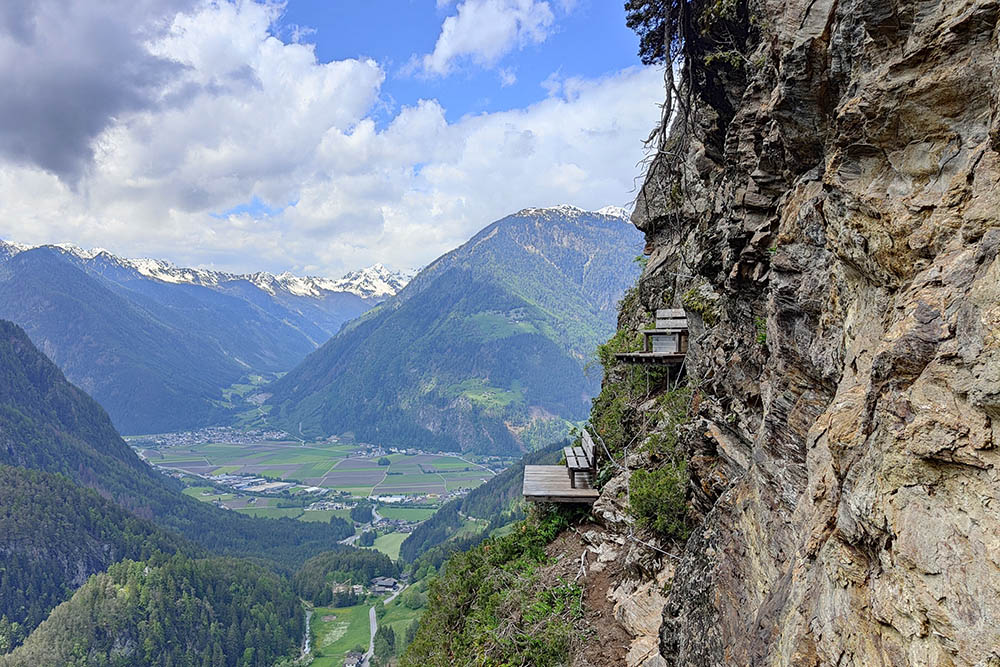
The start of the route is challenging, with a difficulty of E, preparing hikers for the challenges ahead. After an initial obstacle and a relatively easy section, the wall becomes extremely steep, putting a strain on your arms. Along the route, there are two rest points with benches, ideal for resting.
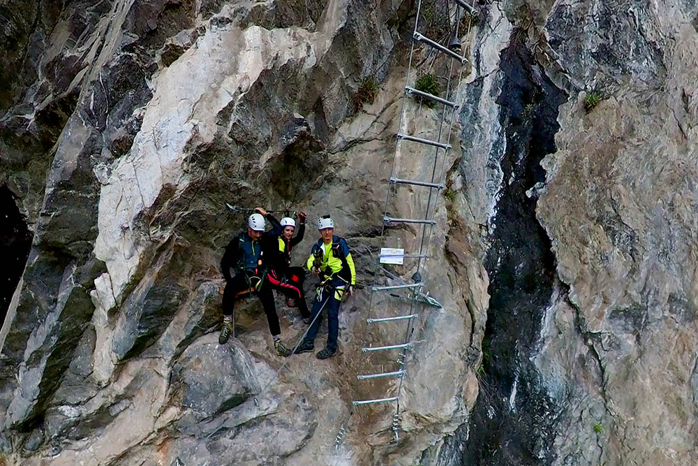
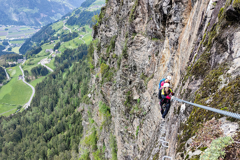
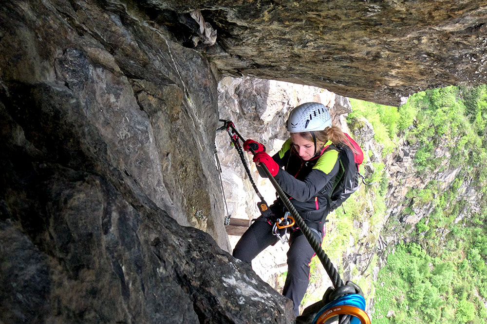
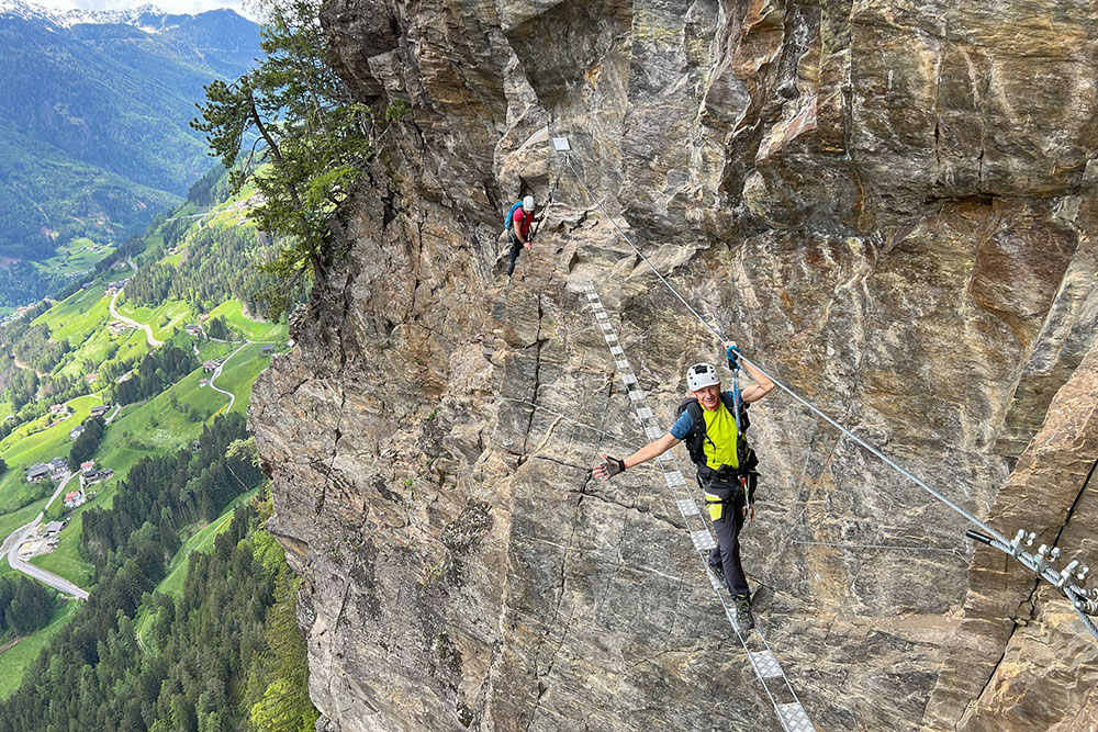
The most mentally difficult sections are the steep suspended ladder and the two wooden logs on the upper overhang. These steps are not technically difficult, but the feeling of emptiness can be overwhelming.
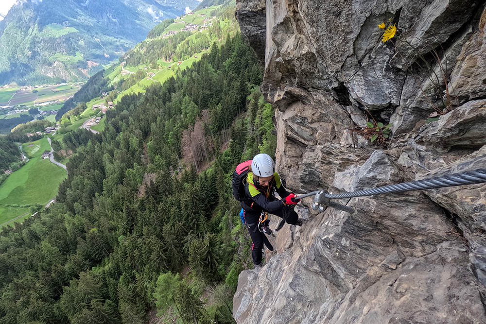
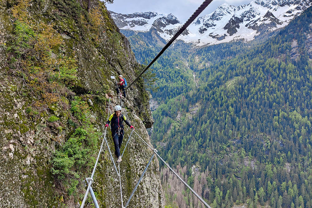
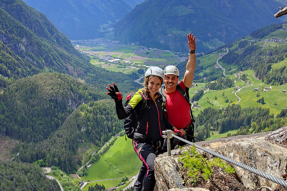
As you climb, those who manage to stay calm will be able to admire spectacular views of the Val di Tures and the peaks of the Vedrette di Ries Group. These views are a real reward for those who face the challenge of this via ferrata.
ITINERARY
Approach: from the car park (1315 m) go up the asphalt road, pass the church and immediately follow Via Hintergasse. Near the Kleingruberhof farm, follow the signs for Via Ferrata Kammerlander and arrive at the start (1260 m).
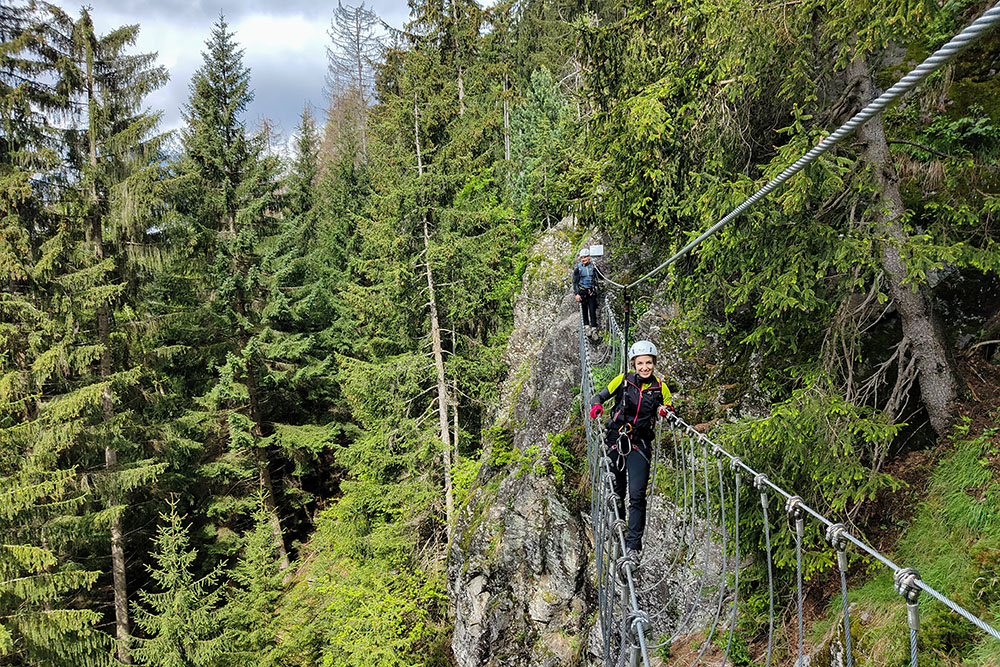
Ferrata: short staircase and vertical section (E), proceed on a traverse (B/C and C) up to the first bridge (A/B). Continue on an easy route (A/B), then continue steeply (D) up to a slab and a narrow gully (D/E) and continue (D) up to the first rest point. Here starts a 15 m ladder (B/C). Once you reach the top of the stairs, you turn left and you have to overcome a section (D/E). Immediately a steep climb (D and C) and then continuing more easily (A/B and B/C). Arrived at the second stopping point. Here a fairly easy stretch (A/B, B and B/C). Now the wall becomes steeper (C/D) reaching the 2 wooden logs. The passage is very exposed (D and C). Horizontal section with second bridge (A/B and B). You go up with difficulty (C and C/D) and more easily (B) up to the third bridge. We start again (B) and last vertical climb (C) before reaching the end of the via ferrata (1546 m).
Return: we go up for a few meters until we reach an asphalt road which we follow going left. On the way back, take some stretches of path to shorten the route.
EXCURSION DATE
May 19, 2024
STARTING POINT
Acereto
REFRESHMENT POINT
Nobody
AUTHOR’S SUGGESTIONS
Obviously, the Hans Kammerlander via ferrata is not recommended for those who suffer from vertigo. This route is extremely difficult and very exposed. The face is sunny from late morning, making the climate very hot, especially in the summer months. It is also strongly discouraged to undertake the via ferrata when it is wet.
SAFETY TIPS
The viability of the proposed itinerary, like all mountain morphology, is subject to environmental changes due to natural events and weather conditions. So, before leaving, consult the competent tourist offices and / or the refuges of reference.
Our GPX tracks are only indicative, that is, the route was carried out at best with the conditions of the trails and weather of that day. So always evaluate what to do on site.
Also remember to evaluate the route based on your physical abilities, training and the equipment you have.
You should leave someone the route you intend to do told.
Remember that the emergency number is 112.
EQUIPMENT
It is recommended to have the appropriate equipment: technical mountain clothing, boots with vibram sole or similar, via ferrata set, harness, helmet, via ferrata gloves, goggles, sunscreen, backpack with drinks.
RECOMMENDED MAPS
Tabacco 036 Campo Tures
INTERESTING LINKS
https://www.campo-tures.net/
HOW TO ARRIVE
From Campo Tures take the SP48 for Acereto/Riva di Tures. After about 2.4 km, keep left and go up to Acereto. The car park is on the right, 200 meters from the first houses.
PARKING AREA
Free in Acereto
GPS coordinates: 46.924929, 11.975751
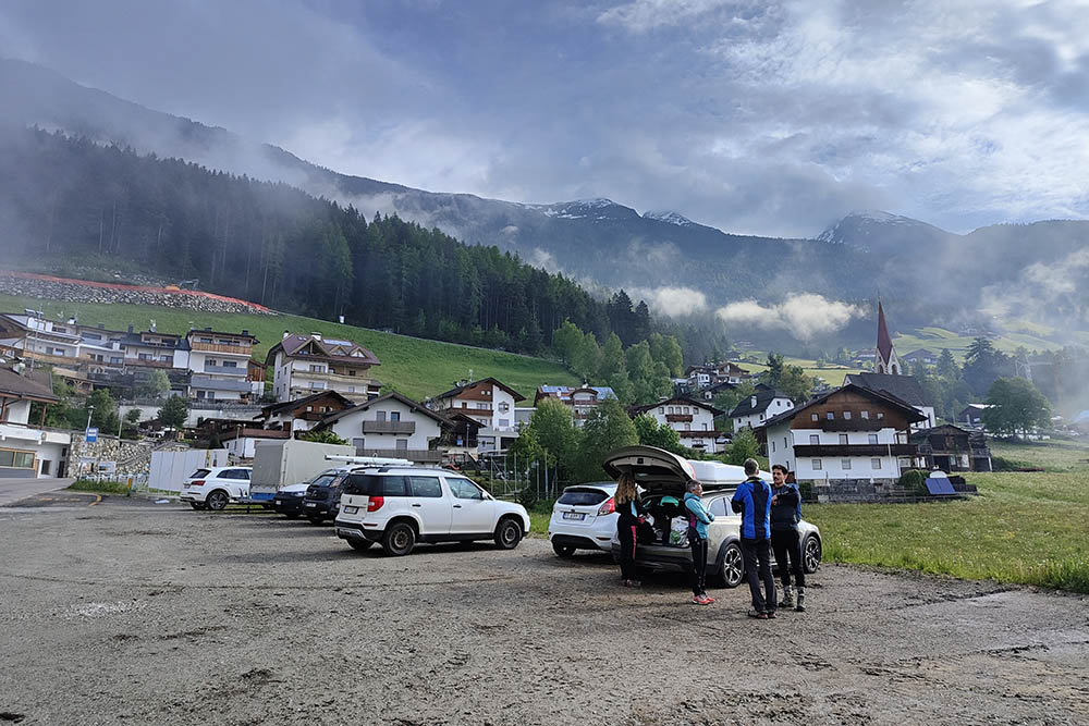
Parcheggio ad Acereto
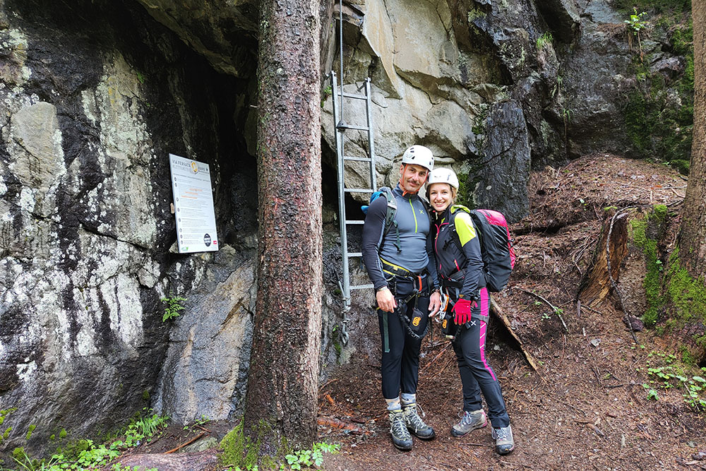
Attacco della ferrata
Primo ponte
Stiamo arrivando alla scala
Punto di sosta prima di fare la scala
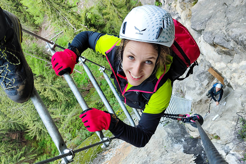
Sulla scala
Tratto con difficoltà C
Secondo punto di sosta
Tratto tranquillo
Punto molto esposto
Il tronco - difficoltà D
Secondo ponte
Si sale ancora in esposizione
Terzo ponte
Arrivati alla fine


